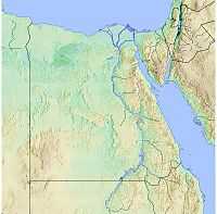
Babylon Fortress

Babylon Fortress was an ancient fortress city or castle in the Delta of Egypt, located at Babylon in the area today known as Coptic Cairo. It was situated in the Heliopolite Nome, upon the east bank of the Nile, at latitude 30°N, near the commencement of the Pharaonic Canal (also called Ptolemy's Canal and Trajan's Canal), from the Nile to the Red Sea. Coordinates: 30°0′22″N 31°13′47″E / 30.00611°N 31.22972°E
It was at the boundary between Lower and Middle Egypt, where the river craft paid tolls when ascending or descending the Nile. Diodorus ascribes the erection of the first fort to rebel Assyrian captives in the reign of Sesostris, and Ctesias (Persica) dates it to the time of Semiramis; but Josephus (l. c.), with greater probability, attributes its structure to some Babylonian followers of Cambyses, in 525 BC. The Romans built a new fortress with typically Roman red and white banded masonry nearer to the river.
Within the fortress' enclosure are the Coptic Museum, a convent, and several churches, including the Church of St. George and the Hanging Church.
The name
Babylon was originally the dominant city of Mesopotamia, but another possibility links the name to the ancient Pr-Hapi-n-Iwnw (Nile house of Heliopolis) that was the deity Hapy's dwelling in Heliopolis city. Hapy was the divinity of the Nile.
Situation
Heliopolis lay northeast of Memphis, on the east bank of the Nile, at latitude 30° N, and near the commencement of the Pharaonic Canal connecting the Nile to the Red Sea. It was the boundary town between Lower and Middle Egypt, where the river craft paid tolls when ascending or descending the Nile.
According to tradition, the first fort was built by the Persians in about the 6th century BC., but at that time it was on the cliffs near the river. When the Romans took possession of Egypt, they used the old fort for a while, recognizing its strategic importance on the Nile, but because of problems of water delivery, the Roman Emperor Trajan relocated the fort to its present location, which at that time was nearer to the River. Since then, the Nile's course has moved some 400 metres (440 yards) to the north.
Roman era and later
In the age of Augustus the Deltaic Babylon became a town of some importance, and was the headquarters of the three legions which ensured the obedience of Egypt. In the Notitia Imperii, Babylon is mentioned as the quarters of Legio XIII Gemina. (It. Anton.; Georg. Ravenn. etc.) Ruins of the town and fortress are still visible a little to the north of Fostat or Old Cairo, among which are vestiges of the Great Aqueduct mentioned by Strabo and the early Arabian topographers. (Champollion, l'Egypte, ii. p. 33.)
The town was the seat of a Christian bishopric, a suffragan of Leontopolis, the capital and metropolitan see of the Roman province of Augustamnica Secunda. The names of several of its bishops are recorded. After the Council of Chalcedon (451), some are of those who accepted the council, but most are of those who rejected it.[1][2] No longer a residential bishopric, Babylon is today listed by the Catholic Church as a titular see.[3]
During the Muslim conquest of Egypt the fort was surrounded for about seven months before finally falling in April 641 to the Arab general 'Amr ibn al-'As.
Photographs of Babylon fortress
See also
References
- ↑ Michel Lequien, Oriens christianus in quatuor Patriarchatus digestus, Paris 1740, Vol. II, coll. 555-560
- ↑ Klaas A. Worp, A Checklist of Bishops in Byzantine Egypt (A.D. 325 - c. 750), in Zeitschrift für Papyrologie und Epigraphik 100 (1994) 283-318
- ↑ Annuario Pontificio 2013 (Libreria Editrice Vaticana 2013 ISBN 978-88-209-9070-1), p. 844
 This article incorporates text from a publication now in the public domain: Smith, William, ed. (1854–1857). "article name needed". Dictionary of Greek and Roman Geography. London: John Murray.
- Richard Talbert, Barrington Atlas of the Greek and Roman World, (ISBN 0-691-03169-X), p. 74.


