Bézenet
| Bézenet | |
|---|---|
 Bézenet | |
|
Location within Auvergne region  Bézenet | |
| Coordinates: 46°19′48″N 2°50′45″E / 46.33°N 2.8458°ECoordinates: 46°19′48″N 2°50′45″E / 46.33°N 2.8458°E | |
| Country | France |
| Region | Auvergne |
| Department | Allier |
| Arrondissement | Montluçon |
| Canton | Montmarault |
| Intercommunality | Région de Montmarault |
| Government | |
| • Mayor (2008–2014) | Daniel Piquandet |
| Area1 | 9.94 km2 (3.84 sq mi) |
| Population (2008)2 | 962 |
| • Density | 97/km2 (250/sq mi) |
| INSEE/Postal code | 03027 / 03170 |
| Elevation |
270–376 m (886–1,234 ft) (avg. 342 m or 1,122 ft) |
|
1 French Land Register data, which excludes lakes, ponds, glaciers > 1 km² (0.386 sq mi or 247 acres) and river estuaries. 2 Population without double counting: residents of multiple communes (e.g., students and military personnel) only counted once. | |
Bézenet (Occitan, Besenet) is a commune in the Allier department in central France.
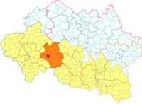
Bézenet in the canton of Montmaraud
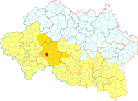
Bézenet in the Region of Montmarault
Population
| Historical population | ||
|---|---|---|
| Year | Pop. | ±% |
| 1962 | 896 | — |
| 1968 | 973 | +8.6% |
| 1975 | 1,009 | +3.7% |
| 1982 | 1,005 | −0.4% |
| 1990 | 922 | −8.3% |
| 1999 | 953 | +3.4% |
| 2008 | 962 | +0.9% |
See also
References
| Wikimedia Commons has media related to Bézenet. |