Ayta ash Shab
| Ayta ash Shab عيتا الشعب | |
|---|---|
| City | |
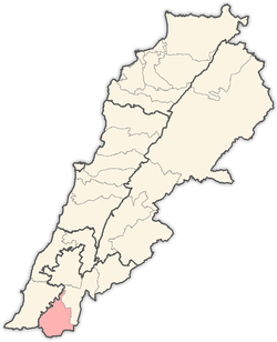
 Ayta ash Shab Location within Lebanon | |
| Coordinates: 33°05′50″N 35°20′04″E / 33.09722°N 35.33444°ECoordinates: 33°05′50″N 35°20′04″E / 33.09722°N 35.33444°E | |
| Country |
|
| Governorate | Nabatieh Governorate |
| District | Bint Jbeil District |
| Time zone | EET (UTC+2) |
| • Summer (DST) | EEST (UTC+3) |
| Dialing code | +961 |
Ayta ash Shab (Arabic: عيتا الشعب; also transliterated Ayta al-Sha'b, Ayta a-Shaab, Ayta ash-Shab or Ayta ash Sha'b') is a small village located in southern Lebanon, about 1 km northeast of the Israeli border.
On July 12, 2006, Hezbollah initiated a cross-border attack on an Israeli routine patrol, which took place on the Israeli side of the Israel-Lebanon border near Ayta ash Shab, between the villages of Zar'it and Shtula (Shetula). The raid resulted in the capture of two and killing of three Israeli soldiers and triggered the 2006 Lebanon War. During the month-long conflict 85% of Ayta ash Shab's homes were destroyed, and heavy ground fighting ensued between Israeli forces and Hezbollah guerillas.[1]
References
- ↑ Rosen, Nir (2007-01-01). "The Mayor, the Martyr, and the Pomegranate Trees". Mother Jones. Retrieved 2007-04-20.
| |||||||||||||||||||||