Avondale, Arizona
| Avondale, Arizona | |
|---|---|
| City | |
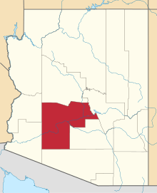
 Location in Maricopa County and the state of Arizona Phoenix | |
| Coordinates: 33°26′01″N 112°20′59″W / 33.43361°N 112.34972°WCoordinates: 33°26′01″N 112°20′59″W / 33.43361°N 112.34972°W | |
| Country | United States |
| State | Arizona |
| County | Maricopa |
| Government | |
| • Mayor | Kenn Weise |
| Area | |
| • Total | 45.1 sq mi (116.81 km2) |
| • Land | 45 sq mi (116.55 km2) |
| • Water | 0.1 sq mi (0.2 km2) |
| Elevation | 974 ft (297 m) |
| Population (2010)[1] | |
| • Total | 76,238 |
| • Estimate (2013[2]) | 78,256 |
| • Density | 1,735.17/sq mi (669.94/km2) |
| Time zone | MST (no daylight saving time) (UTC-7) |
| ZIP code | 85323, 85392 |
| Area code(s) | 623 |
| FIPS code | 04-04720 |
| Website | http://www.ci.avondale.az.us/ |
Avondale is a city in Maricopa County, Arizona, United States, adjacent to Phoenix, Arizona. According to the 2010 census, the population of the city is 76,238.[1]
Avondale, incorporated in 1946, experienced rapid residential and commercial growth in the years since 1980. Once primarily a sparsely populated farming community with many acres of alfalfa and cotton fields, Avondale has transformed into a major bedroom suburb for Phoenix. Several major residential subdivisions and shopping centers have recently been built on former farmland, many adjacent to Interstate 10.
Phoenix Children's Hospital opened a satellite facility (the Southwest Valley Urgent Care Center), at the corner of Avondale Boulevard and McDowell Road in the spring of 2013. Avondale's main arterial streets leading into the city of Phoenix, including Van Buren Street and McDowell Road, have been widened and modernized to a more "suburban" and less "rural" appearance and function.
Geography
Avondale is located at 33°26′01″N 112°20′59″W / 33.43361°N 112.34972°W (33.435322, -112.349758).[3]
According to the United States Census Bureau, the city has a total area of 41.3 square miles (107 km2), of which, 41.3 square miles (107 km2) of it is land and 0.1 square miles (0.26 km2) of it (0.15%) is water.
Demographics
| Historical population | |||
|---|---|---|---|
| Census | Pop. | %± | |
| 1950 | 2,505 | — | |
| 1960 | 6,151 | 145.5% | |
| 1970 | 6,626 | 7.7% | |
| 1980 | 8,168 | 23.3% | |
| 1990 | 16,169 | 98.0% | |
| 2000 | 35,883 | 121.9% | |
| 2010 | 76,238 | 112.5% | |
| Est. 2013 | 78,822 | 3.4% | |
| U.S. Decennial Census[4] 2013 Estimate[2] | |||
As of the census of 2000, there were 35,883 people, 10,640 households, and 8,724 families residing in the city. The population density was 869.7 people per square mile (335.8/km²). There were 11,419 housing units at an average density of 276.8 per square mile (106.9/km²). The racial makeup of the city was 63.27% White, 5.20% Black or African American, 1.28% Native American, 1.89% Asian, 0.14% Pacific Islander, 24.32% from other races, and 3.89% from two or more races. 46.23% of the population were Hispanic or Latino of any race.
There were 10,640 households out of which 47.9% had children under the age of 18 living with them, 62.9% were married couples living together, 12.7% had a female householder with no husband present, and 18.0% were non-families. 12.9% of all households were made up of individuals and 3.1% had someone living alone who was 65 years of age. The average household size was 3.36 and the average family size was 3.66.
In the city the population was spread out with 34.2% under the age of 18, 9.7% from 18 to 24, 33.1% from 25 to 44, 17.7% from 45 to 64, and 5.3% who were 65 years of age or older. The median age was 29 years. For every 100 females there were 102.4 males. For every 100 females age 18 and over, there were 101.1 males.
The median income for a household in the city was $49,153, and the median income for a family was $51,084. Males had a median income of $35,134 versus $27,487 for females. The per capita income for the city was $16,919. About 10.3% of families and 13.8% of the population were below the poverty line, including 17.2% of those under age 18 and 16.7% of those age 65 or over.
In 2010 Avondale had a population of 78,256. The racial and ethnic composition of the population was 50.3% Hispanic or Latino, 34.0% non-Hispanic white, 9.3% black or African American, 1.7% Native American, 3.5% Asian, 0.4% Pacific Islander, 0.2% non-Hispanic of some other race and 4.5% reporting two or more races.[5]
Notable people
- Mitch Garcia - professional soccer player, graduated from Agua Fria High School.
- Shawn Gilbert - MLB player; played high school baseball at Agua Fria High School.
- Everson Griffen - defensive end for the University of Southern California Trojans; attended Agua Fria High School.
- Nick Harris - punter for the Detroit Lions; attended Westview High School.
- Drisan James - wide receiver for the Hamilton Tiger-Cats; attended Westview High School.
- Craig Mabbitt - vocalist for the band Escape The Fate and former vocalist for bands blessthefall and The Word Alive; attended Westview High School.
- Randall McDaniel - a former offensive guard in the National Football League. He was inducted into the National Football Foundation College Hall of Fame in 2008 and inducted to the Pro Football Hall of Fame in 2009. He was a sprinter at Agua Fria High School.[6]
- Clancy Pendergast - defensive coordinator of the Kansas City Chiefs.
- Raymond H. Shuey - retired chief financial officer, finance director, and treasurer for the City of Glendale, Arizona.
- *Shelley Smith - professional football player [7]
Education
Avondale is served by the Littleton Elementary District, the Avondale Elementary District, and the Agua Fria Union High School District. Westview High School, La Joya Community High School, and Agua Fria High School are the high schools in the city.
Climate
This area has a large amount of sunshine year round due to its stable descending air and high pressure. According to the Köppen Climate Classification system, Avondale has a Hot desert climate, abbreviated "Bwh" on climate maps.[8]
Sports
Avondale is home to Phoenix International Raceway. It holds two NASCAR Sprint Cup Series and two Nationwide Series races annually.
The City of Avondale Parks and Recreation Department offers quality sports for both youth and adults. www.avondale.org/sports
Avondale Parks
- Las Ligas
12421 W Lower Buckeye Road
- Festival Fields
101 E. Lower Buckeye
- Donnie Hale Park
10857 West Pima St.
- Friendship Park / Dog Park
12325 West McDowell
- Mountain view
201 E Mountain View Drive [9]
- Sernas Plaza
521 E Western Ave
- Fred Campbell
101 E Lawrence Blvd
- Dennis DeConcini
351 E Western Ave
- Dessie Lorenz
202 E Main St
- Doc Rhodes Park
104 W Western Ave
References
- ↑ 1.0 1.1 "American FactFinder". United States Census Bureau. Retrieved 2012-06-18.
- ↑ 2.0 2.1 "Population Estimates". United States Census Bureau. Retrieved 2014-06-18.
- ↑ "US Gazetteer files: 2010, 2000, and 1990". United States Census Bureau. 2011-02-12. Retrieved 2011-04-23.
- ↑ "U.S. Decennial Census". Census.gov. Retrieved May 3, 2014.
- ↑ 2010 census report for Avondale
- ↑ "Tribute to Randall McDaniel". Pro Football Hall of Fame. Archived from the original on July 14, 2014. Retrieved September 2, 2014.
- ↑ "Shelley Smith". National Football League. Archived from the original on March 4, 2014. Retrieved September 2, 2014.
- ↑ Climate Summary for Avondale, Arizona
- ↑ http://www.avondale.org/index.aspx?NID=1395
External links
| |||||||||||||||||||||||||||||||||||||
| ||||||||||||||||||||||||||||||