Aviezer
| Aviezer | |
|---|---|
|
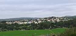
Aviezer as viewed from the Elah Valley | |
 Aviezer | |
| Coordinates: 31°40′53.75″N 35°1′0.48″E / 31.6815972°N 35.0168000°ECoordinates: 31°40′53.75″N 35°1′0.48″E / 31.6815972°N 35.0168000°E | |
| Council | Mateh Yehuda |
| Region | Jerusalem corridor |
| Affiliation | Hapoel HaMizrachi |
| Founded | April 8, 1958 |
| Founded by | Iranian immigrants |
| Population (2012) | 742[1] |
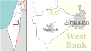
Aviezer (Hebrew: אֲבִיעֶזֶר) is a small religious moshav in central Israel. Located nine kilometres south-west of Beit Shemesh, at the east end of the Elah valley, it falls under the jurisdiction of Mateh Yehuda Regional Council. In 2012 it had a population of 742.[1]
The moshav was founded on 8 April 1958 by immigrants from Iran and by Cochin Jews from Kochi, being the chief ethnic constituent, and was initially named Adulam 9. It was later renamed after Aviezer Zigmond Gestetner, a former president of the Jewish National Fund in the United Kingdom.
Aviezer is located on land belonging to the depopulated Palestinian village of Bayt Nattif.[2]
References
- ↑ 1.0 1.1 "Locality File" (XLS). Israel Central Bureau of Statistics. 2012. Retrieved November 3, 2013.
- ↑ Khalidi, 1992, p. 212
Gallery
-

Moshav Aviezer, overlooking the Elah Valley
-
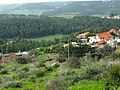
Moshav Aviezer as seen from ruin, Um Ra'us
-
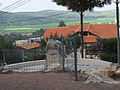
House in Moshav Aviezer
-
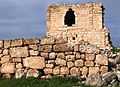
The Ruin of Um Ra'us, near Moshav Aviezer
-
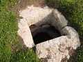
Cistern at the Ruin of Um Ra'us, near Moshav Aviezer
-

Um Ra'us, dating back to Hellenistic, Roman and Byzantine times
Bibliography
| Wikimedia Commons has media related to Aviezer. |
- Khalidi, Walid (1992). All That Remains: The Palestinian Villages Occupied and Depopulated by Israel in 1948. Washington D.C.: Institute for Palestine Studies. ISBN 0-88728-224-5.