Auxerre – Branches Aerodrome
| Auxerre - Branches Aerodrome Aérodrome d'Auxerre - Branches | |||||||||||
|---|---|---|---|---|---|---|---|---|---|---|---|
| IATA: AUF – ICAO: LFLA | |||||||||||
| Summary | |||||||||||
| Airport type | Public | ||||||||||
| Operator | CCI de l'Yonne | ||||||||||
| Serves | Auxerre / Branches, Yonne, France | ||||||||||
| Elevation AMSL | 523 ft / 159 m | ||||||||||
| Coordinates | 47°50′47″N 003°29′48″E / 47.84639°N 3.49667°ECoordinates: 47°50′47″N 003°29′48″E / 47.84639°N 3.49667°E | ||||||||||
| Map | |||||||||||
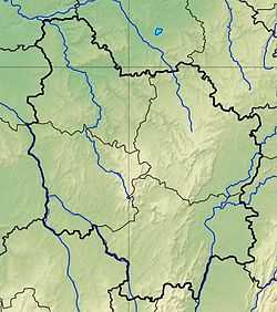 LFLA Location of airfield in Burgundy region Location of Burgundy region in France 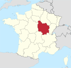 | |||||||||||
| Runways | |||||||||||
| |||||||||||
Auxerre – Branches Aerodrome (French: Aérodrome d'Auxerre - Branches[2]) (IATA: AUF[4][5], ICAO: LFLA) is an airport serving Auxerre and Branches, both communes of the Yonne department[1] in the Bourgogne region of France. The airport is located 8.5 km (4.6 NM) northwest of Auxerre[1] and approximately 4 km (2.2 NM) southeast of Branches.[6]
Facilities
The airport resides at an elevation of 523 feet (159 m) above mean sea level. It has one runway designated 01/19 with an asphalt surface measuring 1,650 by 30 metres (5,413 ft × 98 ft).[1]
References
- ↑ 1.0 1.1 1.2 1.3 LFLA – Auxerre Branches (PDF). AIP from French Service d'information aéronautique, effective 2 Apr 2015.
- ↑ 2.0 2.1 "Aérodrome d'Auxerre - Branches". Union des Aéroports Français. Retrieved 12 May 2010.
- ↑ Airport information for LFLA from DAFIF (effective October 2006)
- ↑ 4.0 4.1 Airport information for AUF at Great Circle Mapper. Source: DAFIF (effective Oct. 2006).
- ↑ "Auxerre-Branches Airport (AUF / LFLA)". Aviation Safety Network. Retrieved 12 May 2010.
- ↑ "Aerial image with distances to airport from Auxerre and Branches". WikiMapia. Retrieved 12 May 2010.
External links
- (French) CCI de l'Yonne
- Aeronautical chart for LFLA at SkyVector