Aurora, Missouri
| Aurora, Missouri | |
|---|---|
| City | |
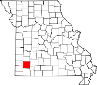
 Location of Aurora, Missouri | |
| Coordinates: 36°58′12″N 93°43′14″W / 36.97000°N 93.72056°WCoordinates: 36°58′12″N 93°43′14″W / 36.97000°N 93.72056°W | |
| Country | United States |
| State | Missouri |
| County | Lawrence |
| Area[1] | |
| • Total | 5.98 sq mi (15.49 km2) |
| • Land | 5.95 sq mi (15.41 km2) |
| • Water | 0.03 sq mi (0.08 km2) |
| Elevation | 1,401 ft (427 m) |
| Population (2010)[2] | |
| • Total | 7,508 |
| • Estimate (2013[3]) | 7,495 |
| • Density | 1,261.8/sq mi (487.2/km2) |
| Time zone | Central (CST) (UTC-6) |
| • Summer (DST) | CDT (UTC-5) |
| ZIP code | 65605 |
| Area code(s) | 417 |
| FIPS code | 29-02548 |
| GNIS feature ID | 0713486[4] |
| Website | aurora-cityhall.org |
Aurora is a city in Lawrence County, Missouri, United States. The population was 7,508 at the 2010 census.
History
The Honey Creek area, near Aurora, Missouri was originally settled by pioneers from Tennessee, including James D. Hillhouse, E. B. Hillhouse, Reverend A. A. Young, James Barrow and James Gibson. They were later instrumental in founding Aurora.[5] Their descendants include actor Brad Pitt and novelist and national security analyst Raelynn Hillhouse.
Aurora was laid out in 1870. It was reportedly named after Aurora, the Roman goddess of dawn.[6]
Galena ore was discovered in 1885 while digging a well on the farm of Thomas D. Liles in November, 1885, marking the beginning of Aurora as a mining town.[7] Mining of surface outcrops began in 1886.[8] Large scale commercial mining began shortly afterwards as the mines grew deeper and zinc and galena were discovered. The zinc from the Aurora mines was of exceptional purity and high grade. By 1893 12,651 tons of zinc ore were mined and shipped from Aurora.[8] The mines attracted prospectors and minors. Aurora's population peaked at 10,000 around 1900.
The Frisco Railroad (now Burlington Northern-Santa Fe) and the Missouri Pacific (now Union Pacific) previously had depots in Aurora. The train master for the Missouri Pacific Railroad's White River division was headquartered in Aurora until the mid-1950s.
Between 1911 and 1920, the virulently anti-Catholic newspaper The Menace was published in Aurora by W. F. Phelps and Earl McClure. In 1914 it achieved a national circulation of over one million, according to the March 1932 issue of American Mercury.
The local newspaper is The Aurora Advertiser.
In the 1950s, the elementary school on the North Side (of the railroad tracks) was Lowell School (the building has since been torn down).
There were two small grocery markets on the North Side: one across from Lowell School, called the "Hilltop Market," but known to all as "Ed's," owned by Ed Jaque, and one several blocks down the road, owned by Mr. and Mrs. Herman Jackson. Mr. Samuels operated a barber shop in a room behind his garage at his home. The doctor on the North Side was K.L. Kelsey, who still made some house calls at that time.
Most businesses were located on the South Side, where the two railroad depots and the U.S. Post Office were located. The Frisco Railroad telegraph operator during most of the 1950s was Virgil L. Walker Jr. The Missouri Pacific trainmaster for many years was J. Kelly Hobbs, Sr. Bob Beatty worked at the post office. There was a Western Auto store in the main business district. Also in that business district were a Ben Franklin Store, Dryer's Shoe Store, Toff's Department Store, the Aurora Bank, Dryer's Shoe Store, McNatt Insurance, B&T Supermarket, MFA Market, Princess Movie Theater, Alexander's Cafe, Sullivan's Jewelry, Neimeyer Shoe Repair, Wooten's Rexall and a number of others. Dr. Brown was one of the dentists. The Methodist Church was downtown, behind the B&T supermarket, and the pastor was Rev. Carlton Knight. Major industries in the 20th Century included the MWM Color Press, Tasopé Company, MFA Mill, a Coca-Cola bottling plant and what was known as the "Cheese Factory." Also on the South Side was an IGA Supermarket. Another Mr. McNatt had a service station there. Further out on the highway that passed through town were Pierce Lumber Company and Dillard's Drug Store. One nightspot, near the edge of town, was the "Cockatoo."
During at least part of this time, Finis King was mayor, and a Mr. Elderbeck was a councilman from the North Side, though he died of cancer sometime during the 1950s.
Geography
Aurora is located at 36°58′12″N 93°43′14″W / 36.97000°N 93.72056°W (36.969956, -93.720574).[9] According to the United States Census Bureau, the city has a total area of 5.98 square miles (15.49 km2), of which 5.95 square miles (15.41 km2) is land and 0.03 square miles (0.08 km2) is water.[1]
Demographics
| Historical population | |||
|---|---|---|---|
| Census | Pop. | %± | |
| 1890 | 3,482 | — | |
| 1900 | 6,191 | 77.8% | |
| 1910 | 4,148 | −33.0% | |
| 1920 | 3,575 | −13.8% | |
| 1930 | 3,875 | 8.4% | |
| 1940 | 4,056 | 4.7% | |
| 1950 | 4,153 | 2.4% | |
| 1960 | 4,683 | 12.8% | |
| 1970 | 5,359 | 14.4% | |
| 1980 | 6,437 | 20.1% | |
| 1990 | 6,459 | 0.3% | |
| 2000 | 7,020 | 8.7% | |
| 2010 | 7,508 | 7.0% | |
| Est. 2013 | 7,495 | −0.2% | |
| U.S. Decennial Census[10] 2013 Estimate[3] | |||
2010 census
As of the census[2] of 2010, there were 7,508 people, 2,948 households, and 1,943 families residing in the city. The population density was 1,261.8 inhabitants per square mile (487.2/km2). There were 3,396 housing units at an average density of 570.8 per square mile (220.4/km2). The racial makeup of the city was 92.3% White, 0.3% African American, 0.9% Native American, 0.2% Asian, 0.1% Pacific Islander, 4.4% from other races, and 1.8% from two or more races. Hispanic or Latino of any race were 7.5% of the population.
There were 2,948 households of which 36.1% had children under the age of 18 living with them, 46.8% were married couples living together, 14.0% had a female householder with no husband present, 5.1% had a male householder with no wife present, and 34.1% were non-families. 28.8% of all households were made up of individuals and 13.2% had someone living alone who was 65 years of age or older. The average household size was 2.52 and the average family size was 3.09.
The median age in the city was 35.8 years. 27.6% of residents were under the age of 18; 8.2% were between the ages of 18 and 24; 25% were from 25 to 44; 23.4% were from 45 to 64; and 15.8% were 65 years of age or older. The gender makeup of the city was 47.2% male and 52.8% female.
2000 census
As of the census of 2000, there were 7,020 people, 2,818 households, and 1,865 families residing in the city. The population density was 1,278.7 people per square mile (493.3/km²). There were 3,093 housing units at an average density of 563.9 per square mile (217.5/km²). The racial makeup of the city was 95.68% White, 0.26% African American, 0.83% Native American, 0.26% Asian, 1.34% from other races, and 1.64% from two or more races. Hispanic or Latino of any race were 2.71% of the population.
There were 2,818 households out of which 33.2% had children under the age of 18 living with them, 50.9% were married couples living together, 11.2% had a female householder with no husband present, and 33.8% were non-families. 29.8% of all households were made up of individuals and 16.0% had someone living alone who was 65 years of age or older. The average household size was 2.44 and the average family size was 3.02.
In the city the population was spread out with 27.7% under the age of 18, 8.2% from 18 to 24, 26.4% from 25 to 44, 19.6% from 45 to 64, and 18.1% who were 65 years of age or older. The median age was 36 years. For every 100 females there were 88.1 males. For every 100 females age 18 and over, there were 82.7 males.
The median income for a household in the city was $25,118, and the median income for a family was $33,029. Males had a median income of $27,591 versus $17,603 for females. The per capita income for the city was $13,410. About 14.4% of families and 18.2% of the population were below the poverty line, including 21.0% of those under age 18 and 15.6% of those age 65 or over.
Transportation
The Jerry Sumners Sr. Aurora Municipal Airport is located two nautical miles (2.3 mi, 3.7 km) southeast of Aurora's central business district.[11]
Notable people
- Don S. Davis, actor, best known for playing General George S. Hammond on Stargate SG-1
- Raelynn Hillhouse, national security and intelligence community analyst, former smuggler during the Cold War, and a spy novelist.
- Frazier Glenn Miller, Jr., a white supremacist transplant from North Carolina known for his involvement with a Ku Klux Klan group and alleged perpetration of the Overland Park Jewish Community Center shooting in 2014.
References
- ↑ 1.0 1.1 "US Gazetteer files 2010". United States Census Bureau. Retrieved 2012-07-08.
- ↑ 2.0 2.1 "American FactFinder". United States Census Bureau. Retrieved 2012-07-08.
- ↑ 3.0 3.1 "Annual Estimates of the Resident Population: April 1, 2010 to July 1, 2013". Retrieved June 15, 2014.
- ↑ "US Board on Geographic Names". United States Geological Survey. 2007-10-25. Retrieved 2008-01-31.
- ↑ http://auroramohistoricalsociety.wordpress.com/2009/02/08/early-history-of-aurora/
- ↑ Eaton, David Wolfe (1916). How Missouri Counties, Towns and Streams Were Named. The State Historical Society of Missouri. p. 184.
- ↑ http://www.worldmapsonline.com/historicalmaps/1W-MO-AU-1891.htm
- ↑ 8.0 8.1 https://archive.org/stream/leadandzincmini00holigoog/leadandzincmini00holigoog_djvu.txt
- ↑ "US Gazetteer files: 2010, 2000, and 1990". United States Census Bureau. 2011-02-12. Retrieved 2011-04-23.
- ↑ United States Census Bureau. "Census of Population and Housing". Retrieved June 15, 2014.
- ↑ FAA Airport Master Record for 2H2 (Form 5010 PDF). Federal Aviation Administration. Effective 30 June 2011.
External links
- City of Aurora
- Historic maps of Aurora in the Sanborn Maps of Missouri Collection at the University of Missouri
| |||||||||||||||||||||||||||||||||