Aujargues
| Aujargues | ||
|---|---|---|
 | ||
| ||
 Aujargues | ||
|
Location within Languedoc-Roussillon region  Aujargues | ||
| Coordinates: 43°47′26″N 4°07′25″E / 43.7906°N 4.1236°ECoordinates: 43°47′26″N 4°07′25″E / 43.7906°N 4.1236°E | ||
| Country | France | |
| Region | Languedoc-Roussillon | |
| Department | Gard | |
| Arrondissement | Nîmes | |
| Canton | Sommières | |
| Intercommunality | Pays de Sommières | |
| Government | ||
| • Mayor (2008–2014) | Guy Lamadie | |
| Area1 | 6.85 km2 (2.64 sq mi) | |
| Population (2008)2 | 822 | |
| • Density | 120/km2 (310/sq mi) | |
| INSEE/Postal code | 30023 / 30250 | |
| Elevation |
50–143 m (164–469 ft) (avg. 70 m or 230 ft) | |
|
1 French Land Register data, which excludes lakes, ponds, glaciers > 1 km² (0.386 sq mi or 247 acres) and river estuaries. 2 Population without double counting: residents of multiple communes (e.g., students and military personnel) only counted once. | ||
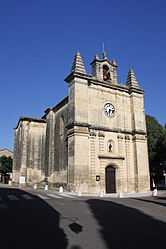
Aujargues is a commune in the Gard department in southern France.
Population
| Historical population | ||
|---|---|---|
| Year | Pop. | ±% |
| 1962 | 223 | — |
| 1968 | 232 | +4.0% |
| 1975 | 295 | +27.2% |
| 1982 | 366 | +24.1% |
| 1990 | 469 | +28.1% |
| 1999 | 673 | +43.5% |
| 2008 | 822 | +22.1% |
See also
References
| Wikimedia Commons has media related to Aujargues. |