Attleborough Falls Historic District
|
Attleborough Falls Historic District | |
 | |
|
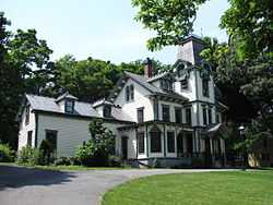
Benjamin Stanley Freeman Home | |
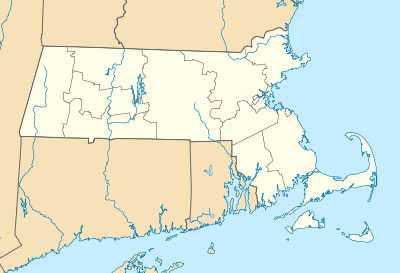 | |
| Location | North Attleborough, Massachusetts |
|---|---|
| Coordinates | 41°58′6″N 71°19′7″W / 41.96833°N 71.31861°WCoordinates: 41°58′6″N 71°19′7″W / 41.96833°N 71.31861°W |
| Area | 42 acres (17 ha) |
| Architectural style | Italianate, Bungalow/Craftsman |
| Governing body | Private |
| NRHP Reference # |
03001372 [1] |
| Added to NRHP | January 6, 2004 |
The Attleborough Falls Historic District is a historic district on Mt. Hope Street, just west of Reservoir Street to the 10 Mile River, Towne Street from Mt. Hope Street to the 10 Mile river in North Attleborough, Massachusetts. It encompasses a stylish late-19th century residential area that developed in the second half of the 19th century due to the increasing urbanization of nearby Pawtucket and Providence, Rhode Island.[2]
The district was added to the National Register of Historic Places in 2004.[1]
See also
References
| Wikimedia Commons has media related to Attleborough Falls. |
- ↑ 1.0 1.1 "National Register Information System". National Register of Historic Places. National Park Service. 2008-04-15.
- ↑ "NRHP nomination for Attleborough Falls Historic District". Commonwealth of Massachusetts. Retrieved 2014-06-15.
| |||||||||||||||||||||||||||||||||||||||||||||||||||||||
