Attavyros (municipality)
| Attavyros Αττάβυρος | |
|---|---|
|
Location within the Regional Unit of Rhodes | |
 Attavyros | |
|
Location within the Dodecanese 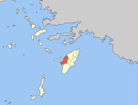 | |
| Coordinates: 36°14′N 27°51′E / 36.233°N 27.850°ECoordinates: 36°14′N 27°51′E / 36.233°N 27.850°E | |
| Country | Greece |
| Administrative region | South Aegean |
| Regional unit | Rhodes |
| Municipality | Rhodes |
| • Municipal unit | 234.4 km2 (90.5 sq mi) |
| Population (2001)[1] | |
| • Municipal unit | 3,225 |
| • Municipal unit density | 14/km2 (36/sq mi) |
| Time zone | EET (UTC+2) |
| • Summer (DST) | EEST (UTC+3) |
Attavyros (Greek: Αττάβυρος) is a former municipality on the island of Rhodes, in the Dodecanese, Greece. Since the 2011 local government reform it is part of the municipality Rhodes, of which it is a municipal unit.[2]
Geography
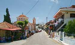
The population is 3,225 (2001 census); the land area is 234.350 km². It is the westernmost municipal unit on the island, occupying the central portion of its western coast. The seat of the municipality was in Empona (pop. 1,216). Its largest other towns are Ágios Isídoros (590) and Kritinía (542). In land area it is the second-largest municipal unit on Rhodes and the second-least densely populated, after South Rhodes (Notia Rodos).
The municipal unit is composed by five communities:
| Community | Population (2001) | Localities (main locality shown in italics) |
|---|---|---|
| Agios Isidoros (Άγιος Ισίδωρος) |
590 |
Agios Isidoros (590 inh.) |
| Emponas (Έμπωνας) |
1,451 |
Emponas (1,216 inh.) Mandriko (Μανδρικό, 235 inh.) |
| Kritinia (Κρητηνία) |
606 |
Kritinia (542 inh.) Kameiros Skala (Κάμειρος Σκάλα, 64 inh.) |
| Monolithos (Μονόλιθος) |
334 |
Monolithos (334 inh.) |
| Siana (Σιάνα) |
244 |
Siana (229 inh.) Lakki (Λακκί, 15 inh.) |
Gallery
-
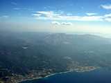
Aerial view of Attavyros mountain and municipal unit
-
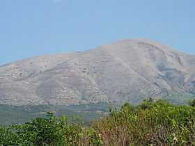
Attavyros mountain
-
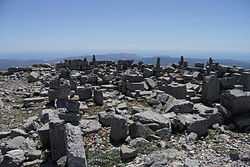
Temple of Zeus at the top of Attavyros Mountain
References
- ↑ De Facto Population of Greece Population and Housing Census of March 18th, 2001 (PDF 39 MB). National Statistical Service of Greece. 2003.
- ↑ Kallikratis law Greece Ministry of Interior (Greek)
External links
![]() Media related to Attavyros at Wikimedia Commons
Media related to Attavyros at Wikimedia Commons
| ||||||||||||||||||||||||||||||||||||||||||