Atsimo-Andrefana
| Atsimo Andrefana Region Région Atsimo Andrefana | |
|---|---|
| Region | |
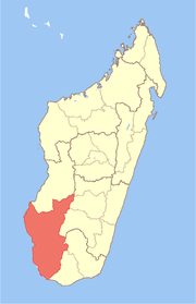 Location in Madagascar | |
| Country |
|
| Capital | Toliara |
| Area[1] | |
| • Total | 66,236 km2 (25,574 sq mi) |
| Population (2004)[1] | |
| • Total | 1,018,500 |
| • Density | 15.4/km2 (40/sq mi) |
| Time zone | EAT (UTC3) |
Atsimo-Andrefana is a region of Madagascar. It borders Menabe in north, Amoron'i Mania and Haute Matsiatra in northeast, Ihorombe and Anosy in east and Androy in southeast. The capital is Toliara and the population was estimated to be 1,018,500 in 2004. Atsimo Andrefana is the largest of all Malagasy regions with an area of 66,236 km2 (25,574 sq mi).[1]
Administrative divisions
Atsimo-Andrefana region is divided into nine districts, which are sub-divided into 105 communes.
- Ampanihy District
- Ankazoabo District
- Benenitra District
- Betioky Sud District
- Beroroha District
- Morombe District
- Sakaraha District
- Toliara District
- Toliara II District
Protected areas
In Atsimo-Andrefana are found the following protected areas:
References
- ↑ 1.0 1.1 1.2 Ralison, Eliane; Goossens, Frans. "Madagascar: Profil des marchés pour les évaluations d’urgence de la sécurité alimentaire" (PDF) (in French). Programme Alimentaire Mondial, Service de l’Evaluation des besoins d’urgence (ODAN). Retrieved 2008-03-01.
Coordinates: 23°24′50″S 43°48′22″E / 23.414°S 43.806°E