Athanaric's Wall
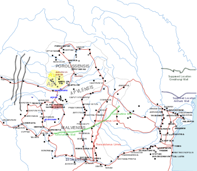
Athanaric's Wall on the map
Athanaric's Wall, also called Lower Trajan's Wall or Southern Trajan's Wall, was a fortification line erected by Athanaric, the king of the Thervingi, between the banks of river Gerasius (modern Prut) and the Danube to the land of Taifali (modern Oltenia). Most probably, Athanaric's Wall has reused the old Roman limes called Limes Transalutanus.[1]
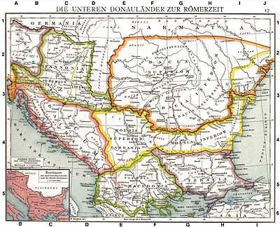
Map of Roman provinces from the Lower Danube showing The Vallum. Old historical map from Droysens Historical Atlas, 1886
See also
References
- ↑ The Goths By Peter Heather page 100