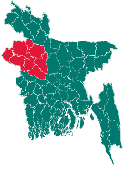
Atgharia Upazila
| Atgharia আটগড়িয়া | |
|---|---|
| Upazila | |
 Atgharia Location in Bangladesh | |
| Coordinates: 24°8′N 89°15′E / 24.133°N 89.250°ECoordinates: 24°8′N 89°15′E / 24.133°N 89.250°E | |
| Country |
|
| Division | Rajshahi Division |
| District | Pabna District |
| Area | |
| • Total | 186.15 km2 (71.87 sq mi) |
| Population (1991) | |
| • Total | 124,454 |
| • Density | 669/km2 (1,730/sq mi) |
| Time zone | BST (UTC+6) |
| Website | Official Map of Atgharia |
Atgharia (Bengali: আটঘোরিয়া or Aatghoriya) is an Upazila of Pabna District in Rajshahi Division, Bangladesh.[1]
Geography
Atgharia is located at 24°08′00″N 89°15′00″E / 24.1333°N 89.2500°E . It has 22339 units of house hold and total area 186.15 km².
Education
Educational institutions include the Schools & High Schools: Debattar Model Government Primary School (1880), Debuttor Kabi Bande Ali Miya High School (1988), Debuttor Pailot Girls High school, Atghoria High School (1954), B.L.K. High School, Khidirpur High School, Parkhidirpur High School, Ekdanta High School, Lakshmipur High School, Shibpur Madrassa, Dhalesshar Dakhil Madrassa. College: Atghoria College, Debuttor Degree College
Demographics
As of the 1991 Bangladesh census, Atgharia has a population of 124454. Males constitute 51.41% of the population, and females 48.59%. This Upazila's eighteen up population is 59721. Atgharia has an average literacy rate of 21.7% (7+ years), and the national average of 32.4% literate.[2]
Administration
Chairman: Isharot Ali (Independent)
Vice Chairman: Abdus Sattar Mohammad Sohel (Independent)
Woman Vice Chairman: Meherun Nessa (from Bangladesh Nationalist Party)
Upazila Nirbahi Officer (UNO): Syed Robiul Islam
Administrative
Atgharia Upazila (pabna district) with an area of 186.15 km2 is bounded by baraigram, chatmohar and faridpur upazilas on the north, pabna sadar upazila on the south, santhia upazila on the east and ishwardi upazilas on the west. Main rivers are Chiknai, Ratnai and Chandrabati; Purulia and Sutir Beels are notable.
Atgharia (Town) located at Debattar, consists of four mouzas. The area of the town is 5.93 km2. The town has a population of 5164; male 50.37%, female 49.63%. The density of population is 871 per km2. Literacy rate among the town people is 23.09%.
Administration Atgharia thana was turned into an upazila in 1983. The upazila consists of five unions, 111 mouzas and 126 villages.
Historical events A fierce battle was fought between the Pak army and the freedom fighters at the Bangshipara Ghat on river Chandrabati of Majpara Union. Md Anwar Hossain led the battle on the Mukti Bahini side.In this battle 12 freedom fighters and three villagers were killed. The Pakistan army lost their commander Captain Tahir and about 13 more soldiers in this battle.
Marks of war of liberation Mass grave near the bamboo-clump of Dr. Magrib (Debattar South Para)
Population 124454; male 51.41%, female 48.59%; Muslim 97.25%; Hindu 2.59% and others 0.16%. Ethnic nationals: very few Bagdi and Buno ethnic people live at Dhaleshwar and Khidirpur.
Religious institutions Mosque 161, temple 17, church 1 the most noted of which are Beruan Mosque, Atgharia Mosque, Debattar Mosque, Sreekantapur Mosque, Ekdanta Mosque and Radhakantapur Mosque.
Literacy and educational institutions Average literacy 21.07%; male 26.4% and female 16.8%. Educational institution: College 5, secondary school 15, madrasa 18, government primary school 44, non-government primary school 29. Noted educational institutions: Debattar Pilot Girls' High School, Atgharia Secondary School, Sahid Abdul Khaleque High School, Atghoria high school (1954), B.L.K High school, Khidirpur high school, Parkhidirpur high school, Ekdanta High School, Lakshmipur High School, Debattar Model Government Primary School (1880), Shibpur Madrassa.
College: Atghoria Degree college (1972), khidirpur Degree college, Akdonto college
Locally published newspapers and periodicals Weekly Pragati (extinct), Sahitya Patrika (extinct).
Cultural organisations Rural club 50, library 16, cinema hall 1, literary society 1, cultural group 1, opera party 1, theatre group 1.
Main occupations Agriculture 46.17%, agricultural labourer 30.27%, wage labourer 3%, weaving 2.95%, commerce 6.69%, service 2.79% and others 8.13%.
Land use Total cultivable land 18656 hectares; fallow land 1555 hectares; forestry 871 hectares, marsh land 503 hectares; single crop land 30%, double crop 60% and treble crop land 10%; cultivable land under irrigation 59%.
Land control Among the peasants 40% are marginal and small, 50% intermediate and 10% rich.
Value of land The market value of the land of the first grade is 7500 Taka per 0.01 hectare.
Main crops Paddy, jute, sugar cane, mustard seed, potato, betel leaf, onion, garlic, green chilly, brinjal, pulse and vegetables.
Extinct or nearly extinct crops Barley, koun, china and bhura.
Main fruits Banana, mango, jack fruit, papaya, litchi and guava.
Fisheries, dairies, poultries dairy farm 5, poultry farm 25, fishery 30 and hatchery 8.
Communications: metalled road 65 km and earthen road 320 km.
Traditional transport Palanquin (extinct), horse carriage and bullock cart (nearly extinct), boat.
Cottage industries Weaving 1200, blacksmiths 50, goldsmiths 20, bamboo and cane works 100, carpenters 250, tailoring 200 and silk works 100.
Main hats, bazars and fairs Main hats and bazars are 18 the most noted of which are Atgharia, Debattar, Khidirpur, Garuri Hat. Fairs- 2.
Exports: Jute, paddy, onion, garlic, brinjal, chille, potol, betel leaf, banana, papaya.
NGOs: BRAC, ASA, CCDB, Nijpath, Asset.
Health centres: 1 Upazila Health Complex, and 5 Union Health Centres.
Notable persons
- Dr. Mohammad Lutfor Rahman, famous cardiac surgeon, LabAid Cardiac Hospital, Dhanmondi, Dhaka
- Alhajj Moulana Md. Obaidur Rahman, Founder- Hashai Khali Siddikia Khanka Sharif, Atghoria, Pabna,
.. Mohammad Masum Billah, Bcs ( General Education), Lecturer, Islamic Studies, Govt. Madrasah -E- Alia, Dhaka.
See also
Late KM. Asad Ullah (Member of civil society atghoria branch).
References
- ↑ Md Alauddin Molla (2012). "Atgharia Upazila". In Sirajul Islam and Ahmed A. Jamal. Banglapedia: National Encyclopedia of Bangladesh (Second ed.). Asiatic Society of Bangladesh.
- ↑ "Population Census Wing, BBS.". Archived from the original on 2005-03-27. Retrieved November 10, 2006.
| |||||||||||||||||||||||||||||||||||||||||
