Astley railway station
| Astley | |
|---|---|
|
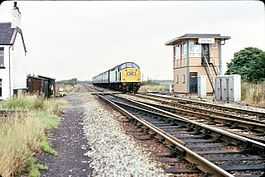
Astley signalbox and level crossing | |
| Location | |
| Place | Astley Green |
| Area | Wigan |
| Operations | |
| Original company | Liverpool and Manchester Railway |
| Pre-grouping | London and North Western Railway |
| Post-grouping | London Midland and Scottish Railway |
| Platforms | 2 |
| History | |
| c. 1844 | Station opens as Flow Moss Cottage |
| Unknown | Station renamed Astley |
| 7 May 1956 | Station closes |
| Disused railway stations in the United Kingdom | |
|
Closed railway stations in Britain A B C D–F G H–J K–L M–O P–R S T–V W–Z | |
| UK Railways portal | |
Astley was a railway station on the Liverpool and Manchester Railway to the south of Astley village in what was then the county of Lancashire in England.
History
Opened in the 1840s by the Liverpool and Manchester Railway, the station became part of the Grand Junction Railway on 8 August 1845. The GJR merged to form the London and North Western Railway on 16 July 1846. The LNWR became part of the London Midland and Scottish Railway during the Grouping of 1923. The station then passed to the London Midland Region of British Railways on nationalisation in 1948 and was then closed by the British Railways Board on 7 May 1956
The site today
Trains on the northerly of the two Liverpool to Manchester Lines still pass the site. The buildings have been demolished and a signal box built since the station's closure occupies part of the site. An electrical switching site is being constructed in the vicinity as part of the Manchester - Liverpool (via Earlestown) section of the NW electrification schemes.
| Preceding station | Disused railways | Following station | ||
|---|---|---|---|---|
| Glazebury and Bury Lane | Liverpool and Manchester Railway | Flow Moss | ||
References
Notes
Bibliography
- Butt, R. V. J. (1995). The Directory of Railway Stations: details every public and private passenger station, halt, platform and stopping place, past and present (1st ed.). Sparkford: Patrick Stephens Ltd. ISBN 1-8526-0508-1. OCLC 60251199.
- Jowett, Alan (2000). Jowett's Nationalised Railway Atlas (1st ed.). Penryn, Cornwall: Atlantic Transport Publishers. ISBN 0-9068-9999-0. OCLC 228266687.
- Jowett, Alan (March 1989). Jowett's Railway Atlas of Great Britain and Ireland: From Pre-Grouping to the Present Day (1st ed.). Sparkford: Patrick Stephens Ltd. ISBN 1-8526-0086-1. OCLC 22311137.