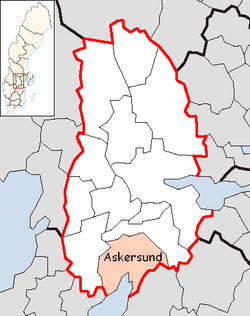
Askersund Municipality
| Askersund Municipality Askersunds kommun | ||
|---|---|---|
| Municipality | ||
| ||
 | ||
| Country | Sweden | |
| County | Örebro County | |
| Seat | Askersund | |
| Area[1] | ||
| • Total | 1,019.74 km2 (393.72 sq mi) | |
| • Land | 815.99 km2 (315.06 sq mi) | |
| • Water | 203.75 km2 (78.67 sq mi) | |
| Area as of January 1, 2014. | ||
| Population (December 31, 2014)[2] | ||
| • Total | 11,119 | |
| • Density | 11/km2 (28/sq mi) | |
| Time zone | CET (UTC+1) | |
| • Summer (DST) | CEST (UTC+2) | |
| ISO 3166 code | SE | |
| Province | Närke | |
| Municipal code | 1882 | |
| Website | www.askersund.se | |


A hamburger bar in Hammar, a village in the northern part of Askersund Municipality.
Askersund Municipality (Askersunds kommun) is a municipality in Örebro County in central Sweden. Its seat is located in the city of Askersund.
The present municipality was created in 1971, when the former City of Askersund was merged with the rural municipalities Hammar and Lerbäck.
Localities
- Askersund (seat)
- Zinkgruvan
- Lerbäck
- Mariedamm
- Åmmeberg
- Åsbro
Twin towns
Askersund's two twin towns with the year of its establishing:
Politics
Result of the 2010 election
Moderate Party 25,55%
Centre Party 8,06%
Liberal People's Party 4,93%
Christian Democrats 6,00%
Swedish Social Democratic Party 39,36%
Left Party 4,61%
Green Party 4,94%
Sweden Democrats 5,81%
Other Parties 0,73%
References
- ↑ "Statistiska centralbyrån, Kommunarealer den 1 januari 2014" (Microsoft Excel) (in Swedish). Statistics Sweden. Retrieved 2014-04-18.
- ↑ "Folkmängd i riket, län och kommuner 31 december 2014" (in Swedish). Statistics Sweden. Retrieved March 2015.
External links
- Askersund Municipality - Official site
| |||||||||||||||||
| ||||||