Ashville, Alabama
| Ashville | |
|---|---|
| City | |
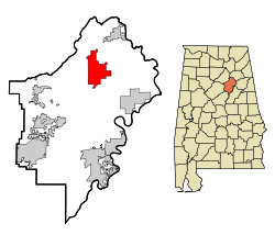 Location in St. Clair County and the state of Alabama | |
| Coordinates: 33°50′37″N 86°15′58″W / 33.84361°N 86.26611°W | |
| Country | United States |
| State | Alabama |
| County | St. Clair |
| Area | |
| • Total | 19.4 sq mi (50.3 km2) |
| • Land | 19.3 sq mi (50.1 km2) |
| • Water | 0.1 sq mi (0.2 km2) |
| Elevation | 577 ft (176 m) |
| Population (2007)[1] | |
| • Total | 2,511 |
| • Density | 116.5/sq mi (44.9/km2) |
| Time zone | Central (CST) (UTC-6) |
| • Summer (DST) | CDT (UTC-5) |
| ZIP code | 35953 |
| Area code(s) | 205 |
| FIPS code | 01-02908 |
| GNIS feature ID | 0164539 |
Ashville is a city[2] in St. Clair County, Alabama, United States. It is part of the Birmingham metropolitan area. Its population was 2,260 at the 2000 census, at which time it was a town. This town is the county seat of St. Clair County[3] along with Pell City. According to the 2005 U.S. Census estimates, the city had a population of 2,429.
Geography
Ashville is located at 33°50′37″N 86°15′59″W / 33.84361°N 86.26639°W (33.843737, -86.266274).[4]
According to the United States Census Bureau, the town had a total area of 19.4 square miles (50 km2), of which, 19.3 square miles (50 km2) of it is land and 0.1 square miles (0.26 km2) of it (0.46%) is water.
Climate
The climate in this area is characterized by hot, humid summers and generally mild to cool winters. According to the Köppen Climate Classification system, Ashville has a humid subtropical climate, abbreviated "Cfa" on climate maps. [5]
| Climate data for Ashville, Alabama | |||||||||||||
|---|---|---|---|---|---|---|---|---|---|---|---|---|---|
| Month | Jan | Feb | Mar | Apr | May | Jun | Jul | Aug | Sep | Oct | Nov | Dec | Year |
| Average high °C (°F) | 13 (55) |
13 (55) |
19 (66) |
23 (73) |
28 (83) |
32 (89) |
32 (90) |
32 (90) |
30 (86) |
24 (76) |
18 (64) |
12 (53) |
23 (73.3) |
| Average low °C (°F) | 1 (33) |
1 (33) |
6 (43) |
9 (48) |
13 (56) |
18 (65) |
20 (68) |
19 (67) |
16 (60) |
9 (49) |
3 (38) |
1 (33) |
9.7 (49.4) |
| Average precipitation mm (inches) | 135 (5.3) |
137 (5.4) |
163 (6.4) |
117 (4.6) |
91 (3.6) |
94 (3.7) |
130 (5) |
99 (3.9) |
91 (3.6) |
66 (2.6) |
86 (3.4) |
130 (5.1) |
1,339 (52.6) |
| Source: Weatherbase [6] | |||||||||||||
Demographics
| Historical population | |||
|---|---|---|---|
| Census | Pop. | %± | |
| 1900 | 362 | — | |
| 1910 | 278 | −23.2% | |
| 1920 | 349 | 25.5% | |
| 1930 | 369 | 5.7% | |
| 1940 | 385 | 4.3% | |
| 1950 | 494 | 28.3% | |
| 1960 | 973 | 97.0% | |
| 1970 | 986 | 1.3% | |
| 1980 | 1,489 | 51.0% | |
| 1990 | 1,494 | 0.3% | |
| 2000 | 2,260 | 51.3% | |
| 2010 | 2,212 | −2.1% | |
| Est. 2013 | 2,253 | 1.9% | |
| U.S. Decennial Census[7] 2013 Estimate[8] | |||
2000 Census data
As of the census[9] of 2000, there were 2,260 people, 814 households, and 608 families residing in the town. The population density was 116.9 people per square mile (45.1/km2). There were 905 housing units at an average density of 46.8 per square mile (18.1/km2). The racial makeup of the town was 69.42% White, 26.55% Black or African American, 0.18% Native American, 0.18% Asian, 0.31% Pacific Islander, 1.81% from other races, and 1.55% from two or more races. 2.88% of the population were Hispanic or Latino of any race.
There were 814 households out of which 37.0% had children under the age of 18 living with them, 56.6% were married couples living together, 14.1% had a female householder with no husband present, and 25.2% were non-families. 22.7% of all households were made up of individuals and 11.2% had someone living alone who was 65 years of age or older. The average household size was 2.64 and the average family size was 3.10.
In the town the population was spread out with 25.7% under the age of 18, 8.9% from 18 to 24, 28.2% from 25 to 44, 23.2% from 45 to 64, and 14.0% who were 65 years of age or older. The median age was 36 years. For every 100 females there were 102.3 males. For every 100 females age 18 and over, there were 100.1 males.
The median income for a household in the town was $31,509, and the median income for a family was $38,355. Males had a median income of $31,081 versus $21,914 for females. The per capita income for the town was $15,867. About 11.4% of families and 15.1% of the population were below the poverty line, including 14.1% of those under age 18 and 18.3% of those age 65 or over.
April 27, 2011 Tornado
Ashville was seriously damaged by a tornado in the early evening of April 27, 2011, primarily in the Shoal Creek area.
Education
- St. Clair County School System
- Ashville Elementary School
- Ashville Middle School
- Ashville High School - Mascot: Bulldogs - School Colors: Kelly Green & White
- Website: www.ashvilleathletics.com
Notable people
- Rufus W. Cobb, Governor of Alabama from 1878 to 1882
- John Grass, head football coach for Jacksonville State University
- Howard Hill, archer. Buried in Ashville.
- Nick Wilson, Director of Operations for Simple Technologies LLC
References
- ↑ "Annual Estimates of the Population for Incorporated Places in Alabama". United States Census Bureau. 2008-07-10. Archived from the original on 1 August 2008. Retrieved 2008-07-14.
- ↑ U.S.Census change list
- ↑ "Find a County". National Association of Counties. Retrieved 2011-06-07.
- ↑ "US Gazetteer files: 2010, 2000, and 1990". United States Census Bureau. 2011-02-12. Retrieved 2011-04-23.
- ↑ Climate Summary for Ashville, Alabama
- ↑ "Weatherbase.com". Weatherbase. 2013. Retrieved on November 2, 2013.
- ↑ "U.S. Decennial Census". Census.gov. Retrieved June 6, 2013.
- ↑ "Annual Estimates of the Resident Population: April 1, 2010 to July 1, 2013". Retrieved June 3, 2014.
- ↑ "American FactFinder". United States Census Bureau. Retrieved 2008-01-31.
External links
Coordinates: 33°50′37″N 86°15′59″W / 33.843737°N 86.266274°W
| |||||||||||||||||||||||||
