Ashland, Pennsylvania
- There is also Ashland Township in Clarion County.
| Ashland, Pennsylvania | |
|---|---|
| Borough | |
|
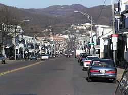
A view of Ashland | |
 Ashland, Pennsylvania | |
| Coordinates: 40°46′54″N 76°20′40″W / 40.78167°N 76.34444°WCoordinates: 40°46′54″N 76°20′40″W / 40.78167°N 76.34444°W | |
| Country | United States |
| State | Pennsylvania |
| County | Schuylkill / Columbia |
| Settled | 1820 |
| Laid out | 1847 |
| Incorporated | 1857 |
| Government | |
| • Type | Borough Council |
| • Mayor | Dennis Kane |
| Area | |
| • Total | 1.7 sq mi (4.5 km2) |
| Population (2010) | |
| • Total | 2,817 |
| • Density | 1,886.0/sq mi (728.5/km2) |
| Time zone | Eastern (EST) (UTC-5) |
| • Summer (DST) | EDT (UTC-4) |
| Zip code | 17921 |
| Area code(s) | 570 Exchange: 875 |
| Website | Ashland Chamber of Commerce |
Ashland is a borough in Schuylkill County in the U.S. state of Pennsylvania, 12 miles (19 km) northwest of Pottsville. A small part of the borough also lies in Columbia County, although all of the population resided in the Schuylkill County portion as of the 2010 census. It comprises less than 1% of the borough's area, and is located at the extreme northwest corner of the borough, bordering Conyngham Township. The Borough lies in the anthracite coal region of eastern Pennsylvania. Settled in 1850, Ashland was incorporated in 1857, and was named for Henry Clay's estate near Lexington, Kentucky. Population in 1900, 6,438; in 1910, 6,855; and in 1940, 7,045. The population was 2,817 at the 2010 census.[1]
Ashland is part of the Pottsville Micropolitan Statistical Area.
It is the location of Pioneer Tunnel, a tourist attraction featuring a tour of a coal mine on mine cars and a separate 3 ft 6 in (1,067 mm) narrow gauge[2] steam train ride.[3]
All residents of Ashland attend North Schuylkill School District, located at 1 Academy Lane, Ashland, PA. This district includes one Elementary building (K-6) and one upper campus High School (7-12).
History
For a long time after the southern part of Pennsylvania became highly industrialized, the area that is now Ashland was mostly wilderness except for a hotel that was in the area in 1820. Despite this, a prominent citizen of the county, Burd S. Patterson, predicted that the area would eventually become a prominent mining town. In 1845, John P. Brock and James Hart joined Patterson in buying 800 acres of land in the Ashland area. In 1846, a group of miners lead by Patrick Devine developed coal seams in veins in the area. However, the town progressed little over the next three years. By 1857, though, the town had 3500 people, and Ashland became a borough, detaching itself from Butler Township. The first post office was built in 1853 and the first church was built in 1855.[4] In 1938, a statue based on the famous painting Whistler's Mother was erected in the town as a tribute to local mothers.[5]
Route 61 in Ashland takes an unexplained detour where a “Keep Out” sign straddles the original highway that used to lead to the abandoned town of Centralia, where an underground mine fire has been burning since 1962.
Geography
Ashland is located at 40°46′54″N 76°20′40″W / 40.78167°N 76.34444°W (40.781587, -76.344426).[6] According to the United States Census Bureau, the borough has a total area of 1.7 square miles (4.4 km2), all land.
Ashland is served by Pennsylvania Route 54 and Pennsylvania Route 61. Most of the borough's terrain is steep hills, but the hills are gentler near the center. The majority of Ashland is forest, with an urban area in the center. Mahanoy Creek passes through Ashland.[7]
Demographics
| Historical population | |||
|---|---|---|---|
| Census | Pop. | %± | |
| 1860 | 3,880 | — | |
| 1870 | 5,714 | 47.3% | |
| 1880 | 6,052 | 5.9% | |
| 1890 | 7,346 | 21.4% | |
| 1900 | 6,438 | −12.4% | |
| 1910 | 6,855 | 6.5% | |
| 1920 | 6,686 | −2.5% | |
| 1930 | 7,164 | 7.1% | |
| 1940 | 7,045 | −1.7% | |
| 1950 | 6,192 | −12.1% | |
| 1960 | 5,237 | −15.4% | |
| 1970 | 4,737 | −9.5% | |
| 1980 | 4,235 | −10.6% | |
| 1990 | 3,859 | −8.9% | |
| 2000 | 3,283 | −14.9% | |
| 2010 | 2,817 | −14.2% | |
| Est. 2012 | 2,787 | −1.1% | |
| Sources:[8][9] | |||
As of the census of 2000,[10] there were 3,283 people, 1,437 households, and 863 families residing in the borough. The population density was 1,886 people per square mile (728.5/km²). There were 1,724 housing units at an average density of 990.4 per square mile (382.6/km²). The racial makeup of the borough was 99.39% White, 0.21% African American, 0.09% Asian, 0.06% from other races, and 0.24% from two or more races. Hispanic or Latino of any race were 0.09% of the population.
There were 1,437 households out of which 24.6% had children under the age of 18 living with them, 43.6% were married couples living together, 12.5% had a female householder with no husband present, and 39.9% were non-families. 36.4% of all households were made up of individuals and 21.7% had someone living alone who was 65 years of age or older. The average household size was 2.28 and the average family size was 3.00.
In the borough the population was spread out with 21.1% under the age of 18, 8.1% from 18 to 24, 27.0% from 25 to 44, 23.4% from 45 to 64, and 20.4% who were 65 years of age or older. The median age was 41 years. For every 100 females there were 93.9 males. For every 100 females age 18 and over, there were 90.0 males.
The median income for a household in the borough was $27,234, and the median income for a family was $34,688. Males had a median income of $30,500 versus $20,920 for females. The per capita income for the borough was $15,036. About 11.1% of families and 12.8% of the population were below the poverty line, including 16.1% of those under age 18 and 13.4% of those age 65 or over.
Notable people
- Dennis Joseph Dougherty - Roman Catholic Archbishop of Philadelphia
- Mickey Doolan - professional baseball player and coach
- Doggie Julian - Hall of Fame basketball coach
- Emil Seidel - Mayor of Milwaukee, Wisconsin and first socialist mayor of a major U.S. city.
- Jack Stivetts - professional baseball player
- Robert Spencer - doctor and safe abortion provider
References
- ↑ "Ashland, Pennsylvania". 2012. Retrieved 20 October 2012.
- ↑ Surviving Steam Locomotive Search
- ↑ "Homepage". Pioneer Tunnel. Retrieved 2 August 2014.
- ↑ http://www.livingplaces.com/PA/Schuylkill_County/Ashland_Borough.html
- ↑ Whistler's Mother Statue
- ↑ "US Gazetteer files: 2010, 2000, and 1990". United States Census Bureau. 2011-02-12. Retrieved 2011-04-23.
- ↑ http://maps.google.com/maps?f=d&source=s_d&saddr=Ashland,%20Northumberland,%20PA
- ↑ "Census of Population and Housing: Decennial Censuses". United States Census Bureau. Retrieved 2012-03-04.
- ↑ "Incorporated Places and Minor Civil Divisions Datasets: Subcounty Resident Population Estimates: April 1, 2010 to July 1, 2012". Population Estimates. U.S. Census Bureau. Retrieved 11 December 2013.
- ↑ "American FactFinder". United States Census Bureau. Retrieved 2008-01-31.
External links
| |||||||||||||||||||||||||||||||||

