Asco, California
| Asco | |
|---|---|
| Unincorporated community | |
 Asco Location in California | |
| Coordinates: 37°40′59″N 121°52′22″W / 37.68306°N 121.87278°WCoordinates: 37°40′59″N 121°52′22″W / 37.68306°N 121.87278°W | |
| Country | United States |
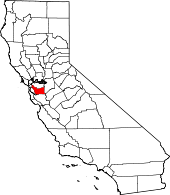
| State | California |
| County | Alameda County |
| Elevation[1] | 351 ft (107 m) |
Asco is a neighborhood in Pleasanton, California. It is located on the Southern Pacific Railroad 6 miles (9.7 km) west of Livermore,[2] at an elevation of 351 feet (107 m). The name comes from the Alameda Sugar Company (ASC), which later changed its name to Holly Sugar Company. The company raised crops there, including sugar beets, from 1899 until the mid-20th Century.[2][3]
References
- ↑ "Asco". Geographic Names Information System. United States Geological Survey.
- ↑ 2.0 2.1 Durham, David L. (1998). California's Geographic Names: A Gazetteer of Historic and Modern Names of the State. Clovis, Calif.: Word Dancer Press. p. 597. ISBN 1-884995-14-4.
- ↑ Hartman, Louise. "It's Harvest Time". San Jose Mercury News. Retrieved 21 May 2014.
| |||||||||||||||||||||||||