Arrondissement of Saint-Étienne
| Saint-Étienne | |
|---|---|
| Arrondissement of France | |
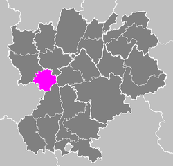 Location of Saint-Étienne in Rhône-Alpes | |
| Country | France |
| Region | Rhône-Alpes |
| Department | Loire |
| Cantons | 19 |
| Communes | 74 |
| Prefecture | Saint-Étienne |
| Area¹ | |
| • Total | 1,041 km2 (402 sq mi) |
| Population (1999) | |
| • Total | 415,576 |
| • Density | 400/km2 (1,000/sq mi) |
| ¹ French Land Register data, which exclude lakes, ponds, and glaciers larger than 1 km² as well as the estuaries of rivers. | |
The arrondissement of Saint-Étienne is located in the Loire department in the Rhône-Alpes region of France. It is composed of 19 cantons and 74 communes.
Composition
Cantons
The cantons of the arrondissement of Saint-Étienne are:
- Bourg-Argental
- Firminy
- La Grand-Croix
- Le Chambon-Feugerolles
- Pélussin
- Rive-de-Gier
- Saint-Chamond-Nord
- Saint-Chamond-Sud
- Saint-Étienne-Nord-Est 1st Canton
- Saint-Étienne-Nord-Est 2nd Canton
- Saint-Étienne-Nord-Ouest 1st Canton
- Saint-Étienne-Nord-Ouest 2nd Canton
- Saint-Étienne-Sud-Est 1st Canton
- Saint-Étienne-Sud-Est 2nd Canton
- Saint-Étienne-Sud-Est 3rd Canton
- Saint-Étienne-Sud-Ouest 1st Canton
- Saint-Étienne-Sud-Ouest 2nd Canton
- Saint-Genest-Malifaux
- Saint-Héand
Communes
The communes of the arrondissement of Saint-Étienne, and their INSEE codes, are:
| 1. Bessey (42018) | 2. Bourg-Argental (42023) | 3. Burdignes (42028) | 4. Çaloire (42031) |
| 5. Cellieu (42032) | 6. Chagnon (42036) | 7. Châteauneuf (42053) | 8. Chavanay (42056) |
| 9. Chuyer (42064) | 10. Colombier (42067) | 11. Dargoire (42083) | 12. Doizieux (42085) |
| 13. Farnay (42093) | 14. Firminy (42095) | 15. Fontanès (42096) | 16. Fraisses (42099) |
| 17. Genilac (42225) | 18. Graix (42101) | 19. Jonzieux (42115) | 20. L'Étrat (42092) |
| 21. L'Horme (42110) | 22. La Chapelle-Villars (42051) | 23. La Fouillouse (42097) | 24. La Grand-Croix (42103) |
| 25. La Ricamarie (42183) | 26. La Talaudière (42305) | 27. La Terrasse-sur-Dorlay (42308) | 28. La Tour-en-Jarez (42311) |
| 29. La Valla-en-Gier (42322) | 30. La Versanne (42329) | 31. Le Bessat (42017) | 32. Le Chambon-Feugerolles (42044) |
| 33. Lorette (42123) | 34. Lupé (42124) | 35. Maclas (42129) | 36. Malleval (42132) |
| 37. Marcenod (42133) | 38. Marlhes (42139) | 39. Pavezin (42167) | 40. Pélussin (42168) |
| 41. Planfoy (42172) | 42. Rive-de-Gier (42186) | 43. Roche-la-Molière (42189) | 44. Roisey (42191) |
| 45. Saint-Appolinard (42201) | 46. Saint-Chamond (42207) | 47. Saint-Christo-en-Jarez (42208) | 48. Saint-Étienne (42218) |
| 49. Saint-Genest-Lerpt (42223) | 50. Saint-Genest-Malifaux (42224) | 51. Saint-Héand (42234) | 52. Saint-Jean-Bonnefonds (42237) |
| 53. Saint-Joseph (42242) | 54. Saint-Julien-Molin-Molette (42246) | 55. Saint-Martin-la-Plaine (42259) | 56. Saint-Michel-sur-Rhône (42265) |
| 57. Saint-Paul-en-Cornillon (42270) | 59. Saint-Paul-en-Jarez (42271) | 59. Saint-Pierre-de-Bœuf (42272) | 60. Saint-Priest-en-Jarez (42275) |
| 61. Saint-Romain-en-Jarez (42283) | 62. Saint-Romain-les-Atheux (42286) | 63. Saint-Régis-du-Coin (42280) | 64. Saint-Sauveur-en-Rue (42287) |
| 65. Sainte-Croix-en-Jarez (42210) | 66. Sorbiers (42302) | 67. Tarentaise (42306) | 68. Tartaras (42307) |
| 69. Thélis-la-Combe (42310) | 70. Unieux (42316) | 71. Valfleury (42320) | 72. Véranne (42326) |
| 73. Vérin (42327) | 74. Villars (42330) |