Arrondissement of Forcalquier
| Forcalquier | |
|---|---|
| Arrondissement of France | |
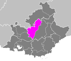 Location of Forcalquier in Provence-Alpes-Côte d'Azur | |
| Country | France |
| Region | Provence-Alpes-Côte d'Azur |
| Department | Alpes-de-Haute-Provence |
| Cantons | 13 |
| Communes | 87 |
| Subprefecture | Forcalquier |
| Area¹ | |
| • Total | 2,112 km2 (815 sq mi) |
| Population (1999) | |
| • Total | 75,739 |
| • Density | 36/km2 (93/sq mi) |
| ¹ French Land Register data, which exclude lakes, ponds, and glaciers larger than 1 km² as well as the estuaries of rivers. | |
The arrondissement of Forcalquier is an arrondissement of France in the Alpes-de-Haute-Provence department in the Provence-Alpes-Côte d'Azur region. It has 13 cantons and 87 communes.
Composition
Cantons
The cantons of the arrondissement of Forcalquier are:
- Banon
- Forcalquier
- Manosque-Nord
- Manosque-Sud-Est
- Manosque-Sud-Ouest
- La Motte-du-Caire
- Noyers-sur-Jabron
- Peyruis
- Reillanne
- Saint-Étienne-les-Orgues
- Sisteron
- Turriers
- Volonne
Communes
The communes of the arrondissement of Forcalquier, and their INSEE codes, are:
| 1. Aubenas-les-Alpes (04012) | 2. Aubignosc (04013) | 3. Authon (04016) | 4. Banon (04018) |
| 5. Bayons (04023) | 6. Bellaffaire (04026) | 7. Bevons (04027) | 8. Château-Arnoux-Saint-Auban (04049) |
| 9. Châteaufort (04050) | 10. Châteauneuf-Miravail (04051) | 11. Châteauneuf-Val-Saint-Donat (04053) | 12. Clamensane (04057) |
| 13. Claret (04058) | 14. Corbières (04063) | 15. Cruis (04065) | 16. Curbans (04066) |
| 17. Curel (04067) | 18. Céreste (04045) | 19. Dauphin (04068) | 20. Entrepierres (04075) |
| 21. Faucon-du-Caire (04085) | 22. Fontienne (04087) | 23. Forcalquier (04088) | 24. Ganagobie (04091) |
| 25. Gigors (04093) | 26. L'Escale (04079) | 27. L'Hospitalet (04095) | 28. La Brillanne (04034) |
| 29. La Motte-du-Caire (04134) | 30. La Rochegiron (04169) | 31. Lardiers (04101) | 32. Le Caire (04037) |
| 33. Les Omergues (04140) | 34. Limans (04104) | 35. Lurs (04106) | 36. Mallefougasse-Augès (04109) |
| 37. Mane (04111) | 38. Manosque (04112) | 39. Melve (04118) | 40. Mison (04123) |
| 41. Montfort (04127) | 42. Montfuron (04128) | 43. Montjustin (04129) | 44. Montlaux (04130) |
| 45. Montsalier (04132) | 46. Nibles (04137) | 47. Niozelles (04138) | 48. Noyers-sur-Jabron (04139) |
| 49. Ongles (04141) | 50. Oppedette (04142) | 51. Peipin (04145) | 52. Peyruis (04149) |
| 53. Pierrerue (04151) | 54. Pierrevert (04152) | 55. Piégut (04150) | 56. Redortiers (04159) |
| 57. Reillanne (04160) | 58. Revest-Saint-Martin (04164) | 59. Revest-des-Brousses (04162) | 60. Revest-du-Bion (04163) |
| 61. Saint-Geniez (04179) | 62. Saint-Maime (04188) | 63. Saint-Martin-les-Eaux (04190) | 64. Saint-Michel-l'Observatoire (04192) |
| 65. Saint-Vincent-sur-Jabron (04199) | 66. Saint-Étienne-les-Orgues (04178) | 67. Sainte-Croix-à-Lauze (04175) | 68. Sainte-Tulle (04197) |
| 69. Salignac (04200) | 70. Saumane (04201) | 71. Sigonce (04206) | 72. Sigoyer (04207) |
| 73. Simiane-la-Rotonde (04208) | 74. Sisteron (04209) | 75. Sourribes (04211) | 76. Thèze (04216) |
| 77. Turriers (04222) | 78. Vachères (04227) | 79. Valavoire (04228) | 80. Valbelle (04229) |
| 81. Valernes (04231) | 82. Vaumeilh (04233) | 83. Venterol (04234) | 84. Villemus (04241) |
| 85. Villeneuve (04242) | 86. Volonne (04244) | 87. Volx (04245) |