Arrigorriaga
| Arrigorriaga | |||
|---|---|---|---|
| Municipality | |||
| |||
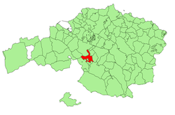 Location of Arrigorriaga in Bizkaia | |||
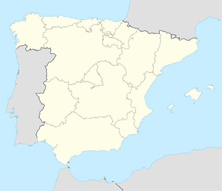 Arrigorriaga Location in Spain | |||
| Coordinates: 43°12′28″N 2°53′10″W / 43.20778°N 2.88611°WCoordinates: 43°12′28″N 2°53′10″W / 43.20778°N 2.88611°W | |||
| Country | Spain | ||
| Autonomous community | Basque Country | ||
| Province | Bizkaia | ||
| Comarca | Greater Bilbao | ||
| Government | |||
| • Alcalde | Asier Albizua (PNV) | ||
| Area | |||
| • Total | 16.36 km2 (6.32 sq mi) | ||
| Elevation | 58 m (190 ft) | ||
| Highest elevation | 585 m (1,919 ft) | ||
| Lowest elevation | 35 m (115 ft) | ||
| Population (2010) | |||
| • Total | 12,358 | ||
| • Density | 760/km2 (2,000/sq mi) | ||
| Demonym | Arrigorriagatar | ||
| Time zone | CET (UTC+1) | ||
| • Summer (DST) | CEST (UTC+2) | ||
| Postal code | 48480 | ||
| Official language(s) | Basque and Spanish | ||
| Website | Official website | ||
Arrigorriaga is a town and municipality located in the province of Bizkaia, in the autonomous community of Basque Country, northern Spain. Arrigorriaga is located 7 km south of Bilbao and is part of Bilbao's metropolitan area. Its official population at the 2010 census was 12,358 inhabitants living on a land area of 16.36 km² (6.3 sq mi). It is conterminous with Bilbao and Basauri in the north, with Ugao-Miraballes and Zeberio in the south, with Zaratamo in the east and with Arrankudiaga and Alonsotegi in the west.
External links
- ARRIGORRIAGA in the Bernardo Estornés Lasa - Auñamendi Encyclopedia (Euskomedia Fundazioa) (Spanish)