Arledge Field
| Arledge Field | |||||||||||
|---|---|---|---|---|---|---|---|---|---|---|---|
|
1995 USGS Photo | |||||||||||
| IATA: none – ICAO: none | |||||||||||
| Summary | |||||||||||
| Airport type | Public | ||||||||||
| Owner | City of Stamford | ||||||||||
| Location | Jones County, near Stamford, Texas | ||||||||||
| Elevation AMSL | 1,561 ft / 475 m | ||||||||||
| Coordinates | 32°54′33″N 099°44′09″W / 32.90917°N 99.73583°WCoordinates: 32°54′33″N 099°44′09″W / 32.90917°N 99.73583°W | ||||||||||
| Runways | |||||||||||
| |||||||||||
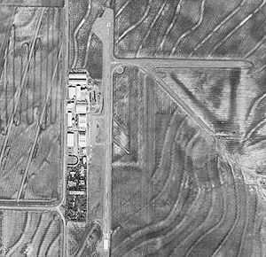
Arledge Field (FAA LID: F56) is a public airport located approximately 4 miles (6.4 km) east of Stamford, Texas. It provides general aviation service.
History
Opened on 1 April 1941. Known as Arledge Field or Stamford-Arledge Field. Began training United States Army Air Corps flying cadets under contract to Stamford Flying School (later: Lou Foote Flying Service; later: Coleman Flying School). Assigned to United States Army Air Forces Gulf Coast Training Center (later Central Flying Training Command) as a primary (level 1) pilot training airfield. Had four hard surface runways for landings and takeoffs. Also had four auxiliary airfields for emergency landings and overflows. Flying training was performed with Fairchild PT-19s as the primary trainer. Also had several PT-17 Stearmans assigned.
Inactivated on 8 September 1944 with the drawdown of AAFTC's pilot training program. Declared surplus and turned over to the Army Corps of Engineers on 30 September 1945. Eventually discharged to the War Assets Administration (WAA) and became a civil airport.
See also
References
![]() This article incorporates public domain material from websites or documents of the Air Force Historical Research Agency.
This article incorporates public domain material from websites or documents of the Air Force Historical Research Agency.
- Shaw, Frederick J. (2004), Locating Air Force Base Sites History’s Legacy, Air Force History and Museums Program, United States Air Force, Washington DC, 2004.
- Manning, Thomas A. (2005), History of Air Education and Training Command, 1942–2002. Office of History and Research, Headquarters, AETC, Randolph AFB, Texas ASIN: B000NYX3PC
External links
- FAA Terminal Procedures for F56, effective April 2, 2015
- Resources for this airport:
- FAA airport information for F56
- AirNav airport information for F56
- FlightAware airport information and live flight tracker
- SkyVector aeronautical chart for F56
| ||||||||||||||||||
