Arinj
Coordinates: 40°13′53″N 44°34′16″E / 40.23139°N 44.57111°E
| Arinj Առինջ | |
|---|---|
|
View of Arinj from the Yerevan-Sevan highway | |
 Arinj | |
| Coordinates: 40°13′53″N 44°34′16″E / 40.23139°N 44.57111°E | |
| Country | Armenia |
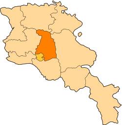
| Marz (Province) | Kotayk |
| Population (2010) | |
| • Total | 5,282 |
| Time zone | (UTC+4) |
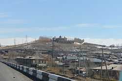
Arinj (Armenian: Առինջ) is a major village in the Kotayk Province of Armenia, located just north of Yerevan. At the eastern outskirts of the village, is Dzagavank (Getargel) Monastery; also known as Getargeli S. Nshan. The monastery consists of a 7th c. Church of S. Nshan and two-story bell tower/chapel of the 13th c. The structures were renovated between 2001-2004.
Etymology
See Առինջ.
Gallery
-
_S._Nshan_General_View.JPG)
Church of S. Nshan (foreground, 7th c.) and 13th-century bell tower/chapel (background) at Dzagavank (Getargel) Monastery (Getargeli S. Nshan).
-
_S._Nshan_Bell_Tower_1.JPG)
Two-story 13th c. bell tower/chapel located northeast of the church of S. Nshan at Dzagavank (Getargel) Monastery (Getargeli S. Nshan).
References
- Arinj at GEOnet Names Server
- World Gazeteer: Armenia – World-Gazetteer.com
- Report of the results of the 2001 Armenian Census, National Statistical Service of the Republic of Armenia