Argentine Antarctica
| Argentine Antarctica Antártida Argentina | |||
|---|---|---|---|
| Department | |||
|
Argentine Antarctica map since 1950, the Orcadas base are from 1904. | |||
| |||
 Location in Antarctica. | |||
| Country |
| ||
| Province |
| ||
| Founded by | José María Sobral | ||
| Area | |||
| • Total | 965,597 km2 (372,819 sq mi) | ||
| Population | |||
| • Total | 300 | ||
| • Density | 0.00031/km2 (0.00080/sq mi) | ||


| Regions of Argentina |
|---|


Argentine Antarctica (Spanish: Antártida Argentina) is a sector of Antarctica claimed by Argentina as part of its national territory consisting of the Antarctic Peninsula and a triangular section extending to the South Pole, is delimited by the 25° West and 74° West meridians and the 60° South parallel.[1] This region overlaps with British and Chilean claims in Antarctica; however, all claims are suspended by the Antarctic Treaty System.
Administratively, Argentine Antarctica is a department of the province of Tierra del Fuego, Antarctica, and South Atlantic Islands. The provincial authorities reside in Ushuaia and the Governor annually designates his or her delegate for the Antarctica region. The "civil power" of any of the administrators extends no further than that nation's own bases. The Argentine exploration of the continent started early in the 20th century. José María Sobral was the first Argentine to set foot on Antarctica in 1902, where he spent 2 seasons with the Swedish Antarctic Expedition of Doctor Otto Nordenskiöld. Shortly afterwards, in 1904, the Orcadas permanent base was already fully operational. Years later other bases would be created, some permanent and others seasonal. The first Argentine expedition to reach the South Pole was the 1965 Operación 90.
The flag of Argentine Antarctica was adopted in 1999, after being designed by an Argentine architect Teresa Beatriz Martinez, who herself hailed from the province of Entre Rios.[2] The flag was nicknamed the Albatross, wherein the orange portion reflected the geography of Tierra del Fuego, and the blue symbolizes the sky and sea surrounding the province, while the Southern Cross reflects the night sky and the albatross itself is a local bird that represents freedom through flight.[3]
Argentine actions in Antarctica are coordinated by the Instituto Antártico Argentino
According the last Argentine national census, on October 2010 (winter) there were 230 habitants in the six permanent bases, including 9 families and 16 children as follow: 75 at Marambio, 66 at Esperanza, 33 at Jubany, 20 at San Martín, 19 at Belgrano II and 17 at Orcadas [4]
Geography
The geographic structure of the Argentine Antarctica continues some features of the Patagonia, located to the north of it. The highest peaks are located at the south of the Antarctic Peninsula, which has islands and archipelagos nearby. The land is under an ice sheet.
The region has a polar climate, with strong winds, snow and thick clouds.
Argentine bases
Esperanza and Marambio are the biggest Argentine bases, holding together 70 buildings, an average of 110 people during the winter, and over a maximum of 250 during the summer. Orcadas Base, located at the South Orkney Islands off the Antarctic mainland (see map, right), was the world's first base in the Antarctic region, operating continuously since 1903. The southernmost Argentine permanent base is Belgrano II, at over 77 degrees south. The southernmost summer base is Sobral, at 1,450 km (901 mi) from Belgrano II.
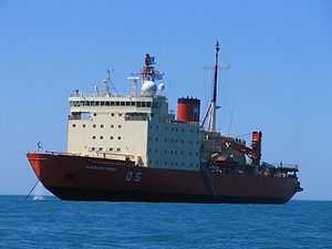
The bases are supplied by the ships: Puerto Deseado, Suboficial Castillo, and Almirante Irizar, and by C-130 Hercules and DHC-6 Twin Otter aircraft.
Permanent
- Belgrano II, (77°52′S 34°37′W / 77.867°S 34.617°W) Laboratory and meteorological station Argentine southernmost base (since 1979).
- Esperanza (63°24′S 57°00′W / 63.400°S 57.000°W) Laboratory and meteorological station (since 1952). Radio LRA Arcángel, School #38 Presidente Raúl Ricardo Alfonsín (since 1978), tourist facilities.
- Carlini, (62°14′S 58°40′W / 62.233°S 58.667°W) Scientific station at King George Island
- Marambio Base Station, (64°14′S 56°37′W / 64.233°S 56.617°W) Seymour-Marambio Island. Laboratory, meteorological station, 1.2 km long, 30m wide landing track (since 1969) (website)
- Orcadas Base (60°44′S 44°44′W / 60.733°S 44.733°W) Orcadas Islands (since 1903)
- San Martín Base (68°08′S 67°06′W / 68.133°S 67.100°W) (since 1951) Laboratory and Meteorological measurements
Seasonal
- Teniente Camara Base (1957) 62°02′S 58°42′W / 62.033°S 58.700°W, Livingston Island
- Base Deception (1948) 62°52′S 60°43′W / 62.867°S 60.717°W, Deception Island
- Petrel Air Station (1967) 63°28′S 56°17′W / 63.467°S 56.283°W Dundee Island
- Base Primavera (1977) 64°09′S 60°57′W / 64.150°S 60.950°W, Alexander Island
- Base Melchior(1947) 64°20′S 62°59′W / 64.333°S 62.983°W Anvers Island
- Almirante Brown Base(1951) 64°53′S 62°53′W / 64.883°S 62.883°W, Paradise Bay
- Teniente Matienzo Base (1961) 64°58′S 60°04′W / 64.967°S 60.067°W, Larsen Nunatak
Camps and other
(64 in all)
- Base Alférez de Navío Sobral (1965) 81°05′S 40°00′W / 81.083°S 40.000°W, Edith Ronne Land
- Estación Científica Ellsworth (ex USA) (1958) 77°45′S 41°00′W / 77.750°S 41.000°W, Weddell Sea
- Base Gurruchaga 62°15′S 59°00′W / 62.250°S 59.000°W, Nelson Island
- Campamento Científico Livingston 62°39′22″S 61°00′39″W / 62.65611°S 61.01083°W, Byers Peninsula, Livingston Island
Argentine claim


According to historical claims, the Argentine presence in the section began during the first decade of the 20th century; though some even affirm that it took place by the end of the previous century. However, navigators from other countries claimed the discovery of Antarctica for themselves. By the end of the 20th century the aid lent by Argentina to foreign expeditions, in particular that of Nordenskiöld, Gerlache and Charcot, was properly appreciated. This included the assignment of Argentine place names to Antarctic geographic features, such as the Argentine Islands, Uruguay Islands, General Roca, Quintana, and others.
In 1904, the permanent occupation began with the opening of Orcadas Base on Laurie Island just off the Antarctic mainland. Argentina was the only nation to have an Antarctic base for 40 years until the British built a base on the same islands.
Argentina bases its claims on this sector of Antarctica on the following grounds:
- The Antarctic peninsula is geologically and geographically part of the Andes.
- Argentina has maintained a permanent occupation for more than a century, and controls the oldest base in Antarctica (Orcadas Station on Laurie Island).
- Argentina conducts many rescue missions in Antarctica.
- Argentina has constructed lighthouses and other navigational aids in Antarctica.
- Argentina constructed Antarctica's first airport in 1969.
- Argentines form more of Antarctica's peninsula's population than nationals of any other country.
- The first Antarctican was born in Esperanza Base (Hope Base), namely Emilio Palma.
- Argentina has sent more people to Antarctica than all the other countries together.[5]
Argentina's claim to the Antarctic Peninsula overlaps with the Antarctic claims of Chile, 53°W to 90°W, and the UK claims, 20°W to 80°W.
Currently, there are no attempts by Argentina or any other country to enforce territorial claims in Antarctica. See List of Antarctic territorial claims.
None of these claims have international recognition and have been suspended by the Antarctic Treaty in 1961.
Demographics
In 1978, the first Antarctic baby was born in the Fortín Sargento Cabral at the Esperanza Base under the name Emilio Palma. In 1991, there were 142 "permanent residents" including 19 minors. "Residents" are families that live in Antarctica or scientists that have lived for more than two years. They were 121 men and 21 women that lived mostly in the colony of Esperanza and other bases. As of 1998-1999, Argentine Antarctica had a winter population of 165.
See also
- (Spanish) Antártida Argentina
- Argentine actions in Antarctica
- Antarctic Treaty System
- List of Antarctic territorial claims
- Chilean Antarctic Territory
- Tierra del Fuego Province, Argentina
- Magallanes and Antártica Chilena Region
- Australian Antarctic Territory
- Ross Dependency
- British Antarctic Territory
- Falklands War
- Beagle Channel Arbitration
- Falkland Islands
- South Georgia and South Sandwich Islands
- South Orkney Islands
References
- ↑ Beck, Peter J. (1986). The international politics of Antarctica. Routledge. p. 119. ISBN 0-7099-3239-1.
- ↑ Bordeleau, Andre G. Flags of the Night Sky: When Astronomy Meets National Pride. Springer Publications: 2011. p.118.
- ↑ Bordeleau, Andre G. Flags of the Night Sky: When Astronomy Meets National Pride. Springer Publications: 2011. p.119.
- ↑ Censo 2010: en la Antártida viven 230 personas, 9 familias y 16 niños
- ↑ http://web.archive.org/web/20140203004212/http://www.marambio.aq/index1.htm. Missing or empty
|title=(help)
Bibliography
- Menutti, Adela; Menutti, María (1980). Geografía Argentina y Universal (in Spanish). Buenos Aires: Edil.
External links
| Wikimedia Commons has media related to Antártida Argentina. |
- Argentine Bases
- (Spanish) (English) Marambio Base
- Dirección Nacional del Antártico: Bases
- (Spanish) Argentine Antarctica History
| ||||||||||||||||
| |||||||||||||||||||||||||
.svg.png)
| ||||||||||