Argalasti
| Argalasti Αργαλαστή | |
|---|---|
|
Argalasti square 2007 | |
 Argalasti | |
|
Location within the regional unit 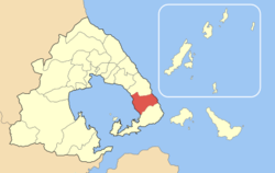 | |
| Coordinates: 39°14′N 23°13′E / 39.233°N 23.217°ECoordinates: 39°14′N 23°13′E / 39.233°N 23.217°E | |
| Country | Greece |
| Administrative region | Thessaly |
| Regional unit | Magnesia |
| Municipality | South Pelion |
| Elevation | 196 m (643 ft) |
| Population (2011)[1] | |
| • Municipal unit | 1,985 |
| Time zone | EET (UTC+2) |
| • Summer (DST) | EEST (UTC+3) |
| Postal code | 370 06 |
| Area code(s) | 24230 |
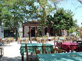
Argalasti (Greek: Αργαλαστή) is a village and a former municipality in Magnesia, Thessaly, Greece. Since the 2011 local government reform it is part of the municipality South Pelion, of which it is the seat and a municipal unit.[2] It is built on a fertile plateau, 40 km southeast of Volos. It is an important commercial and tourism center of the area with a rich cultural tradition. Argalasti is a stopping point for those headed for the nearby beaches of the Pagasetic Gulf (Chorto, Kalamos, Lefokastro) or the Aegean Sea (Potistika, Melani, Paltsi). An example of the architecture of the beginning of the 20th century is the church tower of Sts. Apostles.
Subdivisions
The municipal unit Argalasti is subdivided into the following communities (constituent villages in brackets):
- Argalasti (Argalasti, Kalamos, Kallithea, Lefokastro, Myriovryti, Paltsi, Paou, Chorto)
- Metochi
- Xinovrysi (Xinovrysi, Potistika)
History
This Pelion town is well known for its buildings of architectural interest. Embedded into the walls of many constructions in the village one will find pieces of Ancient and Medieval buildings. The monastery of Saint Nicolas provides a magnificent view to the town. Close to the town square, is the church of Saint Apostles Peter and Paul built in 1886, with a marble bell tower built in 1913.
Historical population
| Year | Population municipal district | Population municipality |
|---|---|---|
| 1981 | 2,016 | - |
| 1991 | 1,393 | 2,415 |
| 2001 | 1,312 | 2,148 |
| 2011 | 1,694 | 1,985 |
References
- ↑ "Detailed census results 2011" (in Greek).
- ↑ Kallikratis law Greece Ministry of Interior (Greek)
 |
Afetes | | ||
| Pagasetic Gulf | |
Aegean Sea | ||
| ||||
| | ||||
| Sipiada |
| ||||||||||||||||||||||