Arcadia University, Pennsylvania
| Arcadia University | |
| Census-designated place Neighborhood of Cheltenham Township | |
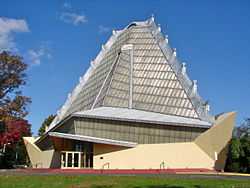
 Flag at Arcadia University | |
| Country | United States of America |
|---|---|
| State | Pennsylvania |
| County | Montgomery |
| Township | Cheltenham |
| Elevation | 317 ft (96.6 m) |
| Coordinates | 40°05′28″N 75°09′51″W / 40.09111°N 75.16417°WCoordinates: 40°05′28″N 75°09′51″W / 40.09111°N 75.16417°W |
| Area | 0.057 sq mi (0.1 km2) |
| - land | 0.057 sq mi (0 km2) |
| - water | 0.00 sq mi (0 km2), 0% |
| Population | 595 (2010 US Census) |
| Density | 10,438.6 / sq mi (4,030.4 / km2) |
| Timezone | Eastern Standard Time (UTC-5) |
| - summer (DST) | Eastern Daylight Time (UTC-4) |
| Zip Code | 19038 |
| Area code | 215 |
 Location of Arcadia University in Pennsylvania
| |
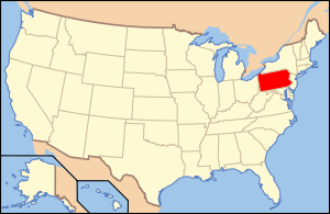 Location of Pennsylvania in the United States
| |
Arcadia University is a census-designated place[1] located in Cheltenham Township, Montgomery County in the state of Pennsylvania. Its location is just off campus at Arcadia University off of Pennsylvania Route 309. As of the 2010 census[2] the population was 595 residents.
At 10,438 people per square mile, Arcadia University is the most densely populated census-designated place in Montgomery County, and 33rd in the entire United States. It is one of only two places in Montgomery County that has over 10,000 people per square mile (the other is Conshohocken). This is attributed to the land area consisting mostly of college dormitories.
Arcadia University is home to National Historic Landmark Grey Towers Castle which serves as the main administration building for Arcadia University.


References
- ↑ Center for New Media and Promotions(C2PO). "2010 Census". census.gov. Retrieved 20 April 2015.
- ↑ US Census Bureau. "Census.gov". census.gov. Retrieved 20 April 2015.
| ||||||||||||||||||||||||||||||||||||||||||||||||||||||||||