Arbury Hill
| Arbury Hill | |
|---|---|
.JPG) Arbury Hill from the west | |
| Elevation | 225 m (738 ft) |
| Listing | County top |
| Location | |
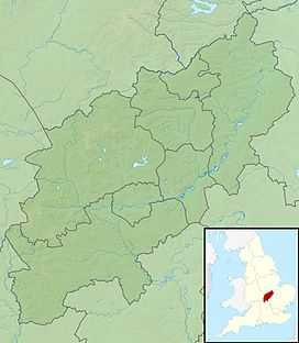 Arbury Hill Arbury Hill in Northamptonshire | |
| Location | Northamptonshire, England |
| OS grid | SP540587 |
| Coordinates | 52°13′27″N 1°12′36″W / 52.2243°N 1.2101°WCoordinates: 52°13′27″N 1°12′36″W / 52.2243°N 1.2101°W |
| Topo map | OS Explorer 206 |
Arbury Hill, at 225 m (738 ft), is the joint highest point in the English county of Northamptonshire. OS Explorer Map 207: Newport Pagnell & Northampton South (1:25 000) ISBN 0319 46387 7. It is 9 km (5.6 mi) southwest of the town of Daventry.
The slopes of Arbury Hill are a drainage divide between three major river catchment areas, with the Nene to the north, east and south, the Cherwell (a tributary of the Thames) to the south-west and the Leam (a tributary of the Severn) to the west and north-west.
Earthworks
On the summit of Arbury Hill there are the vestiges of an Iron Age Fort, although this was disputed by the Royal Commission in 1981. grid reference SP540587 The remains are in the form of a square ditch and embankment about 200 metres across.
There is a moto-cross track on the east side and top of the hill that is used for competitions about three times a year.
Gallery
-
.JPG)
The headwater of the River Nene, on the north east slope of Arbury Hill
-
.JPG)
The southern side of the Hill