Aran Fawddwy
| Aran Fawddwy | |
|---|---|
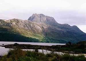
 Aran Fawddwy (on left) and Creiglyn Dyfi | |
| Elevation | 905 m (2,969 ft)[1] |
| Prominence | 670 m (2,200 ft) |
| Parent peak | Snowdon |
| Listing | Marilyn, Hewitt, Nuttall |
| Translation | Mawddwy peak (Welsh) |
| Pronunciation |
Welsh: [ˈaran ˈvauðwɨ] English approx: aran vowthe-wi |
| Location | |
| Location | Gwynedd, UK |
| Range | Snowdonia |
| OS grid | SH862223 |
| Topo map | OS Landranger 124, 125 |
| Listed summits of Aran Fawddwy | ||||
| Name | Grid ref | Height | Status | |
|---|---|---|---|---|
| Aran Benllyn | SH866243 | 885 m (2,904 ft) | H, N | |
| Erw y Ddafad-ddu | SH864234 | 872 m (2,861 ft) | H, N | |
| Foel Hafod-fynydd | SH876227 | 689 m (2,260 ft) | H, N | |
| Gwaun y Llwyni | SH857204 | 685 m (2,247 ft) | H, N | |
| Gwaun Lydan | SH880211 | 632 m (2,073 ft) | N | |
| Waun Camddwr | SH862223 | 621 m (2,037 ft) | N | |
| Pen yr Allt Uchaf | SH867192 | 620 m (2,030 ft) | H, N | |
Aran Fawddwy is a mountain in southern Snowdonia, Wales, United Kingdom. It is the only peak in Wales outside of North Snowdonia above 900m. The nearest urban centres to the mountain are Dinas Mawddwy to the south, Llanymawddwy to the southeast, Llanuwchllyn on the shores of Bala Lake to the north, and Rhydymain to the west. On the eastern slopes of Aran Fawddwy is the small lake named Creiglyn Dyfi, the source of the River Dyfi. Its sister peak is Aran Benllyn at 885 metres (2,904 ft).[2]
A cairn is placed on the eastern ridge as a memorial to a man who was struck by lightning.
Ascent
Aran Fawddwy is best ascended from Cywarch in the south.[3] Although a longer ridge climb is possible from the Bala side.
Geography
Aran Fawddwy, which is only 9.5 metres (31 ft) short of being a member of the Welsh 3000s, is the highest peak in the Aran mountain range and the 16th highest summit in Wales. The other two Marilyns in this range are Glasgwm and Esgeiriau Gwynion.[4]
It is the highest British mountain south of Snowdon and is the principal summit of the predominant southwest-northeast ridge between Dolgellau and Bala, southern Snowdonia, a ridge that continues westwards as Cadair Idris.
References
- ↑ Crocker, Chris; Graham Jackson. "Mountaineering & Rock Climbing in the UK: Aran Fawddwy". Database of British Hills. Mountain Days.net. Retrieved 2008-04-08.
- ↑ Crocker, Chris; Graham Jackson. "Mountaineering & Rock Climbing in the UK: Aran Benllyn". Database of British Hills. Mountain Days.net. Retrieved 2008-04-08.
- ↑ Walk 1190 - Aran Fawddwy from Cwm Cywarch - Snowdonia Gwynedd - a walk description from Walking Britain
- ↑ Nuttall, John & Anne (1999). The Mountains of England & Wales - Volume 1: Wales (2nd edition ed.). Milnthorpe, Cumbria: Cicerone. ISBN 1-85284-304-7.
External links
 Media related to Aran Fawddwy at Wikimedia Commons
- Computer-generated summit panoramas Aran Fawddwy Index
- www.geograph.co.uk : photos of Aran Fawddwy and surrounding area
Coordinates: 52°47′16.35″N 3°41′18.10″W / 52.7878750°N 3.6883611°W
| ||||||||||||||||||||||||||||


