Apache Junction, Arizona
| Apache Junction, Arizona | ||
|---|---|---|
| City | ||
 | ||
| ||
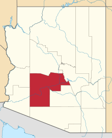
 Location in Pinal County and the state of Arizona | ||
| Coordinates: 33°24′54″N 111°32′46″W / 33.41500°N 111.54611°WCoordinates: 33°24′54″N 111°32′46″W / 33.41500°N 111.54611°W | ||
| Country | United States | |
| State | Arizona | |
| Counties | Maricopa, Pinal | |
| Incorporated | 1978 | |
| Government | ||
| • Mayor | John Insalaco | |
| Area | ||
| • Total | 34.2 sq mi (88.7 km2) | |
| • Land | 34.2 sq mi (88.7 km2) | |
| • Water | 0.0 sq mi (0.0 km2) | |
| Elevation | 1,722 ft (525 m) | |
| Population (2010)[1] | ||
| • Total | 35,840 | |
| • Estimate (2013[2]) | 37,130 | |
| • Density | 944.36/sq mi (364.11/km2) | |
| Time zone | MST (no daylight saving time) (UTC-7) | |
| ZIP codes | 85119-85120 | |
| Area code(s) | 480 | |
| FIPS code | 04-02830 | |
| Website | http://www.ajcity.net/ | |

Apache Junction is a city in Maricopa and Pinal counties in the State of Arizona. According to the 2010 census, the population of the city was 35,840,[1] most of whom lived in Pinal County.
Apache Junction is named for the junction of the Apache Trail and U.S. Route 60. Superstition Mountain, the westernmost peak of the Superstition Mountains, is nearby.
Geography
Apache Junction is at 33°24′54″N 111°32′46″W / 33.415035°N 111.546025°W.[3]
According to the United States Census Bureau, the city has an area of 34.2 square miles (89 km2), all land.
The town is bounded by the Superstition Mountains (a federal wilderness area and home of the Lost Dutchman's Gold Mine) on the east, the Goldfield Mountains with the Bulldog Recreation Area on the north and the city of Mesa, Arizona on the west. Goldfield Ghost Town, a popular tourist spot preserved from former prospecting days, nestles near the western face of Superstition Mountain just off Highway 88 (Apache Trail). It is located just southwest of the site of the ghost town of Goldfield, Arizona.[4] 33°27′28″N 111°29′15″W / 33.45778°N 111.48750°W
Demographics
| Historical population | |||
|---|---|---|---|
| Census | Pop. | %± | |
| 1970 | 3,863 | — | |
| 1980 | 9,935 | 157.2% | |
| 1990 | 18,092 | 82.1% | |
| 2000 | 31,814 | 75.8% | |
| 2010 | 35,840 | 12.7% | |
| Est. 2013 | 37,130 | 3.6% | |
| U.S. Decennial Census[5] 2013 Estimate[2][6] | |||
As of the census of 2010, there were 35,840 people, 15,574 households, and 9,372 families residing in the city. The population density was 929.3 people per square mile (358.9/km²). There were 22,771 housing units at an average density of 665.1 per square mile (256.8/km²). The racial makeup of the city was 89.5% White, 1.2% Black or African American, 1.1% Native American, 0.8% Asian, 0.1% Pacific Islander, 4.9% from other races, and 2.4% from two or more races. Hispanic or Latino of any race were 14.4% of the population.
There were 15,574 households out of which 19.6% had children under the age of 18 living with them, 44.6% were married couples living together, 10.7% had a female householder with no husband present, and 39.8% were non-families. 31.4% of all households were made up of individuals and 15.8% had someone living alone who was 65 years of age or older. The average household size was 2.28 and the average family size was 2.85.
In the city the population had 19.9% under the age of 20, 4.5% from 20 to 24, 20.4% from 25 to 44, 27.1% from 45 to 64, and 26.2% who were 65 years of age or older. The median age was 47.5 years.
The median income (as of the 2000 census) for a household in the city was $33,170, and the median income for a family was $37,726. Males had a median income of $31,283 versus $22,836 for females. The per capita income for the city was $16,806. About 7.3% of families and 11.6% of the population were below the poverty line, including 18.4% of those under age 18 and 7.4% of those age 65 or over.
Government
Apache Junction was incorporated as a city on November 24, 1978. The city is governed by a collection of elected officials, clerk, and nine boards and commissions. The city council has seven members, which includes the mayor and vice-mayor. The mayor serves a two-year term. The mayor is John S. Insalco, whose current term began June 2013.[7]
In popular culture
This city was one of the filming locations for HBO's 1994 film Blind Justice.[8] In the 2003 dark comedy film Bad Santa, the character of Santa tells a child that Apache Junction is the suburb that most resembles the North Pole.[9] A scene from Jerry Maguire was also filmed there, in which Cuba Gooding, Jr.'s character is filming a commercial with a camel. In "Stand-Up Revolution, Episode 2," by Gabriel Iglesias, he uses Apache Junction as an example of a redneck place, in a joke about comedy clubs. He says that a catchy place name is often used on a show which contains a number of people from the same racial or ethnic group.[10]
References
- ↑ 1.0 1.1 "American FactFinder". United States Census Bureau. Retrieved 2014-06-18.
- ↑ 2.0 2.1 "Population Estimates". United States Census Bureau. Retrieved 2014-06-18.
- ↑ "US Gazetteer files: 2010, 2000, and 1990". United States Census Bureau. 2011-02-12. Retrieved 2011-04-23.
- ↑ http://www.mapquest.com/maps?city=Apache+Junction&state=AZ&country=US&latitude=33.415&longitude=-111.548897&geocode=CITY
- ↑ "U.S. Decennial Census". Census.gov. Retrieved May 7, 2014.
- ↑ Census figure in 1970 enumerated prior to incorporation.
- ↑ "Government". Apache Junction, AZ Official Website. City of Apache Junction, Arizona. Retrieved 14 November 2014.
- ↑ Blind Justice Filming Locations. IMDB.com. Retrieved 2013-07-23.
- ↑ "IMDB.com Quotes for Bad Santa". IMDB.com. 2012-03-16. Retrieved 2012-03-16.
- ↑ https://www.youtube.com/watch?v=WJ7mlWiDe8I[]
External links
| Wikimedia Commons has media related to Apache Junction, Arizona. |
| |||||||||||||||||||||||||||||||||||||
| |||||||||||||||||||||||||||||||||||||

| ||||||||||||||||||||||||||||||