Aoyama, Minato, Tokyo
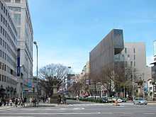
Aoyama (青山 Aoyama, "Blue Mountain") is a neighborhood of Tokyo, located in the northeastern Minato Ward. During the Edo Period, Aoyama was home to various temples, shrines, and samurai residences. The name Aoyama derived from a samurai named Aoyama Tadanari who served the Tokugawa Shogunate and held his mansion in this area. Today, along with Shibuya and Harajuku, it is one of the most popular entertainment and shopping areas for young people in Tokyo. It is well known for its fashion houses, restaurants, and shopping. Chichibunomiya Rugby Stadium is in the North part of Aoyama.
Aoyama municipal cemetery
Aoyama is also the location of Japan's first municipal cemetery, Aoyama Reien, which was opened in 1872. The cemetery is famous for its cherry blossoms, and at the season of hanami, many people visit.
Famous Japanese people buried here include General Nogi Maresuke, a war hero who joined his leader in death by committing suicide when Emperor Meiji died in 1912. Many noted foreigners are buried in the small foreign section of the cemetery, which was at risk of being cleared to make a park in 2005, but has since been preserved by the Tokyo Metropolitan Government. [1]
Famous non-Japanese buried at Aoyama Reien include:
- British minister plenipotentiary Hugh Fraser who died in the post in 1894,
- Alexander Croft Shaw, (1850 - 1902) Anglican missionary.
- Captain Francis Brinkley
- Guido Verbeck
- Henry Spencer Palmer
- Edoardo Chiossone
- Arthur Lloyd, (1852-1911) Anglican missionary, academic and translator.
- Joseph Heco
- Julius Scriba
One of the cemetery's most famous graves is that of Hachikō, the dutiful dog whose statue adorns Shibuya Station.
Places in Aoyama
- Aoyama Hospital
- Aoyama Twin
- Blue Note Tokyo
- President Hotel
- Spiral
Companies and organizations based in Aoyama
- Oracle Corporation Japan
- Berlitz (Asia Headquarters)
- Itochu (Tokyo office)
- Honda Motor
- Sony Financial Holdings
- Sony Life Insurance
- Nikka Whisky Distilling
- Nippon Microscope Works, Ltd., also known as Nikken
- Avex Group Holdings, Inc. (AGHD) (Main Office)[2]
- CSK
- Louis Vuitton Japan
- JCB
- Comme des Garçons
- RIAJ
- Hip Land Music Corp.
- Victor Entertainment
- Acne Studios
- Teikoku Databank
- Nional Federation of Health Insurance Societies
- Embassy of Brazil in Tokyo
- Italian Trade Commission Tokyo Office
- Italian State Tourist Board Tokyo Office
- Four Seeds Corporation (Pizza-La, etc.)[3]
- Prada[4]
- Cube Japan
Subway stations
- Aoyama-itchōme Station (Ginza Line, Hanzōmon Line, Toei Ōedo Line)
- Omotesandō Station (Chiyoda Line, Ginza Line, Hanzōmon Line)
- Gaiemmae Station (Ginza Line)
- Nogizaka Station (Chiyoda Line)
References
- ↑ "The Foreign Section Trust". Archived from the original on 9 May 2006. Retrieved 2006-06-18. – formed in 2005 to preserve the foreign section of Aoyama cemetery in Tokyo
- ↑ Avex Group Holdings, Inc. Company Outline. Avex Group Holdings, Inc. "3-1-30, Minami-Aoyama, Minato-ku, Tokyo 107-8577"
- ↑ Corporate Info Four Seeds Corporation
- ↑ Chevalier, Michel (2012). Luxury Brand Management. Singapore: John Wiley & Sons. ISBN 978-1-118-17176-9.
| ||||||||||||||||||||||
| ||||||