Antonaves
| Antonaves | ||
|---|---|---|
|
A view of the village in Antonaves | ||
| ||
 Antonaves | ||
|
Location within Provence-A.-C.d'A. region 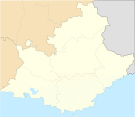 Antonaves | ||
| Coordinates: 44°16′02″N 5°48′20″E / 44.2672°N 5.8056°ECoordinates: 44°16′02″N 5°48′20″E / 44.2672°N 5.8056°E | ||
| Country | France | |
| Region | Provence-Alpes-Côte d'Azur | |
| Department | Hautes-Alpes | |
| Arrondissement | Gap | |
| Canton | Ribiers | |
| Intercommunality | Ribiers Val de Méouge | |
| Government | ||
| • Mayor (2014–2020) | Isabelle Boiteux[1] | |
| Area1 | 8.03 km2 (3.10 sq mi) | |
| Population (2012)2 | 180 | |
| • Density | 22/km2 (58/sq mi) | |
| INSEE/Postal code | 05005 / 05300 | |
| Elevation |
512–1,414 m (1,680–4,639 ft) (avg. 625 m or 2,051 ft) | |
|
1 French Land Register data, which excludes lakes, ponds, glaciers > 1 km² (0.386 sq mi or 247 acres) and river estuaries. 2 Population without double counting: residents of multiple communes (e.g., students and military personnel) only counted once. | ||


Antonaves is a commune of the Hautes-Alpes department in southeastern France. It is located at the confluence of the Méouge river (La Méouge) and the Le Buëch river, and is known as the gateway to the Gorges de la Méouge, a 4 km limestone gorge.
Population
| Historical population | ||
|---|---|---|
| Year | Pop. | ±% |
| 1962 | 60 | — |
| 1968 | 62 | +3.3% |
| 1975 | 70 | +12.9% |
| 1982 | 101 | +44.3% |
| 1990 | 126 | +24.8% |
| 1999 | 158 | +25.4% |
| 2008 | 179 | +13.3% |
| 2012 | 180 | +0.6% |
See also
References
- ↑ "List of mayors of the Hautes-Alpes department". Prefecture of Hautes-Alpes (in French). 3 June 2014. Retrieved 20 March 2015.
| Wikimedia Commons has media related to Antonaves. |