Ankogel Group
| Ankogel Group | |
|---|---|
|
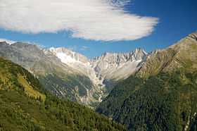
Seebach Valley near Mallnitz with Hochalmspitze | |
| Highest point | |
| Peak | Hochalmspitze |
| Elevation | 3,360 m (11,020 ft) |
| Geography | |
| Country | Austria |
| States | Carinthia and Salzburg |
| Range coordinates | 47°01′N 13°19′E / 47.02°N 13.32°ECoordinates: 47°01′N 13°19′E / 47.02°N 13.32°E |
| Parent range |
Western Tauern Alps Hohe Tauern |
The Ankogel Group (German: Ankogelgruppe) is a sub-group of the Central Eastern Alps. Together with the Goldberg Group, the Glockner Group, the Schober Group, the Kreuzeck Group, the Granatspitze Group, the Venediger Group, the Villgraten Mountains and the Rieserferner Group it forms the mountain range of the Hohe Tauern (High Tauern).
The Ankogel Group is located in the Austrian federal states of Salzburg and Carinthia. Its highest peak is the Hochalmspitze, 3,360 m above sea level (AA) (11,020 ft).
Geography
The Ankogel Group is the easternmost part of the Hohe Tauern on the main chain of the Alps. The Niedere Tauern (Low Tauern) begin further east. The range gets its name from Mt. Ankogel, 3,252 m (10,669 ft).
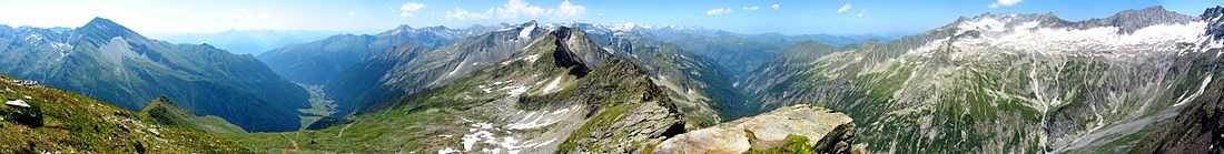
The Ankogel Group can be further divided into the sub-groups of the Ankogel Massif, the Hochalmspitze Group, the Hafner Group and the Reißeck Group south of the Möll Valley. It comprises the picturesque Maltatal ("valley of falling waters") with the Fallbach Waterfall and the Kölnbrein Dam.
Neighbouring ranges
The Ankogel Group borders on the following other mountain ranges in the Eastern Alps:
- Goldberg Group (in the west)
- Kreuzeck Group (in the southwest)
also part of the Hohe Tauern,
- Salzburg Slate Alps, north of the Salzach River
- Radstädter Tauern, northeast of the Mur River
- Nock Mountains, beyond the Lieser Valley in the east
all part of the Central Eastern Alps, and
- Gailtal Alps, south of the Drava
part of the Southern Limestone Alps.
Peaks
All the named three-thousanders in the Ankogel Group:[1]
|
|
References
- ↑ ÖK50 www.austrianmap.at
Sources
- Liselotte Buchenauer, Peter Holl: Alpenvereinsführer Ankogel- und Goldberggruppe. Bergverlag Rudolf Rother, Munich, 1986. ISBN 3-7633-1247-1
External links
| Wikimedia Commons has media related to Ankogel Group. |
| ||||||||

| ||||||||
