Angus Glen, Ontario
Angus Glen (Census Tract No. 5350403.05) (2006 Population 2,596)[1] is a community in Unionville, Ontario, Canada, within the city of Markham. The area was originally farmland, but as the land south has been developed, pressure is increasing to redevelop this area into residential neighbourhood; a new real estate of West Village is under on-going construction.
In addition to the famous golf course, the area is home to the Unionville William Berczy Historic Cemetery, which contains the graves of the early settlers of the city of Markham.
Demographics
Canada census – Angus Glen, Ontario community profile |
|---|
| | | 2011 | 2006 | |
Population:
Land area:
Population density:
Median age:
Total private dwellings:
Median household income:
| |
2, 596 (57.9% from 2001)
4.14 km2 (1.60 sq mi)
626.9/km2 (1,624/sq mi)
N/A (M: N/A, F: N/A)
832
$N/A
| |
| | |
|
Majority of Angus Glenn (including the Cachet community) is of Canadian and European ancestry, while the remaining 17% remains East Asian.
- N/A = Not Available
Other Names
- Angus Glen West Village
- Angus Glen East Village
- Unionville
Other nearest communities to Angus Glen and directions
Public transportation
YRT Buses
- York Region Transit Route#4: Major Mackenzie Drive
- York Region Transit Route#18: Bur Oak Avenue
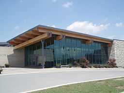
Landmarks/Attractions
External links
References
|
|---|
| | | | | | | | Education |
|---|
| | Elementary | |
|---|
| | Secondary | |
|---|
| | Post Secondary | |
|---|
| | | Athletics, Recreation, and Shopping |
|---|
| | Athletics | |
|---|
| | Recreation | |
|---|
| | Shopping | |
|---|
| | | | | Media and Services |
|---|
| | Media | |
|---|
| | Services | |
|---|
| | | | |
|