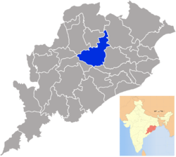
Angul district
| Angul | |
|---|---|
| District | |
 | |
| Coordinates: 20°49′59″N 85°06′00″E / 20.833°N 85.1°ECoordinates: 20°49′59″N 85°06′00″E / 20.833°N 85.1°E | |
| Country |
|
| State | Odisha |
| Established | 1 April 1993 |
| Headquarters | Angul |
| Government | |
| • Type | Municipality |
| • Collector | Sachin R Jadhav[IAS] |
| Area | |
| • Total | 6,232 km2 (2,406 sq mi) |
| Elevation | 875.5 m (2,872.4 ft) |
| Population (2011) | |
| • Total | 1,271,703[1] |
| • Density | 199/km2 (520/sq mi) |
| Languages | |
| • Official | Oriya, Hindi, English |
| Time zone | IST (UTC+5:30) |
| PIN | 759022 |
| Telephone code | 6764 |
| Vehicle registration | OD-19 |
| Nearest city | Bhubaneswar |
| Sex ratio | 0.942 ♂/♀ |
| Literacy | 78.96% |
| Vidhan Sabha constituency | 5 |
| Climate | Aw (Köppen) |
| Precipitation | 1,421 millimetres (55.9 in) |
| Avg. summer temperature | 47 °C (117 °F) |
| Avg. winter temperature | 10 °C (50 °F) |
| Website |
www |
| General Information | |
|---|---|
| Subdivisions: | 4 |
| Blocks: | 8 |
| Municipalities: | 2 |
| N.A.C.: | 1 |
| Tehsils: | 5 |
| Forest Coverage: | 2,716.82 km² |
| Villages: | 1,922 |
| Grama panchayat: | 180 |
| Towns: | 9 |
Angul is a district of Odisha state in India. The city of Angul is the district headquarters.
History
A bridge between western and coastal areas of Odisha where the prehistoric and protohistoric relics are found in village Bhimakund, Kankili, Kulei, Samal, Sanakerjang, Kaliakata, Paranga, Kerjang, Ogi, Tikarapara and Pallahara. The geographical location of Angul made the Bhanjas of Angulaka-pattana, the Sulkis of Kodalaka Mandala, the Nandodbhavas of Airavatta Mandala, the Tungas of Yamagartta Mandala rule over it. But all through the rules of different dynasties, Angul has retained her cultural identity which is much more prominent than its political establishments.
The Bhaumakaras declined by the middle of the 10th Century AD when the eastern part of Odisha including the Dhenkanal region passed to the hands of the Somavamsis of South Kosala. The Somavamsis in their turn, were ousted by the Gangas and Odisha was occupied by Chodagangadedva some time before 1112 AD. The Ganga rule lasted as long as till 1435 AD when a new Solar dynasty founded by Kapilendradeva came to power. About the year 1533-34, Govinda Vidyadhar put an end to the Suryavamsi rule and started the rule of Bhoi dynasty, which lasted up to 1559 when Mukundadeva, belonging to the Chalukya family, forcibly occupied the throne. In 1568, the Afghans of Bengal invaded Odisha, and defeated and killed Mukundadeva after which Odisha came under their occupation. During all this period of dynastic changes, Angul played no remarkable role in history and this territory simply passed from one political authority to the other. During the rule of Suryavamsis and the Bhois & subsequently some new feudal states developed as self-contained political units. These are Angul, Talcher, Pallahara and Athamallik. Somanath Singh was the last king of Angul and he ruled for a long period of 33 years from 1814 to 1847 when he was deposed by Government. He was a spirited and a head-strong ruler and although ruled his territory with considerable efficiency, he incurred displeasure nor only among the neighbouring Feudatory Chiefs of Dhenkanal, Hindol, Daspalla, Baudh, and Athmallik but also among the British Officers by his head-strong dealings and outspoken nature. His State was confiscated by the Government in their Resolution, dated 16 September 1848. Angul thus passed under the direct rule of the British and was administered by the Superintendent of the Tributary Mahals, through the agency of an officer known as Tehsildar, who collected revenue and administered justice, until in 1891 when Angul was constituted a separate district.
This district was formally formed out of the former undivided Dhenkanal district on the date of April 1, 1993 by the Chief Minister of Odisha, Biju Patnaik.
Geography
Angul district is located in the center of the state of Odisha and lies between 20° 31 N & 21° 40 N latitude and 84° 15 E & 85° 23 E longitude. The altitude is between 564 and 1187 metres.[2] The district has a total area of 6232 km2. It is bounded by Dhenkanal and Cuttack district in the east, Deogarh, Kendujhar and Sundargarh district in north, Sambalpur and Sonepur in west and Boudh and Nayagarh in the south side. The district is abundant with natural resources, which ultimately help the district to contribute maximum amount of revenues to the state government. Angul, The district headquarters is about 150 kilometers from the state capital Bhubaneswar.
Even though Angul district blessed with rich natural resources, it is the hottest district in India where maximum temperature goes up to 550C during summer.
A recent study jointly conducted by Indian Institute of Technology, Delhi (IIT-D) and Central Pollution Control Board (CPCB) reveals that Angul district is among the top 10 most polluted Indian cities where the pollution level reached to a 'very alarmingly' level.[3]
Economy
Big industries like National Aluminium Company (NALCO), Mahanadi Coalfields Limited (MCL), National Thermal Power Corporation (NTPC), Jindal Steel and Power Limited (JSPL) Talcher, Indian Aluminium Product Ltd, Bhusan Steels Ltd., BRG ltd. etc. are situated in the district.
Major Industries
NALCO : This is a blue chip company in the Indian Aluminium sector. National Aluminium Company Limited is the largest integrated Bauxite-Alumina-Aluminium complex in Asia. Nalco's 2.18 lac tpa capacity Aluminium Smelter and its 720 MW Captive Power Plant are located in Angul. Nalco's Smelter came up in 1984 and since then the district has developed economically and socially. Nalco's manufacturing plants and township called Nalco Nagar are located at 5 km from Angul town, by the side of National Highway NH-42. Nalco manufactures primary Aluminium metal in the form of Ingots, Wire Rods, Sow moulds, Billets and strips. Nalco's Aluminium is exported to over 30 countries around the world and it also has a share of 30% of the domestic Aluminium market.
NTPC : The National Themal Power Corporation, India's leader in power generation has 2 numbers of thermal power plant in Angul district. One, NTPC/TTPS located 7 kms from Talcher on the way to Bhubaneswar is of 460MWs and the other one, the bigger one NTPC/TSTPS also known as NTPC Kaniha is of 3000 MW super thermal power station located at Kaniha, in Angul. The beneficiary states from the power generation are Odisha, Bihar, Sikkim, Damodar Valley Corporation, West Bengal, Jharkhand and Southern States. Coal for the power generation is sourced from the Talcher Coal Field and water for the thermal power is taken from Samal Barrage Reservoir. The location of NTPC, Talcher is at Kaniha which is 60 km from Angul. NTPC Kanhia has its own township for its 1500 employees.
MCL : Mahanadi Coal Field Limited is located in Talcher (20 km from Angul), a well known mining centre of coal. A unit of Coal India Limited, MCL was previously under SECL (South Eastern Coal Field Ltd.). The major mines under MCL are the Ananta Colliery, Dera colliery & Balanda colliery.
FCI : The Fertilizer Corporation of India has its unit in Talcher, Angul. One of the oldest industries of this area, FCI Talcher has faced problems in its viable operation. Hence, the plant has faced a closure since 1998. The township & plants do exist, waiting for much needed revival. As per a recent report RCF (Rashtriya Chemicals and Fertilizers) plans to revive the FCI plant in Talcher with a capital outlay of about Rs. 3000 crores.
HWP : The Heavy Water Plant is located in Talcher (20 km from Angul), is a Govt. of India organisation under the aegis of Ministry of Atomic Power & Energy. This plant is involved in production of Organic Solvents like TBP, D2EFHA, TAPO & TOPO etc. and other allied chemicals required as a part of the Nuclear Power Programme of the country.
TTPS : Talcher Thermal Power Station was one of the oldest power generation plant of the Government of Odisha, with a capacity of 460 MW power generation and it is located in Talcher. Coal for the power generation is sourced from the Talcher Coal Field and water for the thermal power is taken from nearby Brahmani river. It faced problems in its operations and was in the reds. The company was taken over by NTPC and its operation has once again become economically viable. The power plant is run efficiently by NTPC since 1998.
JSPL : Jindal Steel and Power Ltd is another major industry which has come up in Angul district with a capital investment of Rs. 20,000.00 crores for setting a steel producing facility and a 1500 MW power generation unit. JSPL plans to commission the first phase of its 6 million tonne per annum (MTPA) steel plant in Angul district by mid-2014. In the first phase, it will have a capacity of 1.8 mtpa.
BSSL : Bhushan Steel and Strips Ltd is in the process of setting up a power plant and an advanced hot rolling plant on 1,618 acres (6.55 km2) at Angul, at a cost of Rs. 5,200 crores. It is also in talks with the State Government for the allotment of additional 3,500 acres (14 km2) to enable it to triple the planned capacity of 2.2 million tonnes (mt) in about five years. The Angul plant has already started producing 110 MW, sponge iron and billets production is close to 0.5 million tonnes.
Divisions
Angul district is divided into a number of Blocks, Tehsils and subdivisions to ease in administration. They are:
Subdivisions
- Angul
- Athamalik
- Talcher
- Pallahada
Blocks
- Angul Sadar
- Athamalik Sadar
- Chhendipada
- Talcher Sadar
- Pallahada Sadar
- Banarpal
- Kishorenagar
- Kanhia
Tehsils
- Angul
- Athamalik
- Talcher
- Pallahada
- Chendipada
Demographics
According to the 2011 census Angul district has a population of 1,271,703,[4] roughly equal to the nation of Estonia[5] or the US state of New Hampshire.[6] This gives it a ranking of 380th in India (out of a total of 640).[4] The district has a population density of 199 inhabitants per square kilometre (520/sq mi) .[4] Its population growth rate over the decade 2001-2011 was 11.55%.[4] Anugul has a sex ratio of 942 females for every 1000 males,[4] and a literacy rate of 78.96%.[4]
NGO
People For Animals, Angul Unit
People for Animals also known as PFA is India's largest animal welfare organization with a nationwide network of 26 hospitals, 170 units and 2.5 Lakh members. We work to rescue and rehabilitate sick and needy animals. We set up and run shelters, ambulance services, sterilization programs, treatment camps and disaster rescue missions for animals. We conduct education programs in schools, fight cases in court and lobby on animal issues in parliament. At present, we have a nationwide network of 170 units, 26 hospitals and 60 mobile units. Angul Unit In-Charge : Mr. Biplab Mahapatra, Cell : 9438013873 (Helpline)
Animal Activist
Mr. Biplab Mahapatra, In-Charge, People For Animals, Angul
Culture
The great natural resources and beauties like Satakosia Gorge over River Mahanadi, Rengali Dam & Samal Barage over Brahmani River, hot water spring at Deulajhari in its Athmallik sub-div, Panchadhara hills, Budhi Thakurani & Lord Jagannath Temple, the unique puppet dance. The district is fortified with farmers. The culture of village BALIPATTA, Angul is watchful within the district.
-

Angul Pre Car festival
Places of worship
Garhsantry-Lovi Thakurani
Lovi Thakurani yatra, the annual ceremonial function of Goddess Lovi, is observed every year on Kartik Purnima day. Garh Santry, seventeen kilometers away from the district headquarters town Angul, is the village abode of the presiding deity Lovi.
Anugul - Budhi Thakurani Temple built on a small hill. Recently a huge Jagannatha Temple known as Saila Srikhetra has also been built near the Budhi Thakurani temple. This Jagannath Temple is the exact replica of Puri Jagannath Temple and has been built over a small hill very popular all over the state.
Tikarapada
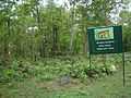
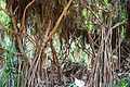
Location : It is 60 kilometers from the district headquarters and 200 kilometers from Bhubaneswar. Regular bus services are available from Angul to Tikarapada, via Badakera and Jaganathpur. Besides one can take a taxi service from Angul to Tikarapada, via village Ogi, Tainsi, and Jaganathpur and probably this is a comfortable route. This is probably the most important wildlife tourist attraction of the district. This place is famous for the Gharial Crocodile Sanctuary, which is situated on the bank of River Mahanadi. Wildlife lovers can have a chance to watch tiger, leopard, elephant, gaur, sambar, spotted deer, mouse deer, nilagai, four-horned antelope and sloth bear. Wild dogs used to be sighted often. Many resident birds frequent this place. Reptiles like the Gharial, mugger crocodile, fresh water turtle and poisonous and non-poisonous snakes can also be sighted. This site is popular among the tourists as a trekking hotspot. Tikarapada is also famous for the Satakoshia George of river Mahanadi, and its lush green forest. Near Tikarapada there is a village named "GAINDI" which is famous for its River Valley Picnic spot.
-
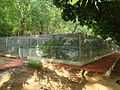
Gharial Breeding Centre
-

River Mahanadi near Tikarpada
-
Tikarpada Tiger Reserve
Bhimkund
This is another tourist place of Angul district, situated about 28 kilometers from the town of Talcher. One can see the sleeping statue of Lord Vishnu on the river bed of Brahmani.
Khuludi
Coordinates: 21°26'16"N 85°15'25"E
The Shiva temple under the foothills of Malyagiri (also known as Malayagiri) is a pilgrim place for the people of the district. Lord Shiva abodes here under the name of Girishwara, meaning the lord of the mountains.The word Girishwara forms combining Giri(Mountain) and Ishwara (God).The waterfall near the temple is major attraction. The waterfall is a small one with a height of 10–12 feet. The khuludi village is 25 Kilometers far from pallahara, 104 Kilometers from dist headquarter Angul via National Highway 23 (India) and 153 Kilometers from Ispat city Rourkela via SH 10A and National Highway 23 (India) .
-

Khuludi Shidheswar Temple during shivaratri 2014
-

beautiful water spring at khuludi
Deulajhari
One more important place from both religious and natural beauty point of view is Deulajhari, better known as the ancient citadel of Saivism. The legacy of traditions and worships in the temple mirrors a heritage in its past and present flowing into eternity. The temple has been consecrated amidst lush indigenous-jasmine forest (locally known as Kiabana) that stands as the high walls. To the south of the temple flows the sacred river Chitrotpala, and in the north stands the towering hills of Panchadhara. The uniqueness of the place lies in its hot springs that surround the temple. As per the ancient records, there were eighty-four such hot springs in and around the place. But as of now there are as many as twenty-four springs still active. Among these springs, the most popular are Agnikunda, Taptakunda, Himakunda, Amrutakunda and Labakusakunda. The temperature of water in these springs varies from 40 degrees Celsius to 62 degrees Celsius.
-

Shree Siddheswar Baba Temple
-
Famous Jasmin Forest
Ogi-Para
It is situated near National Highway No 42(presently changed as NH-55), just 2 kilometers from the highway near village Kanjara. It is 27 kilometers from the district headquarters of Angul. Regular bus services are available for Ogi-Para from Angul. These are two adjacent villages divided by river Lingara and popular for the Budha Thakura Temple and Agara Fair or Phalguna Fair[3]. Besides, there is a small temple in the village of Ogi, where the idol of Goddess Budha Thakura is kept. The Agara Jatra[4] is one of the oldest festivals of its kind in the area.
Kanjara is a big village situated 20 km from Angul. The important festivals are dol yatra, Rath yatra, Dand yatra, Chandan yatra and Ramnavami.
Saradhapur
It is near to Angul, just 5 km from district headquarters. There is a famous ashram named as Purunapani located in this village. The Famous Mandaragiri mountain is also in this village. There are good farm houses, natural sites and many picnic spots in this village. October–December is perfect time for visiting this village.
Politics
Influential persons of Angul District -
- Tathagata Satpathy ( BJD )
- Nagendra Pradhan ( BJD )
- Rajani Kant Singh ( BJD )
- Rabi Narayan Pani ( BJD )
- Suparno Satpathy ( AAP )
- Rudra Narayan Pani ( BJP )
- Dharmendra Pradhan ( BJP )
- Ramesh chandra jena(ex-mla)
Vidhan sabha constituencies
The following is the 5 Vidhan sabha constituencies[7][8] of Angul district and the elected members[9] of that area
| No. | Constituency | Reservation | Extent of the Assembly Constituency (Blocks) | Member of 14th Assembly | Party |
|---|---|---|---|---|---|
| 59 | Pallahara | None | Pallahara, Kaniha (part) | Mahesh Sahoo | BJD |
| 60 | Talcher | None | Talcher (M), Talcher, Kaniha (part) | Braja Kishore Pradhan | BJD |
| 61 | Angul | None | Angul (M), NALCO (C. T), Angul (part), Banarpal (part) | Rajani Kant Singh | BJD |
| 62 | Chhendipada | SC | Chhendipada, Banarpal (part) | Sushanta Behera | BJD |
| 63 | Athmallik | None | Athmallik (NAC), Athmallik, Kishorenagar, Angul (part) | Sanjeeb Kumar Sahoo | BJD |
References
- ↑ http://www.census2011.co.in/census/district/408-anugul.html
- ↑ "Census of India 2001: Data from the 2001 Census, including cities, villages and towns (Provisional)". Census Commission of India. Archived from the original on 2004-06-16. Retrieved 2008-11-01.
- ↑ hindu.com:Angul-Talcher seventh most polluted industrial cluster in the country
- ↑ 4.0 4.1 4.2 4.3 4.4 4.5 "District Census 2011". Census2011.co.in. 2011. Retrieved 2011-09-30.
- ↑ US Directorate of Intelligence. "Country Comparison:Population". Retrieved 2011-10-01.
Estonia 1,282,963 July 2011 est.
- ↑ "2010 Resident Population Data". U. S. Census Bureau. Retrieved 2011-09-30.
New Hampshire 1,316,470
- ↑ Assembly Constituencies and their EXtent
- ↑ Seats of Odisha
- ↑ "List of Member in Fourteenth Assembly". ws.ori.nic.in. Retrieved 19 February 2013.
MEMBER NAME
External links
- Official website
- Deulajhari
- Tikarapada
- List of places in Anugul
 |
Debagarh district | Sundargarh district | Kendujhar district | |
| Sambalpur district | |
Dhenkanal district | ||
| ||||
| | ||||
| Subarnapur district Baudh district |
Nayagarh district | Cuttack district |
| ||||||||||||||
| ||||||||||||||||||||||||||||||
| ||||||||||||||||||||||||||||||||||||||||||||||||||||||||