Angul
| Angul ଅନୁଗୋଳ 'अनुगुल' | |
|---|---|
| Urban agglomeration/City | |
|
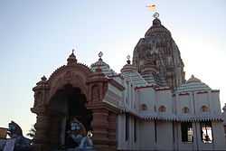
Jagannath Temple, Angul | |
| Nickname(s): Aluminium City | |
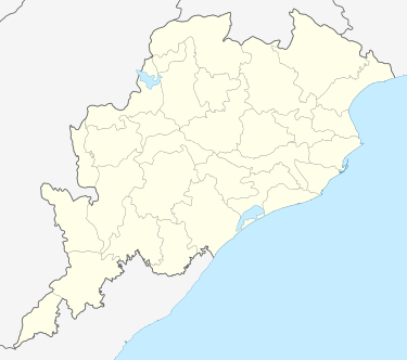 Angul Location in Odisha, India | |
| Coordinates: 20°47′50″N 85°1′26″E / 20.79722°N 85.02389°ECoordinates: 20°47′50″N 85°1′26″E / 20.79722°N 85.02389°E | |
| Country |
|
| State | Odisha |
| District | Angul |
| Government | |
| • Collector & District Magistrate | Sachin R Jadhav[IAS] |
| Population (2011) | |
| • Total | 44,390 |
| Languages | |
| • Official | Oriya |
| Time zone | IST (UTC+5:30) |
| PIN | 759122 |
| Telephone code | 06764 |
| Vehicle registration | OD-19 |
| Nearest city | Cuttack, Bhubaneswar |
| Sex ratio | 893 female per 1000 male ♂/♀ |
| Literacy | 68% |
| Lok Sabha constituency | Dhenkanal |
| Climate | according to weather (Köppen) |
| Avg. summer temperature | 47 °C (117 °F) |
| Avg. winter temperature | 10 °C (50 °F) |
| Website |
www |
Angul (also known as Anugul) ![]() pronunciation (Oriya: ଅନୁଗୋଳ) is a town and a municipality and the headquarters of Angul district in the state of Odisha, India.
pronunciation (Oriya: ଅନୁଗୋଳ) is a town and a municipality and the headquarters of Angul district in the state of Odisha, India.
Geography
Anugul is located at 21°13′N 86°07′E / 21.21°N 86.11°E.[1] It has an average elevation of 195 m (640 ft) above sea level. The total geographical area of the district is 6232 km2. From the point of view of area it stands 11th among the 30 Districts of Orissa.
Climate
Climate The climatic condition of Angul is much varied. It has mainly 4 seasons. The summer season is from March to Mid June, the period from Mid June to September is the Rainy season, October and November constitute the post monsoon season and winter is from December to February. The best time to visit this district is during winter.
Rainfall The average annual rainfall of the district is 1421 mm. However there is a great variation of rainfall from year to year. The rainfall in the district during the last 10 years varied between 896 mm & 1744 mm. There are 70 rainy days on an average in a year, but it varies from 66 at Athamallik to 80 at Pallahara. The distribution of rainfall is also quite erratic causing widespread drought year after year.2013 was marked by Cyclone Phailin that caused extensive rainfall resulting to floods.
Temperature There is a meteorological observatory in the district. The data of this observatory may be taken as representative of the meteorological condition of the whole district. The hot season commences by beginning of March. May is the hottest month with a mean daily maximum temperature at 44 degree Celsius. With the onset of monsoon, early in June day temperature drops appreciably. After withdrawal of monsoon by the 1st week of October both day and night temperature began to diminish steadily. December is usually coldest month of a year with a mean daily minimum temperature of 11 degree Celsius. In association with the passage of western disturbances across north India during winter months short spells of cold occur and the minimum temperature drops down to 10 degree Celsius. The lowest minimum temperature was 5.2 degree Celsius in Angul and neighborhood are hottest part of the district and have lower rainfall. The summer temperature has shown as increasing trend in recent past.
Winds Winds are generally light to moderate with some increase in force in the summer and southwest monsoon seasons. Winds usually blow from southwest and northwest directions in the monsoon. In the post monsoon and cold seasons winds blow between the west and north. In the summer months the winds become variable in direction.2013 cyclone Phailin rose wind speed gusts to 100kmph.
Rare Weather Phenomenon The district is affected by hailstorm and depressions in the monsoon season and in October, when winds increase in force and widespread heavy rain occurs. Thunder storms, occurs mostly in the afternoon in the summer months and in October. The hailstorm, which occurred on 12 April 2002, caused heavy damage in the Angul town and nearby villages. Occasional dense fog occurs in the cold seasons causing poor visibility.
| Climate data for Angul | |||||||||||||
|---|---|---|---|---|---|---|---|---|---|---|---|---|---|
| Month | Jan | Feb | Mar | Apr | May | Jun | Jul | Aug | Sep | Oct | Nov | Dec | Year |
| Record high °C (°F) | 36.2 (97.2) |
38.2 (100.8) |
42 (108) |
46.8 (116.2) |
50.9 (123.6) |
46.4 (115.5) |
44.0 (111.2) |
38.2 (100.8) |
38.7 (101.7) |
36.4 (97.5) |
32.0 (89.6) |
30.3 (86.5) |
50.9 (123.6) |
| Average high °C (°F) | 25 (77) |
27 (81) |
31 (88) |
36 (97) |
39 (102) |
34 (93) |
32 (90) |
29 (84) |
28 (82) |
28 (82) |
27 (81) |
25 (77) |
30.1 (86.2) |
| Average low °C (°F) | 10 (50) |
13 (55) |
16 (61) |
21 (70) |
25 (77) |
25 (77) |
24 (75) |
22 (72) |
22 (72) |
19 (66) |
14 (57) |
10 (50) |
18.4 (65.2) |
| Record low °C (°F) | 5.2 (41.4) |
7.0 (44.6) |
13.4 (56.1) |
19.8 (67.6) |
23.2 (73.8) |
21.4 (70.5) |
20.4 (68.7) |
18.3 (64.9) |
17.9 (64.2) |
14.1 (57.4) |
11.2 (52.2) |
7.7 (45.9) |
5.2 (41.4) |
| Average precipitation mm (inches) | 14 (0.55) |
12 (0.47) |
25 (0.98) |
27 (1.06) |
39 (1.54) |
243 (9.57) |
264 (10.39) |
279 (10.98) |
193 (7.6) |
140 (5.51) |
22 (0.87) |
8 (0.31) |
1,266 (49.83) |
| Average relative humidity (%) | 55 | 57 | 60 | 63 | 67 | 74 | 83 | 85 | 82 | 76 | 62 | 56 | 68.3 |
| Angul | ||||||||||||||||||||||||||||||||||||||||||||||||||||||||||||
|---|---|---|---|---|---|---|---|---|---|---|---|---|---|---|---|---|---|---|---|---|---|---|---|---|---|---|---|---|---|---|---|---|---|---|---|---|---|---|---|---|---|---|---|---|---|---|---|---|---|---|---|---|---|---|---|---|---|---|---|---|
| Climate chart (explanation) | ||||||||||||||||||||||||||||||||||||||||||||||||||||||||||||
| ||||||||||||||||||||||||||||||||||||||||||||||||||||||||||||
| ||||||||||||||||||||||||||||||||||||||||||||||||||||||||||||
Demographics
As of 2001 India census,[2] Angul had a population of 38,022. Males constitute 55% of the population and females 45%. Anugul has an average literacy rate of 80%, higher than the national average of 59.5%; with 58% of the males and 42% of females literate. About 11% of the population is under 6 years of age.
Services
Utilities
Electricity is supplied by the state-operated Central Electricity Supply Utility of Odisha, or CESU. Fire services are handled by state agency Odisha Fire Service. Drinking water is sourced from the Brahmani river. Water supply and sewerage are handled by the Public Works Department. State-owned Bharat Sanchar Nigam Limited, or BSNL, as well as private enterprises, among them Vodafone, Bharti Airtel, Reliance, Idea Cellular, Aircel, and Tata DoCoMo, are the leading telephone, cell phone and internet service providers in the town.[3][4]
NGO
People For Animals, Angul Unit
People for Animals also known as PFA is India's largest animal welfare organization with a nationwide network of 26 hospitals, 170 units and 2.5 Lakh members. We work to rescue and rehabilitate sick and needy animals. We set up and run shelters, ambulance services, sterilization programs, treatment camps and disaster rescue missions for animals. We conduct education programs in schools, fight cases in court and lobby on animal issues in parliament. At present, we have a nationwide network of 170 units, 26 hospitals and 60 mobile units. Angul Unit In-Charge : Mr. Biplab Mahapatra, Cell : 9438013873 (Helpline)
Animal Activist
Mr. Biplab Mahapatra, Chairman Cum In-Charge, People For Animals, Angul He is an Animal Rights Activist, Environmentalist and Journalist Cum Wildlife Conservationist
Transport
As Angul is a commercial and industrial centre of Odisha, it has a developed transportation network. It is well connected with the capital Bhubaneswar, cuttack and other part of Odisha
Rail
Angul Railway Station is on the Barang Jn.–Sambalpur section of Howrah-Nagpur-Mumbai line in the East Coat Railway Zone headquartered at Bhubaneswar. Important train routes to Ahmedabad, Amritsar, Visakhapatnam make it helpful for Angul citizens to commute to other parts of nation.
Road
Centrally located in the state of odisha it has well connectivity to other major cities.NH 55 connects Angul to cuttack at NH 5 in the east & sambalpur in the west .NH 23 connects to northern towns of Talcher & rourkela. Besides other major state highways have access to other important places.
Local transport
The city is well connected to the other towns of the state. Local transport include mini buses that ply to nearby suburbs, autorickshaws & taxis.
Air
No major airport is located in the town.A private Jindal's Airstrip handles the Air traffic. Nearby major Airports located at Bhubaneswar which is 143 km from Angul.
Tourist Places
1. Budhi Thakurani: The temple of Budhi Thakurani is situated in one side Sunasagad hill which is in the middle place of the Angul town. The Bigraha of the Goddess is made in Black Granite stone and looks like a pillar. 2.Jagannath Mandir: Saila Shreekhetra, Odisha's second biggest temple of Lord Jagannath, Situated near Maa Budhi Thakurani Temple. 3.BAGADHARA PITHA – One of the most attractive place situated in RANIGODA.
Recreation
Angul has a few recreation parks: Children's Park, Gopabandhu Park, Zoological & Botanical garden, NALCO township park. Angul & NALCO stadium are host to important state and national level tournaments.
Angul Kalakendra and Sabha Ghara hosts the State level and National Level Drama and Dancing competitions held annually.
The city has three movie theaters DivyaJyoti Talkies, Kanchan Talkies & Asha Talkies (Banalpal)that screens local and national releases.
Shopping Mall
Angul has many shopping malls: GHASIRAM MART (A Multy Brand Showroom), Raymond Showroom(Navyam), Bazar Kolkata, Ramayana, Nandankanan, Bhootnath,Rajdeep Bichona Centre, Rangoli, Dwarika Prasad Jagdish Prasad and The SS Mart(family bazar), Big Mart
Media
Angul has a FM radio station of All India Radio (A.I.R)broadcasting at 100.1Mhz. Print media Sambad & Dharitri publish Angul A Half-yearly Oriya magazine named SAMBHABANA (Editor-RAJASHREE BEHERA)publish from Angul.
Health
Angul has a few good Health care institutions.
- Kalinga Eye Hospital, 6th Lane, Amalapada
- District Headquarters Hospital
- NALCO Hospital, Nalconagar
- Samal Care, Banarpal
Politics
In 2009 MLA & MP election Mr. Amarnath Pradhan (Congress) & Mr. Tathagat Satpathy (BJD) were elected from Sambalpur & Dhenkanal loksabha constituency respectively. Angul is part of Dhenkanal (Lok Sabha constituency).
Current MLA from Angul Assembly Constituency is Rajani Kant Singh of BJD & also minister in Government of odisha, Dept. of Steel and mines, who won the seat in State elections of 2004. Adwait Prasad Singh had won this seat in 2000 as BJD candidate, in 1990 as JD candidate and in 1977 as JNP candidate. Earlier MLAs from this seat were Ramesh Jena of INC in 1995, Prafulla Mishra of INC in 1985, and Santosh Kumar Pradhan of INC(I) in 1980.[5]
During the 2007 election Zilla Parisad elected Er. Sasmita Naik (Congress) as president. Due to any problem she resigned from her post. That's why another election took place in which Mr. Santosh Kumar Naik (BJD) was elected as President.
Economy
The last few years has witnessed a steep rise in the Economy of Angul District, with the setting up of the various public sector undertakings like National Aluminium Company Limited (NALCO), Mahanadi Coal Fields Limited (MCL), National Thermal Power Corporation (NTPC) and Talcher Thermal Power Station (TTPS). There has been an increase in the total production of power from 15.5 MT to 36.5 MT, with the revenue increasing by a staggering 400%. The present power operational levels of NTPC and NALCO are 3460 MW and 840 MW respectively, with strong possibilities of this figure increasing in the near future. Here, there is also the presence of a heavy water plant and a coal washer.
The District Industries Center functioning in the District promotes its various industrial activities. Bauxite mines, Alumina Refinery, Aluminium Smelter, Captive Power Plant and Port Facilities etc. also contribute to the District’s Economic growth. One of the major coalfields is the Talcher coalfield, which contains huge reserves of power grade non-coking coal. Engineering Units, Rice Mills, Hotels, Fly Ash Brick units, Stone Crushers, Service Units, Bleaching units, Bread and Bakery units, Tyre Ret reading units, Flour Mills and Spices Grinding units etc. are some of the small-scale industries functioning here. In the rural areas, Chuda Mills, Oil Expellers, Spices Grinding Units etc. have been set up, catering to the needs of the rural people. Dhokra casting works, Terracotta works, Wood carvings, Art textiles and Soft toys etc. are some examples of the crafts that have also been generating revenues for this District. The artisans dealing with Pottery, Carpentry, Stone crushing, Brick making, Spices grinding, Paddy processing, Beedi making, Khali stitching and Bamboo basket making etc. have been assisted by the State Government, through its Odisha Khadi and Village Industries Board.
Agriculture is the major contributor to the District’s Economy with about 2, 16,403 hectares of land being cultivated, providing direct and indirect employment to about 70% of the total workforce of the District as per the 2001 census. The major crops of the Kharif season are paddy, maize, ragi, oilseeds, pulses, small millets and vegetables etc. Paddy, wheat, maize, field pea, sunflower, garlic, ginger, potato, onion, tobacco, sugarcane and coriander etc. are the major Rabi crops cultivated in the District.
Blocks
- Angul
- Chhendipada
- Kaniha
- Banarpal
- Athamallik
- Kishorenagar
- Talcher
- Palalahara
Education
Angul has a few good educational and technical institutions. It houses many Oriya, Hindi, and English-medium schools of HSC, CBSE and ICSE Curriculum.
- Angul High School, Angul
- Girls High School,Angul
- Saraswati Shishu/Vidya Mandir, Angul
- Saraswati Vidya Mandir, Nalco Nagar, Angul
- Delhi Public School,Nalco Nagar,Angul
- Saint Lawrence School,Angul
- Kurudol Gramya Panchayat High School
- P.T.C. High School
- Maharshi VidyaMandir
- Saradhapur U.Primary school,Angul
- Amarvani School
- Jindal Public School
- Kendriya Vidyalaya (Central School)
- DAV Public Schools
- Bacchpan Play School
- Rotary Public School
- Xavier Public School
- PRAJNAJAGRUTI SIKSHA NIKETANA, RADHAMOHAN VIHAR, PHULAPADA, ANGUL
- Girls High School
- Siksha Institute, Angul
- S.S.B.M & N.M High school (Tubey), Angul
- Balaram Prasad High school, balaram prasad, Angul
- Panchayat High School, Balipatta.
- Govt. High School, Chhendipada.
- Podapada High school, Podapada
- Kanjara G.P. High School, Nakachanipal
- Patitapaban Mohabidyalaya, Jarapada.
- Little Hearts Toddler's Academy and Secondary School
Colleges
- Government Autonomous College, Angul
- Kalinga Institute of Mining Engineering and Technology (KIMET),Chhendipada (angul)
- Women's College, Angul
- Narayani Institute of Engineering & Technology (N.I.E.T)
- Raneswar Institute of management and Information Technology, Angul
- Adarsh Engineering College
- Adarsh I.T.I.
- Purna Chandra Institute of Engineering and Technology, Chhendipada, Angul
- Bapujee College, S. Nagar, Chhendipada.
- PABITRA MOHAN INSTITUTE OF TECHNOLOGY, Manikapara, Dharampur
References
- ↑ Falling Rain Genomics, Inc – Anugul
- ↑ "Census of India 2001: Data from the 2001 Census, including cities, villages and towns (Provisional)". Census Commission of India. Archived from the original on 2004-06-16. Retrieved 2008-11-01.
- ↑ "Annual report 2010–11" (PDF). Telecom Regulatory Authority of India. Retrieved 13 June 2012.
- ↑ "The Indian telecom services performance indicators October — December 2011" (PDF). Telecom Regulatory Authority of India. 13 April 2012. pp. 122–126. Retrieved 25 June 2012.
- ↑ "State Elections 2004 – Partywise Comparison for 116-Angul Constituency of ODISHA". Election Commission of India. Retrieved 2008-09-27.
External links
- Official Website
- http://nietanugul.edu.in/index.php
- http://www.cescoorissa.com
- http://www.worksodisha.gov.in
- Angul - Times of India
| ||||||||||||||
| ||||||