Angle Tree Stone
|
Angle Tree Stone | |
 | |
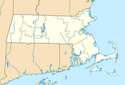 | |
| Nearest city | Plainville, Massachusetts |
|---|---|
| Coordinates | 41°59′6″N 71°21′54″W / 41.98500°N 71.36500°WCoordinates: 41°59′6″N 71°21′54″W / 41.98500°N 71.36500°W |
| Built | 1790 |
| Architect | Unknown |
| Governing body | State |
| NRHP Reference # |
76000228 [1] |
| Added to NRHP | January 1, 1976 |
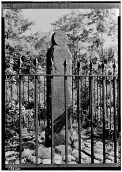
The Angle Tree Stone is a historic boundary marker astride the border of North Attleboro, Massachusetts and Plainville, Massachusetts.[2][3]
The slate marker was built in 1790[4] by a father and son team of gravestone makers. The stone was added to the National Historic Register in 1976. The stone replaced the "Angle Tree" from the 17th century, which was a surveying landmark for the boundary between Bristol and Norfolk counties, and also between North Attleborough and Plainville, Massachusetts. The county border is a straight east-west line coming from Cumberland, Rhode Island to the site of the tree (now the stone) and then turning at an angle (hence the "angle tree" designation) and running in a straight line from there almost to Massachusetts Bay near Cohasset.
The Angle Tree Stone has been encased in a brick and plexiglass structure since 1985 to protect it from the ravages of graffiti. It is set back 1/4 mile down a dirt road on private property.
In 1640, the Plymouth Colony and the Massachusetts Bay Colony had agreed that a line from Accord Pond, in Hingham, to Wrentham, Massachusetts, should be the dividing line between the colonies. It was an extremely important point because at that time the grant to Massachusetts extended to the Pacific Ocean. The line was often the subject of disputes and not finally settled until a U.S. Supreme Court decision was handed down two centuries later in Massachusetts v. Rhode Island, 37 U.S. 12 Pet. 755 (1838). The line is still recognized as the border between Massachusetts, Rhode Island and Connecticut.[5]
See also
- National Register of Historic Places listings in Norfolk County, Massachusetts
- National Register of Historic Places listings in Bristol County, Massachusetts
References
- ↑ "National Register Information System". National Register of Historic Places. National Park Service. 2008-04-15.
- ↑ Dawes and allied families. Priv. print. [Wisconsin Cuneo Press]. 1943. p. 162.
- ↑ Vuilleumier, Marion (1982-01-01). Cape Cod, a pictorial history. Donning Co. p. 38. Retrieved 18 March 2013.
- ↑ Lanpher, Bob; Donnelly, Dorothea; Cunningham, George (1999-03-01). North Attleborough. Arcadia Publishing. pp. 115–. ISBN 9780752408859. Retrieved 18 March 2013.
- ↑ Joe MacDougald, Wrentham Historical Society
| |||||||||||||||||||||||||||||||||||||||||||||||||||||||
