Andrian
| Andrian | |
|---|---|
| Comune | |
| Gemeinde Andrian Comune di Adriano | |
 Andrian Location of Andrian in Italy | |
| Coordinates: 46°31′N 11°14′E / 46.517°N 11.233°ECoordinates: 46°31′N 11°14′E / 46.517°N 11.233°E | |
| Country | Italy |
| Region | Trentino-Alto Adige/Südtirol |
| Province | South Tyrol (BZ) |
| Government | |
| • Mayor | Roland Danay |
| Area | |
| • Total | 4.9 km2 (1.9 sq mi) |
| Elevation | 285 m (935 ft) |
| Population (Nov. 2010) | |
| • Total | 1,043 |
| • Density | 210/km2 (550/sq mi) |
| Demonym |
German: Andrianer Italian: andrianesi |
| Time zone | CET (UTC+1) |
| • Summer (DST) | CEST (UTC+2) |
| Postal code | 39010 |
| Dialing code | 0471 |
| Website | Official website |
Andrian (Italian: Andriano) is a comune or Gemeinde (municipality) in South Tyrol in northern Italy, located about 9 kilometres (6 mi) north-west of the city of Bolzano.
Geography
As of 30 November 2010, it had a population of 1,043 and an area of 4.9 square kilometres (1.9 sq mi).[1]
Andrian borders the following municipalities: Eppan, Nals and Terlan.
History
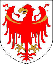
Coat-of-arms
The emblem is that of the Lords of Andrian. It's party per pale of gules and argent with a pile curved inward and the colours alternating. The emblem was adopted in 1968.[2]
Society
Linguistic distribution
According to the 2011 census, 89.96% of the population speak German, 9.53% Italian and 0.51% Ladin as first language.[3]
|
Demographic evolution

References
- ↑ All demographics and other statistics: Italian statistical institute Istat.
- ↑ of the World: Andrian
- ↑ 3.0 3.1 "Volkszählung 2011/Censimento della popolazione 2011". astat info (Provincial Statistics Institute of the Autonomous Province of South Tyrol) (38): 6–7. June 2012. Retrieved 2012-06-14.
- ↑ Oscar Benvenuto (ed.): "South Tyrol in Figures 2008", Provincial Statistics Institute of the Autonomous Province of South Tyrol, Bozen/Bolzano 2007, p. 16, table 10
External links
![]() Media related to Andrian at Wikimedia Commons
Media related to Andrian at Wikimedia Commons
- (German) (Italian) Homepage of the municipality
- (German) (Italian) (English) Tourism info