Andijan Dam
| Andijan Dam | |
|---|---|
 | |
| Country | Uzbekistan |
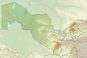
| Location | Andijan, Andijan Province |
| Coordinates | 40°46′9.18″N 73°3′45.95″E / 40.7692167°N 73.0627639°ECoordinates: 40°46′9.18″N 73°3′45.95″E / 40.7692167°N 73.0627639°E |
| Purpose | Irrigation, power |
| Status | Operational |
| Construction began | 1969 |
| Opening date | 1974 |
| Owner(s) | Ministry of Agriculture and Water Resources |
| Dam and spillways | |
| Type of dam | Buttress |
| Impounds | Kara Darya River |
| Height | 115 m (377 ft) |
| Length | 1,115 m (3,658 ft) |
| Reservoir | |
| Total capacity | 1,900,000,000 m3 (1,500,000 acre·ft) |
| Surface area | 57.28 m (187.9 ft) |
| Power station | |
| Commission date |
Andijan 1:1974-1984 Andijan 2:2010 |
| Type | Conventional |
| Hydraulic head |
Andijan 1: 83 m (272 ft) Andijan 2: 82 m (269 ft) |
| Turbines |
Andijan 1: 4 x 35 MW Andijan 2: 2 x 25 MW Francis-type |
| Installed capacity |
Andijan 1: 140 MW Andijan 2: 50 MW Total: 190 MW |
The Andijan Dam is a buttress dam on the Kara Darya River near Andijan in Andijan Province, Uzbekistan. Its reservoir covers 57.28 m (187.9 ft) and stretches into neighboring Osh Province, Kyrgyzstan. The dam serves several purposes to include irrigation in the Fergana Valley and hydroelectric power production. Water released from the dam can enter a canal on either side of the river downstream. The dam has two power stations located at its base, Andijan 1 and Andijan 2. The former contains four 35 MW turbine-generators and the latter contains two 25 MW Francis turbine-generators for a total installed capacity of 190 MW. Construction on the dam began in 1969 and the generators in Andijan 1 were commissioned between 1974 and 1984.[1] Construction on Andijan 2 began in 2007 and it was commissioned on 2 September 2010. It cost US$28.5 million of which US$15.93 million was supplied by the Exim Bank of China.[2]
References
- ↑ "Building of Small HPP-2 at Andijan water basin". United Nation CDM. 3 February 2010. Retrieved 17 January 2015.
- ↑ "Uzbekistan commissions Andijan station". Trend. 2 September 2010. Retrieved 17 January 2015.