Andørja
| Andørja herred | |
|---|---|
| Former Municipality | |
|
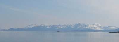
Andørja viewed from Harstad | |
| Coordinates: 68°48′53″N 17°17′41″E / 68.81472°N 17.29472°ECoordinates: 68°48′53″N 17°17′41″E / 68.81472°N 17.29472°E | |
| Country | Norway |
| County | Troms |
| District | Central Hålogaland |
| Municipality ID | NO-1916 |
| Area[1] | |
| • Total | 135 km2 (52 sq mi) |
| Created from | Ibestad in 1926 |
| Merged into | Ibestad in 1964 |
Andørja (Northern Sami: Áttir) is a former municipality in Troms county in Norway. It is located in the northeastern half of the present-day municipality of Ibestad. It encompassed the entire 135-square-kilometre (52 sq mi) island of Andørja. Andørja Church in Engenes was the church for the whole municipality.[1]
History
The municipality of Andørja was established on 1 July 1926 when the large municipality of Ibestad was separated into Ibestad, Andørja, Astafjord and Gratangen. Andørja had an initial population of 1,420. On 1 January 1964, Andørja was merged with Ibestad and the part of neighboring Skånland municipality that was located on the island of Rolla. Prior to the merger, Andørja had a population of 1,330.[2]
Name
The name of the municipality is the same as the name for the island (Old Norse: Andyrja). The meaning of the name is not certain, but one theory is that the first element and comes from the word for "against" and the second element yrja means "gravel" or "rocks", possibly referring to the waves from the sea hitting against the rocky shores.[1]
References
- ↑ 1.0 1.1 1.2 "Andørja" (in Norwegian). Store norske leksikon. Retrieved 2010-01-04.
- ↑ Jukvam, Dag (1999). "Historisk oversikt over endringer i kommune- og fylkesinndelingen" (PDF) (in Norwegian). Statistisk sentralbyrå.
External links
 Troms travel guide from Wikivoyage
- Andørja Adventures (German)
