Ancrum
| Ancrum | |
| Scottish Gaelic: Alan Crom | |
 Ancrum |
|
| Population | 392 (2001 census) |
|---|---|
| OS grid reference | NT625245 |
| Council area | Scottish Borders |
| Lieutenancy area | Roxburgh, Ettrick and Lauderdale |
| Country | Scotland |
| Sovereign state | United Kingdom |
| Post town | JEDBURGH |
| Postcode district | TD8 |
| Dialling code | 01835 |
| Police | Scottish |
| Fire | Scottish |
| Ambulance | Scottish |
| EU Parliament | Scotland |
| UK Parliament | Berwickshire, Roxburgh and Selkirk |
| Scottish Parliament | Ettrick, Roxburgh and Berwickshire |
Coordinates: 55°30′48″N 2°35′40″W / 55.513265°N 2.594581°W
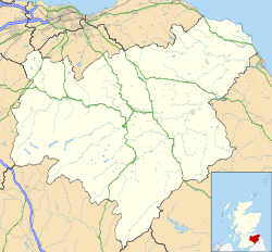
Ancrum (Scottish Gaelic: Alan Crom) is a village in the Borders area of Scotland, 5 km north west of Jedburgh.
The village — which currently has a population of around 300 — is situated just off the A68 trunk road on the B6400 which runs through Ancrum. Lilliesleaf lies 7 miles (11 km) further along the B6400 and Denholm can be reached along the unclassified road which runs parallel to the River Teviot.

Two local landmarks which are visible from certain areas around the village are the Waterloo Monument and the Timpendean Tower.
Ancrum sits in a loop in the Ale Water which is where the name derives from (crooked land on the Ale). The Ale joins the Teviot just to the south which in turn then flows past Monteviot House which is home of Lord Ancrum.
The village's original name was "Ancram", as in "Earl of Ancram" - see Michael Ancram, Marquess of Lothian and Baron Teviot.
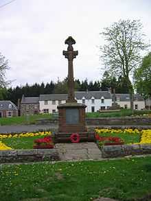
The area just north of the village was the site of the Battle of Ancrum Moor in 1545.[1]
The village boasts a single pub — the Cross Keys — as well as a village shop incorporating the local Post Office, and a B&B.
People from Ancrum
- John Veitch (1752 – 1839), the founder of the Veitch Nurseries business, was born in Ancrum.[2]
- Archibald Elliot (1760-1823), architect
See also
References
- ↑ http://www.battlefieldstrust.com/media/649.pdf
- ↑ Sue Shephard (2003). Seeds of Fortune - A Gardening Dynasty. Bloomsbury. p. 2. ISBN 0-7475-6066-8.
External links
| Wikimedia Commons has media related to Ancrum. |