Amarbhumi
| Amarbhumi अमरभूमि | |
|---|---|
| Village development committee | |
 Amarbhumi Location in Nepal | |
| Coordinates: 28°16′48″N 83°27′0″E / 28.28000°N 83.45000°ECoordinates: 28°16′48″N 83°27′0″E / 28.28000°N 83.45000°E | |
| Country |
|
| Zone | Dhaulagiri Zone |
| District | Baglung District |
| Population (1991) | |
| • Total | 2,248 |
| • Religions | Hindu |
| Time zone | Nepal Time (UTC+5:45) |
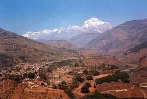
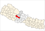
Amarbhumi is a village development committee in Baglung District in the Dhaulagiri Zone of central Nepal. At the time of the 1991 Nepal census it had a population of 2,248 and had 409 houses in the village.[1] It has been reported that the villagers of Amarbhumi VDC in Baglung district have changed their village's name to Mulabari (meaning radish farm).
References
- ↑ "Nepal Census 2001". Nepal's Village Development Committees. Digital Himalaya. Retrieved 2008-08-23.

