Alvaston
| Alvaston | |
 |
|
 Alvaston |
|
| Population | 13,686 (2001 Census) |
|---|---|
| OS grid reference | SK345395 |
| District | Derby |
| Shire county | Derbyshire |
| Region | East Midlands |
| Country | England |
| Sovereign state | United Kingdom |
| Post town | DERBY |
| Postcode district | DE24 |
| Dialling code | 01332 |
| Police | Derbyshire |
| Fire | Derbyshire |
| Ambulance | East Midlands |
| EU Parliament | East Midlands |
| UK Parliament | Derby South |
|
|
Coordinates: 52°53′51″N 1°25′23″W / 52.89754°N 1.42319°W
Alvaston is a large suburb and ward of Derby, England. Alvaston is situated on the A6, three miles south-east of Derby city centre and probably owes its name to Allwald. It is bordered to the north by the wards of Derwent, Chaddesden and Spondon, to the west is the City Centre, to the south are Sinfin and Chellaston and to the east the district of South Derbyshire.
The village of Alvaston has existed since at least the eleventh century.[1] Rapid expansion came in the second half of the 19th Century and in 1904 the electric tram replaced the horse-bus service and, with the advent of the motor car, London Road became the A6. It became part of Derby in the late twentieth century.
The smaller, neighbouring village of Boulton[1] has been swallowed up by Alvaston, and Boulton is rarely referred to by name.
Alvaston's population is around 25,000.
Housing

The village expanded rapidly with the coming of improved public transport to Derby, and the arrival of the railways and associated employment in the mid nineteenth century. Alvaston was the terminus of a tram route, and later a trolleybus route, which ran along London Road.

Few of the buildings in Alvaston date from before this era. There are several parallel streets of terraced Victorian housing in the Crewton district, large Edwardian detached villas stringing out away from the village centre, 1930s semi-detached homes, and a large expanse of post-Second World War council housing.
Perched on the edge of the settlement, on Stocker Flat and overlooking Boulton Moor may be found a maze of 1970s–1980s-built culs-de-sac and footpaths, leading to council and privately built homes.
Location
The River Derwent flows to the north of Alvaston, and runs alongside Alvaston Park, which features a playground, lake and skate park.
Two miles to the west lies the site of the Derby Canal, the nineteenth century township of Allenton, and the Osmaston Park Industrial Estate. To the north-west on the A6 towards Derby, a small settlement of Victorian terraced homes forms Wilmorton. The Pride Park development, which includes the Derby County football stadium, is a short walk away. To the north, the River Derwent flows from Derby towards its confluence with the River Trent. The long-established chemical works of Celenese(formally Accordis and Courtaulds) are the northern bank, towards Spondon. To the east lies the open countryside of South Derbyshire and Elvaston Castle Country Park, a favourite place for picnics and lakeside walks. To the south, Boulton Moor stretches towards Chellaston and Aston-on-Trent.
Schools, churches, pubs and shopping
Schools
Alvaston has two secondary schools: Noel-Baker School and Merrill Academy. The suburb has several primary schools, notably Alvaston Junior Community School (AJCS), St John Fisher and Oakwood infant and junior school.
Churches
There are several churches, of Anglican, Baptist, Methodist, United Reformed and Roman Catholic denominations. There are two Anglican churches: The 1856 St Michael and All Angels Church[2] is at the heart of the old village of Alvaston and the St Mary's Church in Boulton.[3] "Boulton St Mary's", is thought to be of Norman origin.
 |
 |
 |
 |
| English martyrs Catholic church | Alvaston Methodist church | Alvaston Baptist church | St Michael and All Angels' church |
Pubs
The Blue Peter, The Needles, The Lodge, The Roundhouse, The Silver Ghost, The Cornishman, The Brackens, The Blue Jay, The Coronation.
 The Blue peter pub |
 Blue jay pub, Marston's Inns and Taverns |
 The Roundhouse pub |
Shopping
The main shopping centre of Alvaston can be found at the junction of the A6 London Road and the A5111 Derby Ring Road.
Alvaston shopping centre holds a small number of chain and independent shops, including a men's barbers, two card shops, Michaels Drink Store, BP and Iceland. In recent years a lot of independent shops have closed down and have been replaced with many takeaways. A taxi rank has now opened in Alvaston.


McDonald's
As reported by Derby Telegraph, McDonald's have applied for planning permission, for a TWO-STOREY McDonald's restaurant with space for 160 diners – creating 65 jobs
Transport
Bus Routes
- ARRIVA – 44,45 – Derby – Alvaston Circular
- ARRIVA – 42,43 – Derby – Alvaston – Allenton Circular
- ARRIVA – 40,41 – Derby – Allenton – Alvaston – London Road – Derby
- KINCHBUS – skylink – Derby – Alvaston – East Midlands Airport – Loughborough – Leicester
Surgeries in Alvaston
Doctors' surgeries
- Alvaston Medical Centre, 14 Boulton Lane
- Hema Medical Centre, 84 Keldholme Lane
- Parkfields Surgery, 1217 London Road
Dental surgeries
- Charming Smiles, 1089 London Road
- Coleman Dental, Coleman Street
- Raynesway Dental Practice, 1 Raynesway
- Pearl Dental, 1242 London Road
Notable people
.jpg)
- Jack O'Connell, an actor who has appeared in This Is England (2006), Skins (2009–10), and Unbroken (2014)
- Jordon Mutch, an English footballer who plays for Crystal Palace
- Tony Hateley, an English footballer
- Mark Hateley, an English footballer and son of Tony
National BMX Track
Alvaston has a National Standard track, it has hosted regional and national race meetings. The track is open to the public and available at any time, except when race events are being held.
Alvaston BMX Track is located at Alvaston Park.
Alvaston Park
Alvaston Park is a picturesque, riverside park covering 85 acres.
Alvaston Park's facilities

- Community building,
- Café,
- Lake,
- Fishing,
- Science garden,
- Play area with zip-slide,
- adiZone outdoor gym,
- Cycle route,
- BMX track and skateboard park,
- Pitches with changing rooms,
- Model Boat
k Club
- Toilets,
- Car park..
 Alvaston lake
History of Alvaston Park
The park opened to the public in 1913 after William Curzon of Breedon Hall made some of his land available. It was landscaped by William Barron and Son of Borrowash – a firm founded by the young Scotsman who laid out the park at Elvaston Castle for Lord Harrington in 1830.
A five acre lake was added in 1923, and a further 61.8 acres was added to be used as playing fields after the Second World War.
In 1934 the lake was found to be badly polluted and the town council had to urgently clear Cotton Brook to restore the water purity of the lake in time for the carnival.
During the second world war the park was used as a prisoner of war camp, part of which was for Germans and the other for Italians. The Italians worked in the fields of local farmers and the Germans worked at the ordnance depot on Sinfin Lane.
On 7 December 2009 the deputy mayor of Derby Councillor Fareed Hussain opened an outdoor gymasium called the AdiZone.
The new changing rooms and café were built by Derby City Council in partnership with the Football Foundation and were opened on 2 May 2011.
Geography
 |
Derby | Chaddesden | Spondon | |
| Allenton | |
Draycott, Derbyshire | ||
| ||||
| | ||||
| Shelton Lock | Chellaston | Elvaston, Derbyshire |
Climate of Alvaston
| Climate data for Alvaston | |||||||||||||
|---|---|---|---|---|---|---|---|---|---|---|---|---|---|
| Month | Jan | Feb | Mar | Apr | May | Jun | Jul | Aug | Sep | Oct | Nov | Dec | Year |
| Average high °C (°F) | 7 (45) |
7 (45) |
9 (48) |
12 (54) |
15 (59) |
18 (64) |
21 (70) |
21 (70) |
18 (64) |
14 (57) |
10 (50) |
7 (45) |
13 (55) |
| Average low °C (°F) | 1 (34) |
1 (34) |
2 (36) |
4 (39) |
6 (43) |
9 (48) |
11 (52) |
11 (52) |
9 (48) |
7 (45) |
4 (39) |
2 (36) |
6 (43) |
| Average precipitation mm (inches) | 84 (3.31) |
60 (2.36) |
67 (2.64) |
57 (2.24) |
48 (1.89) |
55 (2.17) |
50 (1.97) |
55 (2.17) |
60 (2.36) |
60 (2.36) |
70 (2.76) |
80 (3.15) |
746 (29.37) |
| Source: Met Office[4] | |||||||||||||
Gallery
-

Former Road Toll House on London Road
-

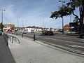
Harvey road (A5111) ring road leading into Alvaston
Notes
References
- ↑ 1.0 1.1 Domesday Book: A Complete Translation. London: Penguin, 2003. ISBN 0-14-143994-7 p.750-2
- ↑ St Michael and All Angels Church
- ↑ St Mary's Church
- ↑ "England 1971–2000 averages". Met Office. August 2012. Check date values in:
|year= / |date= mismatch(help) - ↑ "McDonald's plans new 160-seat Derby restaurant, creating 65 jobs", Derby Telegraph, Posted: 24 February 2014.
External links
| Wikimedia Commons has media related to Alvaston. |
- Alvaston in the Domesday Book
| ||||||