Almere
| Almere | |||
|---|---|---|---|
| Municipality | |||
|
Skyline of Almere | |||
| |||
.svg.png) Location in Flevoland | |||
| Coordinates: 52°22′N 5°13′E / 52.367°N 5.217°ECoordinates: 52°22′N 5°13′E / 52.367°N 5.217°E | |||
| Country | Netherlands | ||
| Province | Flevoland | ||
| Government[1] | |||
| • Body | Municipal council | ||
| • Mayor | Annemarie Jorritsma (VVD) | ||
| Area[2] | |||
| • Total | 248.77 km2 (96.05 sq mi) | ||
| • Land | 129.60 km2 (50.04 sq mi) | ||
| • Water | 119.17 km2 (46.01 sq mi) | ||
| Elevation[3] | −3 m (−10 ft) | ||
| Population (May 2014)[4] | |||
| • Total | 196,290 | ||
| • Density | 1,515/km2 (3,920/sq mi) | ||
| Demonym | Almeerder | ||
| Time zone | CET (UTC+1) | ||
| • Summer (DST) | CEST (UTC+2) | ||
| Postcode | 1300–1379 | ||
| Area code | 036 | ||
| Website |
www | ||


Almere (Dutch pronunciation: [ɑlˈmeːrə]) is a planned city and municipality in the province of Flevoland, the Netherlands, bordering Lelystad and Zeewolde. The municipality of Almere comprises the districts Almere Stad, Almere Buiten, Almere Oosterwold (design phase) and Almere Pampus (planned for future). and the boroughs of Almere Haven, Almere Hout and Almere Poort.
Almere is the newest city in the Netherlands: the land on which Almere sits, the Southern Flevoland Polder, was reclaimed from the IJsselmeer in 1959-68. The first house was finished in 1976, and Almere became a municipality in 1984. It is the largest municipality in Flevoland with 196,290 citizens in 2014 and the 7th largest in the Netherlands.[5] In October 2007, the city council of Almere made agreements with the government to expand the city to 350,000 inhabitants by 2030.[6]
History
The original plans for the IJsselmeerpolders saw the land being used for agriculture. However, after World War II housing was needed for the rapidly growing population of Amsterdam and two towns were planned in the polders Oostelijk Flevoland and Zuidelijk Flevoland. The town in Oostelijk Flevoland became Lelystad. The town in Zuidelijk Flevoland was still called Zuidweststad (English: South West City) on the first sketches, but in the 1970s it became called Almere, named after the lake Almere, the early medieval name of the Zuiderzee. The first house in Almere was finished in 1976. At that time the town was still controlled by the Openbaar Lichaam Zuidelijke IJsselmeerpolders (Z.IJ.P.), with a Landdrost. In 1984 Almere became an official municipality. Originally, Almere was envisioned as a town with multiple centres. This idea was later abandoned in favor of allowing neighbourhoods like Tussen de Vaarten to be built. There is also a difference between the way houses are built in the oldest and the newest parts of the city. The housing plan in Almere in the 1970s was basic functionality and a levelling of social status. However, starting in the 1990s more exclusive homes with striking designs were built (e.g., in the Regenboogbuurt).
Governance
Local executive
Former minister Annemarie Jorritsma-Lebbink (VVD) has been the mayor of Almere since 16 August 2003. On 20 May 2010 the new council was inaugurated. The populist Party for Freedom had won the most seats in the local elections, which was both national and international news due to the controversial statements of its leader Geert Wilders. Even though the largest party they didn't take part in the local administration.
- Henk Mulder (PvdA)
- Ineke Smidt (PvdA)
- Arno Visser (VVD)
- Ben Scholten (VVD)
- René Peeters (D66)
- Ed Anker (CDA/CU)
List of mayors:
- 1984 - 1986 Han Lammers (PvdA)
- 1986 - 1993 Cees de Cloe (PvdA)
- 1993 - 1994 Cees Roozemond (PvdA, supervisor)
- 1994 - 1998 Ralph Pans (PvdA)
- 1998 - 2003 Hans Ouwerkerk (PvdA)
- 2003 - 2003 Jaap van der Doef (PvdA, supervisor)
- 2003–present Annemarie Jorritsma-Lebbink (VVD)
City council
The first local council was installed on 2 January 1984 in the presence of the then minister of the Interior Koos Rietkerk. The council elections took place on 21 September 1983. Prior to 1984 Almere had an Adviesraad, which was chosen every 2 years (1978–1980, 1980–1982, 1982–1984). This Adviesraad was made up of different political parties similar to a local council. On 11 March 1977 the first adviescommissie was elected. It consisted of 5 people that were chosen on personal title. Since 1998, the council of Almere has a total of 39 members.
| Party | 1984 | 1986 | 1990 | 1994 | 1998 | 2002 | 2006 | 2010 |
|---|---|---|---|---|---|---|---|---|
| PVV | - | - | - | - | - | - | - | 9 |
| PvdA | 10 | 14 | 9 | 6 | 9 | 7 | 12 | 8 |
| VVD | 5 | 5 | 7 | 10 | 12 | 8 | 7 | 7 |
| Leefbaar Almere | - | - | - | - | - | 9 | 4 | 3 |
| SP | - | - | - | - | - | - | 4 | 2 |
| GroenLinks | 2 | 1 | 3 | 4 | 4 | 4 | 3 | 3 |
| CDA | 2 | 3 | 4 | 3 | 3 | 4 | 3 | 2 |
| Almere Partij | - | 1 | 2 | 2 | 3 | 2 | 2 | - |
| ChristenUnie | - | - | - | - | 1 | 1 | 2 | 1 |
| D66 | 1 | 2 | 7 | 10 | 5 | 2 | 1 | 3 |
| Trots op Nederland | - | - | - | - | - | - | - | 1 |
| Verenigde Senioren Partij | - | - | - | - | 1 | 1 | 1 | - |
| Stadspartij Almere | - | - | - | - | 1 | 1 | - | - |
| CP/CD | 2 | 1 | 1 | 2 | - | - | - | - |
| Stap '84 | 1 | - | - | - | - | - | - | - |
| Total | 23 | 27 | 33 | 37 | 39 | 39 | 39 | 39 |
International relations
Twin towns — Sister cities
Almere maintains international relations with the following twin cities:[7][8]
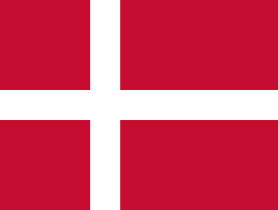 Aalborg, Denmark[9]
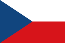 České Budějovice, Czech Republic
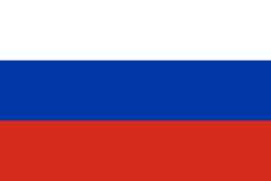 Dmitrov, Russia
- Yaroslavl, Russia
 Haapsalu, Estonia
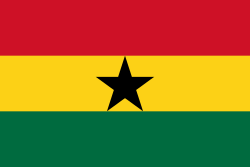 Kumasi, Ghana
 Port Sudan, Sudan (1986)
 Lancaster, United Kingdom
- Milton Keynes, United Kingdom
 Rendsburg, Germany
 Växjö, Sweden
 Tainan City, Taiwan (2009)
Geography
.png)


Almere is located in the polder of Southern Flevoland (Dutch: Zuidelijk Flevoland). It is the most western municipality of the province Flevoland. It borders with Lake Marken in the west and north, Lelystad in the northeast, Zeewolde in the east, and Lake Gooi in the south.
Almere consists of three boroughs and three districts (Dutch: stadsdelen), three of which are under construction.[10]
| Name | Year[11] | Location |
|---|---|---|
| Almere Haven | 1976 | 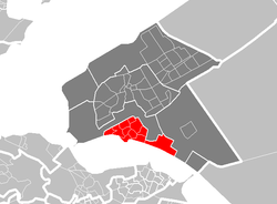 |
| Almere Stad | 1980 |  |
| Almere Buiten | 1984 |  |
| Almere Hout | 1991 |  |
| Almere Poort | 2000 |  |
| Almere Pampus | - |  |
Climate
Almere has an oceanic climate characterized by mild to cool winters, and warm summers with fair precipitation year round.
| Climate data for Almere | |||||||||||||
|---|---|---|---|---|---|---|---|---|---|---|---|---|---|
| Month | Jan | Feb | Mar | Apr | May | Jun | Jul | Aug | Sep | Oct | Nov | Dec | Year |
| Average high °C (°F) | 4.9 (40.8) |
5.5 (41.9) |
8.2 (46.8) |
9.6 (49.3) |
16.2 (61.2) |
19.3 (66.7) |
20.8 (69.4) |
21.0 (69.8) |
18.5 (65.3) |
14.2 (57.6) |
8.9 (48) |
5.9 (42.6) |
12.75 (54.95) |
| Daily mean °C (°F) | 2.2 (36) |
2.5 (36.5) |
4.8 (40.6) |
6.7 (44.1) |
11.9 (53.4) |
14.9 (58.8) |
16.5 (61.7) |
16.6 (61.9) |
14.3 (57.7) |
10.6 (51.1) |
6.1 (43) |
3.4 (38.1) |
9.21 (48.58) |
| Average low °C (°F) | −0.4 (31.3) |
−0.4 (31.3) |
1.5 (34.7) |
3.8 (38.8) |
7.6 (45.7) |
10.5 (50.9) |
12.3 (54.1) |
12.2 (54) |
10.1 (50.2) |
7.1 (44.8) |
3.4 (38.1) |
0.9 (33.6) |
5.72 (42.29) |
| Average precipitation mm (inches) | 68.0 (2.677) |
47.0 (1.85) |
59.0 (2.323) |
45.0 (1.772) |
53.0 (2.087) |
62.0 (2.441) |
75.0 (2.953) |
77.0 (3.031) |
76.0 (2.992) |
80.0 (3.15) |
78.0 (3.071) |
76.0 (2.992) |
838.2 (33) |
| Source: climatedata.org (1981–2010 normals)[12] | |||||||||||||
Demography
Inhabitants by origin
| 2011 | Numbers | % |
|---|---|---|
| Dutch natives | 118,902 | 62.3 |
| European immigrants | 18,617 | 9.8 |
| Non European immigrants | 53,136 | 27.9 |
| Surinam | 21,183 | 11.1 |
| Morocco | 6,900 | 3.6 |
| Turkey | 3,262 | 1.7 |
| Netherlands Antilles and Aruba | 4,750 | 2.5 |
| Others | 17,041 | 8.9 |
| Almere Haven | Almere Stad | Almere Buiten | Almere Hout | Almere Poort | Almere Pampus | Almere in total | |
|---|---|---|---|---|---|---|---|
| 1970 | 52 | ||||||
| 1975 | 47 | ||||||
| 1980 | 6596 | 6632 | |||||
| 1985 | 21410 | 17240 | 1559 | 40297 | |||
| 1990 | 22355 | 37024 | 11499 | 71087 | |||
| 1995 | 22376 | 58816 | 22740 | 564 | 104496 | ||
| 2000 | 22237 | 83934 | 35290 | 1336 | 142797 | ||
| 2005 | 22590 | 103560 | 47358 | 1366 | 175008 | ||
| 2007 | 22507 | 105261 | 51751 | 1345 | 134 | 180998 |
Sport
Almere is the home of Almere City FC
Transport

The traffic infrastructure in Almere is recognisable because of its separate infrastructure for cycles (which have separate cycle paths), cars and buses (In Almere the buses drive on a separate bus lane). Almere is connected to the motorways the A6 and the A27.
Railway
In 1987 Almere was connected to the national railway system (see NS) with the fully completed Flevolijn which connected Weesp to Lelystad Centrum. Almere currently has six railway stations:
- Almere Poort (opened on December 9, 2012)
- Almere Muziekwijk (opened in 1987)
- Almere Centrum (opened in 1987)
- Almere Parkwijk (opened on February 1, 1996)
- Almere Buiten (opened in 1987)
- Almere Oostvaarders (opened in 2004)
A temporary station, Almere Strand, is set up for certain events, such as Libelle Zomerweek. It was closed just after the summer of 2012 and the iron platforms were torn down at the weekend of October 6–7, 2012, due to the opening of the closely located Almere Poort.
Public buses
In Almere there are 10 bus lines which service the urban area:
- 1 Almere Buiten Stripheldenbuurt - Almere CS - Almere Haven De Marken
- 2 Almere CS - Almere Poort Topsporthal - Almere Poort Station
- 4 Almere CS - Almere Poort Homeruskwartier - Almere Poort Station
- 5 Almere Oostvaarders - Almere CS
- 6 Noorderplassen - CS Almere - Almere Parkwijk Station
- 7 Almere CS - Almere Parkwijk Station - Almere Sallandsekant
- 10 Almere de Vaart/PIA - 't Oor - Almere Poort Station
- 14 Almere CS - Almere Muziekwijk Station - Almere Poort Station (only during the wintermonths and during rush hours)
Most buses run about every 7,5 minutes (8 times every hour). The bus company that runs the buses is called Connexxion and the name of the local bus system is called Maxx Almere owned by Connexxion. In the buses one can use the national transportation chipcard (smart card), subscriptions or one can buy bus tickets of Maxx Almere.
Besides the local bus lines there are regional bus lines to Naarden & Bussum (151), Hilversum (156), Zeewolde & Harderwijk (159), Nijkerk (160), Amsterdam Amstel (322 and 327) and Amsterdam Bijlmer & Amsterdam Holendrecht (328)
In addition to the regional bus lines, there are also spitsbusses (buses that only run during rush hours) to Utrecht (150), Amsterdam (153 and 155), Amstelveen & Schiphol (215 and 216).
Since April 2012 a new rush hour bus line, 150, to Utrecht connects Almere directly with the University Area of Utrecht called De Uithof. (This was previously done by former bus line 700).
Notable residents
- Ali B (16 October 1981), Rapper, show host presenter, music label owner
- Danny Holla (31 December 1987), footballer
- Hedwiges Maduro (14 February 1985), footballer
- Yfke Sturm (19 November 1981), international model
- Danny Masseling also known as Angerfist (20 June 1981), hardcore producer and DJ
- Jörgen Raymann, TV host
- Quinty Trustfull, TV host
References
Notes
- ↑ "The municipal executive". Gemeente Almere. Retrieved 1 September 2013.
- ↑ "Kerncijfers wijken en buurten" [Key figures for neighbourhoods]. CBS Statline (in Dutch). CBS. 2 July 2013. Retrieved 12 March 2014.
- ↑ "Postcodetool for 1315HR". Actueel Hoogtebestand Nederland (in Dutch). Het Waterschapshuis. Retrieved 1 September 2013.
- ↑ "Bevolkingsontwikkeling; regio per maand" [Population growth; regions per month]. CBS Statline (in Dutch). CBS. 26 June 2014. Retrieved 24 July 2014.
- ↑ (Dutch) Lijst van grooste gemeenten in Nederland. Retrieved on 2010-12-31.
- ↑ (Dutch) Schaalsprong Almere 2030, PDF. Retrieved on 2008-06-09.
- ↑ (Dutch) Gemeente Almere: Partnersteden. Retrieved on 2008-02-23.
- ↑ (Dutch) Algemene Informatie. Retrieved on 2008-02-23.
- ↑ "Aalborg Twin Towns". Europeprize.net. Retrieved 19 August 2013.
- ↑ (Dutch) Gemeente Almere: Stadsdelen. Retrieved on 2008-02-23.
- ↑ (Dutch) Sociale Atlas 2007 Bevolkingsopbouw. Retrieved on 2008-02-23.
- ↑ "Almere Climate Data 1981–2010".
External links
| Wikimedia Commons has media related to Almere. |
| Wikivoyage has a travel guide for Almere. |
- Gemeente Almere (official website)
- (Dutch) Geheugen van Almere (people's stories about Almere)
- Oldest location in Almere
 |
Markermeer | Lelystad | | |
| IJmeer | |
Zeewolde | ||
| ||||
| | ||||
| Muiden (NH) / IJmeer | Gooimeer Naarden (NH), Huizen (NH), Blaricum (NH) |
Gooimeer / Eemnes (UT) |
| |||||||||||||
