Almartha, Missouri
| Almartha, Missouri | |
|---|---|
| Community | |
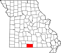
 Almartha, Missouri Location of Almartha, Missouri | |
| Coordinates: 36°45′51″N 92°31′2″W / 36.76417°N 92.51722°WCoordinates: 36°45′51″N 92°31′2″W / 36.76417°N 92.51722°W[1] | |
| Country | U. S. A. |
| State | Missouri |
| County | Ozark County |
| Elevation[1] | 284 m (932 ft) |
| Time zone | CST (UTC-6) |
| • Summer (DST) | CDT (UTC-5) |
Almartha is an unincorporated community in northern Ozark County, Missouri. It is located about thirteen miles north of Gainesville and four miles southeast of Wasola on Route 95. The village is located in a valley on a tributary of Spring Creek.[1] Several homes are located there.
Almartha post office was established in 1855 and the village was named from the first names of early settlers Albert and Martha McSpadden.[2] Mail is now served by the Wasola post office.
References
- ↑ 1.0 1.1 1.2 Wasola, Missouri, 7.5 Minute Topographic Quadrangle, USGS, 2004
- ↑ Ozark County Place Names, 1928-1945, State Historical Society of Missouri
| |||||||||||||||||||||||||||||