Alipur, Delhi
| Alipur | |
|---|---|
| Village | |
 Alipur Location in India | |
| Coordinates: 28°48′00″N 77°09′00″E / 28.80°N 77.150°ECoordinates: 28°48′00″N 77°09′00″E / 28.80°N 77.150°E | |
| Country |
|
| State | Delhi |
| District | North West |
| Elevation | 209 m (686 ft) |
| Population (2001) | |
| • Total | 16,623 |
| Languages | |
| • Official | Hindi, English |
| Time zone | IST (UTC+5:30) |

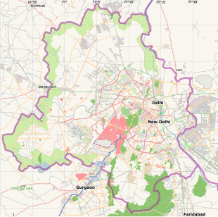
Map of Delhi showing location of Alipur
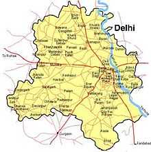
Alipur is a census town in North West district in the state of Delhi, India, surrounded by the localities of Bawana, Narela, Budhpur, Bakoli and Mukhmelpur. Alipur comes under the Narela constituency.
Demographics
As of 2001 India census,[1] Alipur had a population of 16,623. Males constitute 58% of the population and females, 42%. It has an average literacy rate of 68%, higher than the national average of 59.5%; 63% for males and 37% for females. 15% of the population is below 6 years of age.
Education
- Swami Shraddhanand College
- Govt Boys senior secondary school
- Nigam pratibha vidyalya Garhi Alipur ,Delhi
- Delhi Technological University
Temples
- Shani Mandir
- Lord Shiv Temple
- shri ram mandir
Attractions
- Splash Water Park
- Tivoli resort
References
- ↑ "Census of India 2001: Data from the 2001 Census, including cities, villages and towns (Provisional)". Census Commission of India. Archived from the original on 2004-06-16. Retrieved 2008-11-01.
External links
- Alipur, Delhi at Wikimapia
- MSN Map