Algibre River

Algibre River
River Algibre
Country Portugal
Region Algarve
District Faro
Municipality Loulé
Primary source Moinhos River
 - location Querença, Algarve
 - elevation 200 m (656 ft)
 - coordinates 37°11′29.9″N 8°00′26.2″W / 37.191639°N 8.007278°W
Secondary source Mercês River
 - location Querença
 - elevation 200 m (656 ft)
 - coordinates 37°11′29.9″N 8°00′26.2″W / 37.191639°N 8.007278°W
Source confluence
 - location Quarteira River
 - elevation 50 m (164 ft)
 - coordinates 37°10′51.5″N 8°12′28.1″W / 37.180972°N 8.207806°W
Mouth Into the Atlantic at Quarteira
Length 13.5 mi (22 km), East to West
Red Dot = Valley of Algibre

River Algibre is a small river in the Portuguese region of the Algarve. The river along with the Alte River, another tributary, becomes the River Quarteira after the two rivers conflux. The river runs eastwards for 21.7 kilometres (13.5 mi) from its start, which is the confluence of the River Mercês and River Moinhos.[1]

Description

The Algibre is one of a number of small rivers in the central Algarve that make up the water ecosystem known as the Querença – Silves Aquifer System.[2]

Gallery

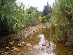
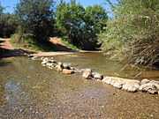
Stepping stone crossing next to a fording point on the river 
Road bridge over Algibre River (Ribeira de Algibre), Loule, Algarve, Portugal. The road links the town of Loule to the village of Querença 
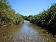
Clear water of the river in the springtime 
Wikimedia Commons has media related to Algibre River.

References

  1. The Algarve. Sheet Map showing the course of the River Algibre and its Confluences (Rough guides – Penguin Group). 2010. ISBN 9781848364981.
  2. "Quantifying and modelling the contribution of streams that recharge the Querença – Silves Aquifer in south Portugal". Information about the Aquifer System. Natural Hazards and Earth System Sciences.