Alaotra-Mangoro
| Alaotra-Mangoro Region | |
|---|---|
| Region | |
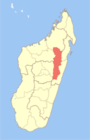 Location in Madagascar | |
| Country |
|
| Capital | Ambatondrazaka |
| Area[1] | |
| • Total | 31,948 km2 (12,335 sq mi) |
| Population (2004)[1] | |
| • Total | 877,700 |
| • Density | 27.5/km2 (71/sq mi) |
| Time zone | EAT (UTC3) |
Alaotra-Mangoro is a region in eastern Madagascar. It borders Sofia Region in north, Analanjirofo in northeast, Atsinanana in east, Vakinankaratra in southwest, Analamanga in west and Betsiboka in northwest. The capital of the region is Ambatondrazaka, and the population was estimated to be 877,700 in 2004. The area of the region is 31,948 km2 (12,335 sq mi).[1]
Administrative divisions
Alaotra-Mangoro region is divided into five districts, which are sub-divided into 79 communes.
- Ambatondrazaka District (Ambatondrazaka)
- Amparafaravola District (Amparafaravola)
- Andilamena District (Andilamena)
- Anosibe An'ala District (Anosibe An'ala)
- Moramanga District (Moramanga)
Protected areas
- Part of Zahamena Reserve and Zahamena National Park
- Andasibe-Mantadia National Park
- Analamazoatra Reserve
- Part of Marotandrano Reserve
References
- ↑ 1.0 1.1 1.2 "Madagascar: Profil des marchés pour les évaluations d’urgence de la sécurité alimentaire" (PDF) (in French). Retrieved 2008-02-24.
| ||||||||||||||||||||||||
Coordinates: 17°49′48″S 48°25′48″E / 17.83000°S 48.43000°E