Al Jazirah (state)
| Al Jazirah ولاية الجزيرة Gezira | |
|---|---|
| State | |
 | |
 Location in Sudan. | |
| Coordinates: 14°30′N 33°30′E / 14.500°N 33.500°ECoordinates: 14°30′N 33°30′E / 14.500°N 33.500°E | |
| Country |
|
| Region | Blue Nile |
| Capital | Wad Madani |
| Area | |
| • Total | 27,549 km2 (10,637 sq mi) |
| Population (2006 (est.)) | |
| • Total | 2,796,330 |
| Time zone | EAT (UTC+3) |
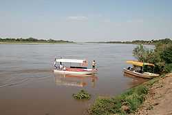
Al Jazirah (Arabic: ولاية الجزيرة Al Ǧazīra), (Madani) also spelt Gezira, is one of the 18 states of Sudan. The state lies between the Blue Nile and the White Nile in the east-central region of the country. It has an area of 27,549 km2.[1] The name comes from the Arabic word for island. Wad Madani is the capital of the state.
Irrigated cotton-producing state

Al Jazirah ( Gezira) is a well populated area suitable for agriculture. The area was at the southern end of Nubia and little is known about its ancient history and only limited archaeological work has been conducted in this area. It was part of the kingdom of Alodia for several centuries and with that state's collapse in the early sixteenth century became the centre of the Funj Kingdom of Sennar.
The region has benefited from the Gezira Scheme, a program to foster cotton farming begun in 1925. At that time the Sennar Dam and numerous irrigation canals were built. Al Jazirah became the Sudan's major agricultural region with more than 10,000 square kilometres (2.5×10⁶ acres) under cultivation. The initial development project was semi-private, but the government nationalized it in 1950. Cotton production increased in the 1970s but by the 1990s increased wheat production has supplanted a third of the land formerly seeded with cotton.[2]
References
- ↑ "Home – Al-Gezira State". Sudan Tribune. 2003–2013. Retrieved March 19, 2013.
- ↑ Hyslop, J (1952). The Sudan Story. Naldrett Press. pp. "The Bounteous River".
| ||||||||||||||||||||||||||||||||