Al-Arroub (camp)
| al-Arroub Camp | |
|---|---|
| Other transcription(s) | |
| • Arabic | مخيّم العروبة |
| • Also spelled |
al-'Arrub (official) al-Aroub (unofficial) |
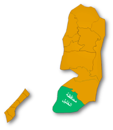
 al-Arroub Camp Location of al-Arroub Camp within Palestine | |
| Coordinates: 31°37′23.18″N 35°08′12.19″E / 31.6231056°N 35.1367194°ECoordinates: 31°37′23.18″N 35°08′12.19″E / 31.6231056°N 35.1367194°E | |
| Governorate | Hebron |
| Government | |
| • Type | Refugee Camp (from 1950) |
| Area | |
| • Jurisdiction | 350 dunams (0.4 km2 or 0.2 sq mi) |
| Population (2007) | |
| • Jurisdiction | 7,941 |
al-Arroub (Arabic: مخيّم العروب) is a Palestinian refugee camp located in the southern West Bank along the Hebron-Jerusalem road in the Hebron Governorate. It is 15 kilometers south of Bethlehem. The camp's total land area is 350 dunums and according to the UNRWA, in 2005, it had a population of 9,859 registered refugees.[1] However, according to the Palestinian Central Bureau of Statistics (PCBS), the camp's population was 7,941 in 2007.[2] In 2002, two schools were built in the camp: the Arroup Secondary school for boys and the other for girls.[1]

Al-Arroub before 1948. Supplying water to Jerusalem.
References
- ↑ 1.0 1.1 Arroub Refugee Camp United Nations Relief and Works Agency for Palestine Refugees in the Near East (UNRWA)
- ↑ 2007 PCBS Census Palestinian Central Bureau of Statistics. p.118.
External links
- Al 'Arrub Refugee Camp (Fact Sheet)
- Al 'Arrub Refugee Camp Profile
- Al 'Arrub Refugee Camp Areal photo
- Arroub refugee camp, UNWRA
- The priorities and needs for development in Al 'Arrub camp based on the community and local authorities’ assessment
| ||||||||||||||||||||
| |||||||||||||||||||||||||||||||||||||||||||||||||||||||||||||||||||||||||||||||||||||||||||||||||||||||||||||||||||||||||||||||||||||||||||
