Akyaka, Kars
| Akyaka | |
|---|---|
 Akyaka Location of Akyaka in Turkey | |
| Coordinates: 40°44′40″N 43°37′30″E / 40.74444°N 43.62500°ECoordinates: 40°44′40″N 43°37′30″E / 40.74444°N 43.62500°E | |
| Country |
|
| Region | Eastern Anatolia |
| Province | Kars |
| Government | |
| • Mayor | Muhammed Toptaş (CHP) |
| Area[1] | |
| • District | 406.77 km2 (157.05 sq mi) |
| Population (2012)[2] | |
| • Urban | 2,094 |
| • District | 11,641 |
| • District density | 29/km2 (74/sq mi) |
| Time zone | EET (UTC+2) |
| • Summer (DST) | EEST (UTC+3) |
| Postal code | 36xxx |
| Area code(s) | +(90)474 |
| Website | www.yerelnet.org.tr |
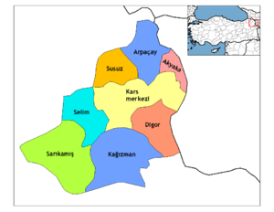
Districts of Kars
Akyaka (Ottoman Turkish: شوره کل Şoregil or Şöregel,[3] ) is a district of Kars Province in eastern Turkey, and the name of the small town that is the district's administrative capital. It is located at Armenian border of Turkey. The settlement was called Şuregel until 1922 and Kızılçakçak between 1922-1961. It was also a district between 1922-1926, and a township in Arpaçay district between 1926-1988. Akyaka municipality was established in 1972. The population was 2,273 in 2010.
Akyaka is a border checkpoint on the railway into Armenia, which is closed since 1993. The route D.060 from Kars runs next to the railway leading to the border.[4]
References
- ↑ "Area of regions (including lakes), km²". Regional Statistics Database. Turkish Statistical Institute. 2002. Retrieved 2013-03-05.
- ↑ "Population of province/district centers and towns/villages by districts - 2012". Address Based Population Registration System (ABPRS) Database. Turkish Statistical Institute. Retrieved 2013-02-27.
- ↑ Tahir Sezen, Osmanlı Yer Adları (Alfabetik Sırayla)(Kurdish: Şûrêgel), , T.C. Başbakanlık Devlet Arşivleri Genel Müdürlüğü, Yayın Nu 21, Ankara, p. 474.
- ↑ Kanbolat, Hasan (October 9, 2007). "Ermenistan'ın Türkiye ile Sorunu Nedir, Sınır Kapısı Açılmalı mıdır?" (in Turkish). Avrasya Bir Vakfı-Avrasya Stratejik Araştırmalar Merkezi. Retrieved March 15, 2009.
| ||||||||||||||||||||||||||||||||||